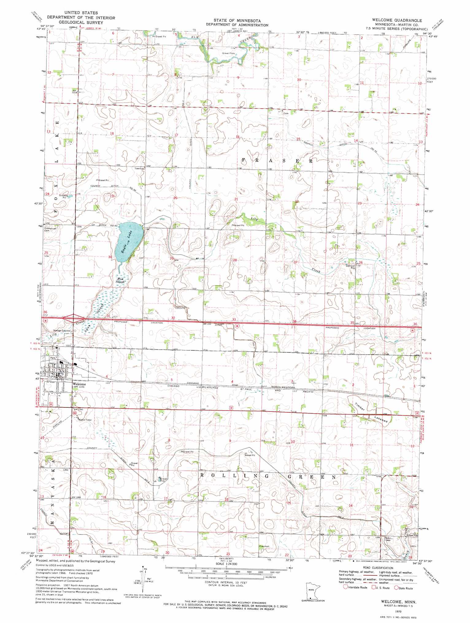
Welcome Topo Map Minnesota
To zoom in, hover over the map of Welcome
USGS Topo Quad 43094f5 - 1:24,000 scale
| Topo Map Name: | Welcome |
| USGS Topo Quad ID: | 43094f5 |
| Print Size: | ca. 21 1/4" wide x 27" high |
| Southeast Coordinates: | 43.625° N latitude / 94.5° W longitude |
| Map Center Coordinates: | 43.6875° N latitude / 94.5625° W longitude |
| U.S. State: | MN |
| Filename: | o43094f5.jpg |
| Download Map JPG Image: | Welcome topo map 1:24,000 scale |
| Map Type: | Topographic |
| Topo Series: | 7.5´ |
| Map Scale: | 1:24,000 |
| Source of Map Images: | United States Geological Survey (USGS) |
| Alternate Map Versions: |
Welcome MN 1970, updated 1972 Download PDF Buy paper map Welcome MN 2010 Download PDF Buy paper map Welcome MN 2013 Download PDF Buy paper map Welcome MN 2016 Download PDF Buy paper map |
1:24,000 Topo Quads surrounding Welcome
Butterfield |
Saint James West |
Saint James East |
Lewisville |
Willow Creek |
Mountain Lake Se |
Trimont |
Saint James Se |
Truman |
Truman Se |
Alpha |
Sherburn |
Welcome |
Fairmont |
Granada |
Dunnell |
Ceylon |
Wilbert |
Wilmert Lake |
East Chain |
Estherville |
Gruver |
Dolliver |
Armstrong |
Swea City |
> Back to 43094e1 at 1:100,000 scale
> Back to 43094a1 at 1:250,000 scale
> Back to U.S. Topo Maps home
Welcome topo map: Gazetteer
Welcome: Canals
County Ditch Number Fiftyseven elevation 378m 1240′County Ditch Number Fiftytwo elevation 360m 1181′
County Ditch Number Seventyone elevation 366m 1200′
County Ditch Number Seventytwo elevation 355m 1164′
County Ditch Number Sixtythree elevation 363m 1190′
County Ditch Number Three elevation 358m 1174′
County Ditch Number Two elevation 372m 1220′
Welcome: Crossings
Interchange 93 elevation 369m 1210′Welcome: Dams
Eagle Lake Dam elevation 361m 1184′Welcome: Flats
Timber Lakebed elevation 366m 1200′Welcome: Guts
Mud Slough elevation 361m 1184′Swan Slough elevation 361m 1184′
Welcome: Populated Places
Elm Tree Mobile Home Park elevation 379m 1243′Welcome elevation 379m 1243′
Welcome: Post Offices
Welcome Post Office elevation 379m 1243′Welcome: Reservoirs
Eagle Lake elevation 359m 1177′Welcome digital topo map on disk
Buy this Welcome topo map showing relief, roads, GPS coordinates and other geographical features, as a high-resolution digital map file on DVD: