Gillett Grove Topo Map Iowa
To zoom in, hover over the map of Gillett Grove
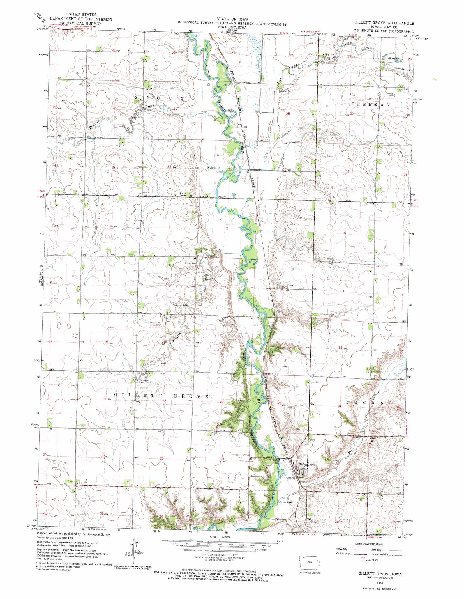
USGS Topo Quad 43095a1 - 1:24,000 scale
| Topo Map Name: | Gillett Grove |
| USGS Topo Quad ID: | 43095a1 |
| Print Size: | ca. 21 1/4" wide x 27" high |
| Southeast Coordinates: | 43° N latitude / 95° W longitude |
| Map Center Coordinates: | 43.0625° N latitude / 95.0625° W longitude |
| U.S. State: | IA |
| Filename: | o43095a1.jpg |
| Download Map JPG Image: | Gillett Grove topo map 1:24,000 scale |
| Map Type: | Topographic |
| Topo Series: | 7.5´ |
| Map Scale: | 1:24,000 |
| Source of Map Images: | United States Geological Survey (USGS) |
| Alternate Map Versions: |
Gillett Grove IA 1966, updated 1967 Download PDF Buy paper map Gillett Grove IA 2010 Download PDF Buy paper map Gillett Grove IA 2013 Download PDF Buy paper map Gillett Grove IA 2015 Download PDF Buy paper map |
1:24,000 Topo Quads surrounding Gillett Grove
Lake Park Se |
Milford |
Spirit Lake Se |
Terril |
Wallingford |
Everly |
Spencer |
Dickens |
Ruthven |
Graettinger West |
Royal |
Creenville |
Gillett Grove |
Silver Lake |
Ayrshire |
Peterson |
Sioux Rapids |
Webb |
Rush Lake West |
Rush Lake East |
Peterson Se |
Rembrandt |
Sioux Rapids Se |
Albert City |
Laurens |
> Back to 43095a1 at 1:100,000 scale
> Back to 43094a1 at 1:250,000 scale
> Back to U.S. Topo Maps home
Gillett Grove topo map: Gazetteer
Gillett Grove: Parks
Dickens Pit elevation 402m 1318′Fen Valley Area elevation 415m 1361′
Little Sioux Wildlife Management Area elevation 418m 1371′
Gillett Grove: Populated Places
Gillett Grove elevation 398m 1305′Gillett Grove: Post Offices
Gillett Grove Post Office elevation 398m 1305′Gillett Grove: Streams
Elk Creek elevation 388m 1272′Lexington Creek elevation 390m 1279′
Lost Island Outlet elevation 393m 1289′
Prairie Creek elevation 393m 1289′
Gillett Grove digital topo map on disk
Buy this Gillett Grove topo map showing relief, roads, GPS coordinates and other geographical features, as a high-resolution digital map file on DVD: