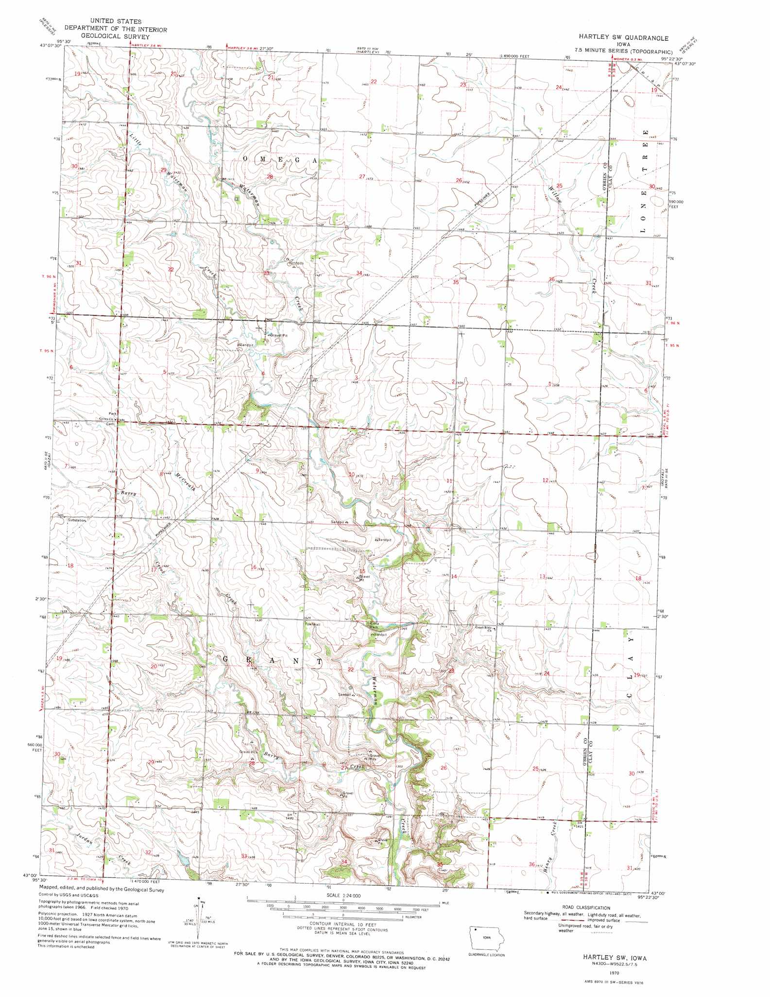
Hartley Sw Topo Map Iowa
To zoom in, hover over the map of Hartley Sw
USGS Topo Quad 43095a4 - 1:24,000 scale
| Topo Map Name: | Hartley Sw |
| USGS Topo Quad ID: | 43095a4 |
| Print Size: | ca. 21 1/4" wide x 27" high |
| Southeast Coordinates: | 43° N latitude / 95.375° W longitude |
| Map Center Coordinates: | 43.0625° N latitude / 95.4375° W longitude |
| U.S. State: | IA |
| Filename: | o43095a4.jpg |
| Download Map JPG Image: | Hartley Sw topo map 1:24,000 scale |
| Map Type: | Topographic |
| Topo Series: | 7.5´ |
| Map Scale: | 1:24,000 |
| Source of Map Images: | United States Geological Survey (USGS) |
| Alternate Map Versions: |
Hartley SW IA 1970, updated 1972 Download PDF Buy paper map Hartley SW IA 2010 Download PDF Buy paper map Hartley SW IA 2013 Download PDF Buy paper map Hartley SW IA 2015 Download PDF Buy paper map |
1:24,000 Topo Quads surrounding Hartley Sw
Cloverdale |
Melvin |
May City |
Lake Park Se |
Milford |
Sanborn |
Plessis |
Hartley |
Everly |
Spencer |
Primghar |
Gaza |
Hartley Sw |
Royal |
Creenville |
Paullina |
Sutherland West |
Sutherland East |
Peterson |
Sioux Rapids |
Cleghorn |
Cherokee North |
Peterson Sw |
Peterson Se |
Rembrandt |
> Back to 43095a1 at 1:100,000 scale
> Back to 43094a1 at 1:250,000 scale
> Back to U.S. Topo Maps home
Hartley Sw topo map: Gazetteer
Hartley Sw: Parks
Covey Church Park elevation 438m 1437′Litka Park elevation 421m 1381′
Rahbusch Tract elevation 417m 1368′
Waterman Wildlife Area elevation 426m 1397′
Weale Area elevation 427m 1400′
Hartley Sw: Streams
Barry Creek elevation 394m 1292′McCreath Creek elevation 401m 1315′
Hartley Sw digital topo map on disk
Buy this Hartley Sw topo map showing relief, roads, GPS coordinates and other geographical features, as a high-resolution digital map file on DVD: