Gaza Topo Map Iowa
To zoom in, hover over the map of Gaza
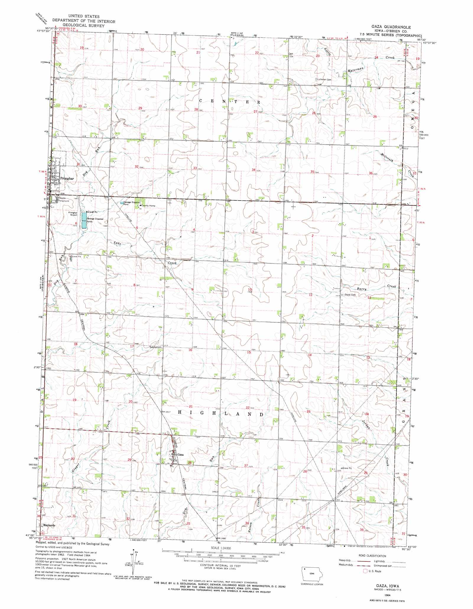
USGS Topo Quad 43095a5 - 1:24,000 scale
| Topo Map Name: | Gaza |
| USGS Topo Quad ID: | 43095a5 |
| Print Size: | ca. 21 1/4" wide x 27" high |
| Southeast Coordinates: | 43° N latitude / 95.5° W longitude |
| Map Center Coordinates: | 43.0625° N latitude / 95.5625° W longitude |
| U.S. State: | IA |
| Filename: | o43095a5.jpg |
| Download Map JPG Image: | Gaza topo map 1:24,000 scale |
| Map Type: | Topographic |
| Topo Series: | 7.5´ |
| Map Scale: | 1:24,000 |
| Source of Map Images: | United States Geological Survey (USGS) |
| Alternate Map Versions: |
Gaza IA 1964, updated 1966 Download PDF Buy paper map Gaza IA 2010 Download PDF Buy paper map Gaza IA 2013 Download PDF Buy paper map Gaza IA 2015 Download PDF Buy paper map |
1:24,000 Topo Quads surrounding Gaza
Ashton |
Cloverdale |
Melvin |
May City |
Lake Park Se |
Sheldon |
Sanborn |
Plessis |
Hartley |
Everly |
Sheldon Se |
Primghar |
Gaza |
Hartley Sw |
Royal |
Granville East |
Paullina |
Sutherland West |
Sutherland East |
Peterson |
Marcus |
Cleghorn |
Cherokee North |
Peterson Sw |
Peterson Se |
> Back to 43095a1 at 1:100,000 scale
> Back to 43094a1 at 1:250,000 scale
> Back to U.S. Topo Maps home
Gaza topo map: Gazetteer
Gaza: Airports
Baum-Harmon Memorial Hospital Heliport elevation 464m 1522′Primghar Airport elevation 448m 1469′
Gaza: Parks
Primghar City Park elevation 461m 1512′Tjossem Park elevation 443m 1453′
Gaza: Populated Places
Gaza elevation 457m 1499′Mapleside elevation 444m 1456′
Gaza: Post Offices
Crona Post Office (historical) elevation 457m 1499′Elcho Post Office (historical) elevation 456m 1496′
Gaza Post Office (historical) elevation 457m 1499′
Gaza: Streams
Lake Creek elevation 445m 1459′Little Waterman Creek elevation 443m 1453′
Gaza digital topo map on disk
Buy this Gaza topo map showing relief, roads, GPS coordinates and other geographical features, as a high-resolution digital map file on DVD: