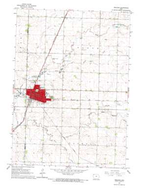
Sheldon Topo Map Iowa
To zoom in, hover over the map of Sheldon
USGS Topo Quad 43095b7 - 1:24,000 scale
| Topo Map Name: | Sheldon |
| USGS Topo Quad ID: | 43095b7 |
| Print Size: | ca. 21 1/4" wide x 27" high |
| Southeast Coordinates: | 43.125° N latitude / 95.75° W longitude |
| Map Center Coordinates: | 43.1875° N latitude / 95.8125° W longitude |
| U.S. State: | IA |
| Filename: | o43095b7.jpg |
| Download Map JPG Image: | Sheldon topo map 1:24,000 scale |
| Map Type: | Topographic |
| Topo Series: | 7.5´ |
| Map Scale: | 1:24,000 |
| Source of Map Images: | United States Geological Survey (USGS) |
| Alternate Map Versions: |
Sheldon IA 1964, updated 1965 Download PDF Buy paper map Sheldon IA 2010 Download PDF Buy paper map Sheldon IA 2013 Download PDF Buy paper map Sheldon IA 2015 Download PDF Buy paper map |
1:24,000 Topo Quads surrounding Sheldon
> Back to 43095a1 at 1:100,000 scale
> Back to 43094a1 at 1:250,000 scale
> Back to U.S. Topo Maps home
Sheldon topo map: Gazetteer
Sheldon: Airports
Sheldon Municipal Airport elevation 432m 1417′Sheldon: Parks
Hills Park elevation 426m 1397′Honoring World War I Veterans Historical Marker elevation 437m 1433′
Memorial to Four Pioneers Historical Marker elevation 434m 1423′
Sheldon City Park elevation 437m 1433′
Sunrise Park elevation 427m 1400′
Thorman Park elevation 434m 1423′
Sheldon: Populated Places
Evander elevation 433m 1420′Ritter elevation 436m 1430′
Sheldon elevation 435m 1427′
Sheldon: Post Offices
Sheldon Post Office elevation 433m 1420′Sheldon: Streams
Engels Creek elevation 425m 1394′Lamkin Creek elevation 420m 1377′
Little Floyd River elevation 413m 1354′
South Branch Little Floyd River elevation 429m 1407′
Sweeney Creek elevation 427m 1400′
Wolf Creek elevation 420m 1377′
Sheldon digital topo map on disk
Buy this Sheldon topo map showing relief, roads, GPS coordinates and other geographical features, as a high-resolution digital map file on DVD:


