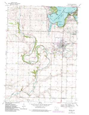
Milford Topo Map Iowa
To zoom in, hover over the map of Milford
USGS Topo Quad 43095c2 - 1:24,000 scale
| Topo Map Name: | Milford |
| USGS Topo Quad ID: | 43095c2 |
| Print Size: | ca. 21 1/4" wide x 27" high |
| Southeast Coordinates: | 43.25° N latitude / 95.125° W longitude |
| Map Center Coordinates: | 43.3125° N latitude / 95.1875° W longitude |
| U.S. State: | IA |
| Filename: | o43095c2.jpg |
| Download Map JPG Image: | Milford topo map 1:24,000 scale |
| Map Type: | Topographic |
| Topo Series: | 7.5´ |
| Map Scale: | 1:24,000 |
| Source of Map Images: | United States Geological Survey (USGS) |
| Alternate Map Versions: |
Milford IA 1970, updated 1972 Download PDF Buy paper map Milford IA 1970, updated 1983 Download PDF Buy paper map Milford IA 2010 Download PDF Buy paper map Milford IA 2013 Download PDF Buy paper map Milford IA 2015 Download PDF Buy paper map |
1:24,000 Topo Quads surrounding Milford
> Back to 43095a1 at 1:100,000 scale
> Back to 43094a1 at 1:250,000 scale
> Back to U.S. Topo Maps home
Milford topo map: Gazetteer
Milford: Airports
Airport Okoboji elevation 437m 1433′Fuller Airport elevation 438m 1437′
Milford: Bays
Browns Bay elevation 426m 1397′Emersons Bay elevation 426m 1397′
Smiths Bay elevation 426m 1397′
Milford: Beaches
Arrowhead Beach elevation 427m 1400′Bay View Beach elevation 430m 1410′
Crescent Beach elevation 426m 1397′
Fillenworth Beach elevation 426m 1397′
Gilleys Beach elevation 433m 1420′
Jones Beach elevation 426m 1397′
Maywood Beach elevation 435m 1427′
Milford Beach elevation 426m 1397′
Spencer Beach elevation 426m 1397′
Sunset Beach elevation 430m 1410′
Wheelers Beach elevation 439m 1440′
Milford: Capes
Breezy Point elevation 426m 1397′Cass Bay elevation 426m 1397′
Christys Point elevation 427m 1400′
Eagle Point elevation 427m 1400′
Givens Point elevation 426m 1397′
Gull Point elevation 426m 1397′
Lime Kiln Point elevation 438m 1437′
Pillsbury Point elevation 434m 1423′
Pocahontas Point elevation 428m 1404′
Milford: Guts
Garlock Slough elevation 426m 1397′Milford: Lakes
Lower Gar Lake elevation 426m 1397′Okoboji Lake elevation 412m 1351′
Pratt Lake (historical) elevation 443m 1453′
Milford: Parks
Arnolds Park elevation 427m 1400′Arnolds Park Amusement Park elevation 429m 1407′
Boji Bay Water Park elevation 435m 1427′
Buchanan Park elevation 439m 1440′
Calkins Park elevation 437m 1433′
Emerson Bay State Recreation Area elevation 426m 1397′
Florence Park elevation 437m 1433′
Freda Haffner Kettlehole State Preserve elevation 420m 1377′
Garlock Slough Wildlife Management Area elevation 430m 1410′
Gull Point State Park elevation 430m 1410′
Horseshoe Bend County Recreation Area elevation 429m 1407′
Judd Wildlife Area elevation 419m 1374′
Luce Cabin Historical Marker elevation 431m 1414′
Marble Shaft Monument elevation 441m 1446′
Mattock Cabin Historical Marker elevation 433m 1420′
Memorial Park elevation 438m 1437′
Original Gardner Cabin Historical Marker elevation 433m 1420′
Pillsbury Point State Park elevation 434m 1423′
Spirit Lake Massacre Monument elevation 433m 1420′
West Okoboji Lake Wildlife Management Area elevation 426m 1397′
Milford: Populated Places
Crescent Beach Resort elevation 426m 1397′Milford elevation 439m 1440′
Old Town elevation 431m 1414′
Wahpeton elevation 426m 1397′
West Okoboji elevation 432m 1417′
Milford: Post Offices
Arnolds Park Post Office elevation 437m 1433′Lakeville Post Office (historical) elevation 453m 1486′
Milford Post Office elevation 439m 1440′
Milford: Streams
Milford Creek elevation 416m 1364′Milford: Trails
Barney Peterson Memorial Trail elevation 427m 1400′Dickinson County Spine Trail elevation 427m 1400′
Horseshoe Bend Trail elevation 430m 1410′
Milford digital topo map on disk
Buy this Milford topo map showing relief, roads, GPS coordinates and other geographical features, as a high-resolution digital map file on DVD:


