Lake Park Se Topo Map Iowa
To zoom in, hover over the map of Lake Park Se
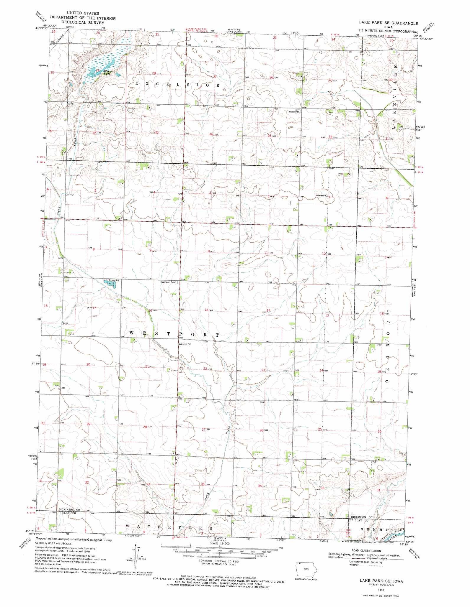
USGS Topo Quad 43095c3 - 1:24,000 scale
| Topo Map Name: | Lake Park Se |
| USGS Topo Quad ID: | 43095c3 |
| Print Size: | ca. 21 1/4" wide x 27" high |
| Southeast Coordinates: | 43.25° N latitude / 95.25° W longitude |
| Map Center Coordinates: | 43.3125° N latitude / 95.3125° W longitude |
| U.S. State: | IA |
| Filename: | o43095c3.jpg |
| Download Map JPG Image: | Lake Park Se topo map 1:24,000 scale |
| Map Type: | Topographic |
| Topo Series: | 7.5´ |
| Map Scale: | 1:24,000 |
| Source of Map Images: | United States Geological Survey (USGS) |
| Alternate Map Versions: |
Lake Park SE IA 1970, updated 1972 Download PDF Buy paper map Lake Park SE IA 2010 Download PDF Buy paper map Lake Park SE IA 2013 Download PDF Buy paper map Lake Park SE IA 2015 Download PDF Buy paper map |
1:24,000 Topo Quads surrounding Lake Park Se
Worthington South |
Round Lake |
Sioux Valley |
Lakefield Sw |
Lakefield Se |
Ocheyedan |
Harris |
Lake Park |
Okoboji |
Spirit Lake |
Melvin |
May City |
Lake Park Se |
Milford |
Spirit Lake Se |
Plessis |
Hartley |
Everly |
Spencer |
Dickens |
Gaza |
Hartley Sw |
Royal |
Creenville |
Gillett Grove |
> Back to 43095a1 at 1:100,000 scale
> Back to 43094a1 at 1:250,000 scale
> Back to U.S. Topo Maps home
Lake Park Se topo map: Gazetteer
Lake Park Se: Lakes
Pillsbury Lake (historical) elevation 436m 1430′Stony Lake elevation 436m 1430′
Sylvan Lake (historical) elevation 440m 1443′
Lake Park Se: Parks
Westport Park elevation 430m 1410′Lake Park Se: Populated Places
Hagerty elevation 438m 1437′Wallace elevation 436m 1430′
Lake Park Se: Post Offices
Hagerty Post Office (historical) elevation 428m 1404′Wallace Post Office (historical) elevation 436m 1430′
Lake Park Se digital topo map on disk
Buy this Lake Park Se topo map showing relief, roads, GPS coordinates and other geographical features, as a high-resolution digital map file on DVD: