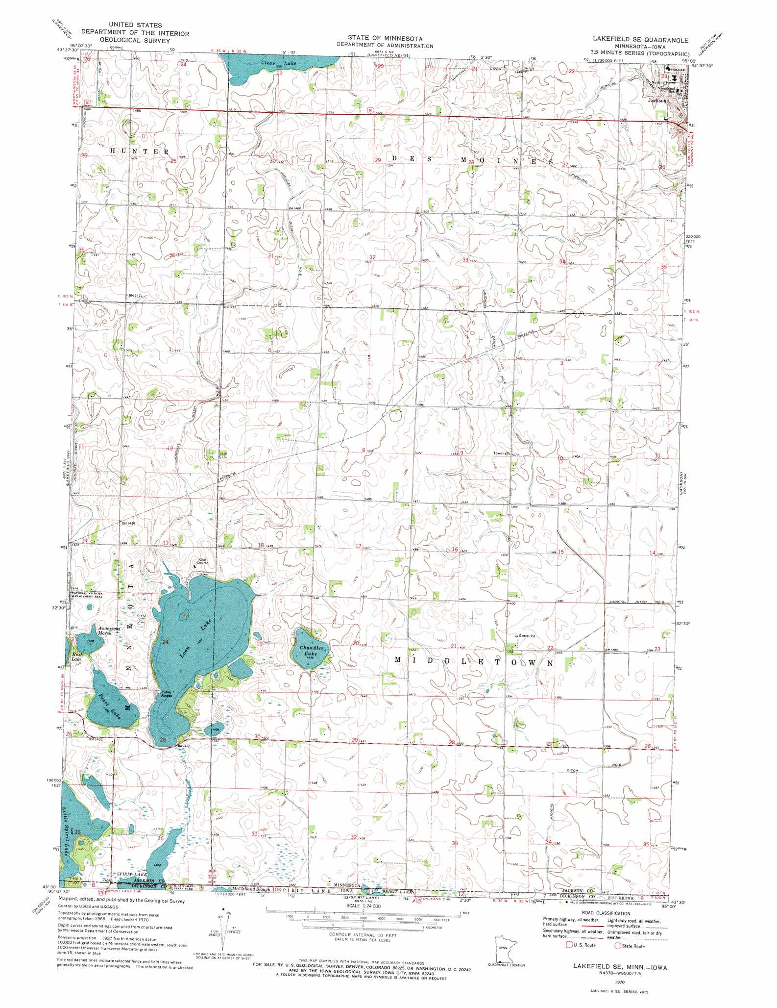
Lakefield Se Topo Map Minnesota
To zoom in, hover over the map of Lakefield Se
USGS Topo Quad 43095e1 - 1:24,000 scale
| Topo Map Name: | Lakefield Se |
| USGS Topo Quad ID: | 43095e1 |
| Print Size: | ca. 21 1/4" wide x 27" high |
| Southeast Coordinates: | 43.5° N latitude / 95° W longitude |
| Map Center Coordinates: | 43.5625° N latitude / 95.0625° W longitude |
| U.S. States: | MN, IA |
| Filename: | o43095e1.jpg |
| Download Map JPG Image: | Lakefield Se topo map 1:24,000 scale |
| Map Type: | Topographic |
| Topo Series: | 7.5´ |
| Map Scale: | 1:24,000 |
| Source of Map Images: | United States Geological Survey (USGS) |
| Alternate Map Versions: |
Lakefield SE MN 1970, updated 1972 Download PDF Buy paper map Lakefield SE MN 2010 Download PDF Buy paper map Lakefield SE MN 2013 Download PDF Buy paper map Lakefield SE MN 2016 Download PDF Buy paper map |
1:24,000 Topo Quads surrounding Lakefield Se
Heron Lake |
Wilder |
Windom |
Bergen |
Mountain Lake Se |
Okabena |
Lakefield |
Lakefield Ne |
Jackson Nw |
Alpha |
Sioux Valley |
Lakefield Sw |
Lakefield Se |
Jackson |
Dunnell |
Lake Park |
Okoboji |
Spirit Lake |
Superior |
Estherville |
Lake Park Se |
Milford |
Spirit Lake Se |
Terril |
Wallingford |
> Back to 43095e1 at 1:100,000 scale
> Back to 43094a1 at 1:250,000 scale
> Back to U.S. Topo Maps home
Lakefield Se topo map: Gazetteer
Lakefield Se: Canals
Judicial Ditch Number Eight elevation 444m 1456′Judicial Ditch Number Six elevation 421m 1381′
Judicial Ditch Number Sixtyeight elevation 441m 1446′
Judicial Ditch Number Sixtysix elevation 427m 1400′
Lakefield Se: Dams
Loon Lake Dam elevation 430m 1410′Lakefield Se: Lakes
Andersons Marsh elevation 427m 1400′Chandler Lake elevation 436m 1430′
Loon Lake elevation 427m 1400′
Pear Lake elevation 427m 1400′
Lakefield Se: Reservoirs
Loon Lake elevation 430m 1410′Lakefield Se digital topo map on disk
Buy this Lakefield Se topo map showing relief, roads, GPS coordinates and other geographical features, as a high-resolution digital map file on DVD: