Chandler Topo Map Minnesota
To zoom in, hover over the map of Chandler
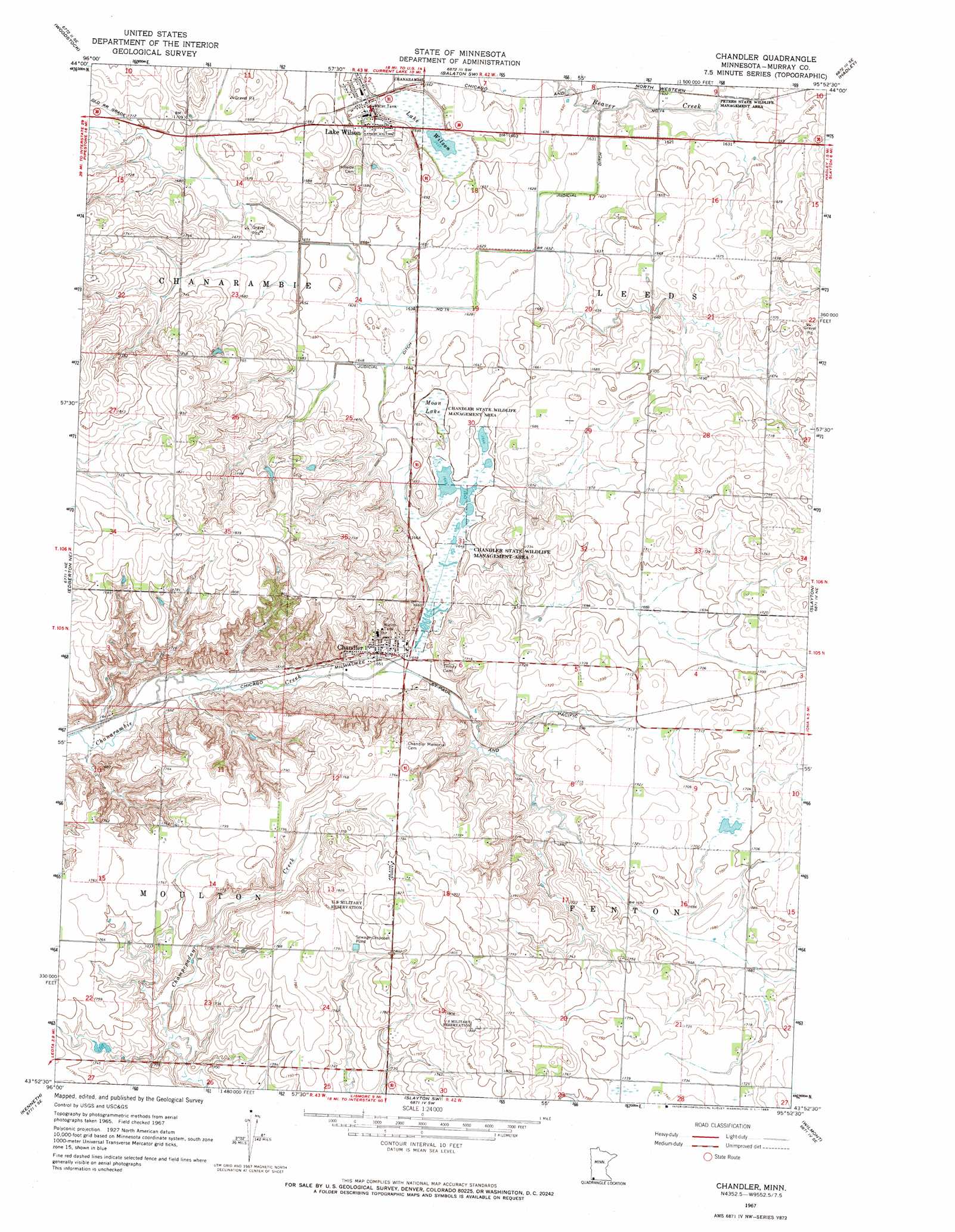
USGS Topo Quad 43095h8 - 1:24,000 scale
| Topo Map Name: | Chandler |
| USGS Topo Quad ID: | 43095h8 |
| Print Size: | ca. 21 1/4" wide x 27" high |
| Southeast Coordinates: | 43.875° N latitude / 95.875° W longitude |
| Map Center Coordinates: | 43.9375° N latitude / 95.9375° W longitude |
| U.S. State: | MN |
| Filename: | o43095h8.jpg |
| Download Map JPG Image: | Chandler topo map 1:24,000 scale |
| Map Type: | Topographic |
| Topo Series: | 7.5´ |
| Map Scale: | 1:24,000 |
| Source of Map Images: | United States Geological Survey (USGS) |
| Alternate Map Versions: |
Chandler MN 1967, updated 1969 Download PDF Buy paper map Chandler MN 2010 Download PDF Buy paper map Chandler MN 2013 Download PDF Buy paper map Chandler MN 2016 Download PDF Buy paper map |
1:24,000 Topo Quads surrounding Chandler
Ruthton Nw |
Ruthton |
Current Lake |
Balaton |
Tracy West |
Holland |
Woodstock |
Balaton Sw |
Hadley |
Currie |
Edgerton North |
Edgerton Ne |
Chandler |
Slayton |
Avoca |
Edgerton South |
Kenneth |
Slayton Sw |
Wilmont |
Fulda Sw |
Luverne |
Magnolia |
Adrian |
Adrian Ne |
Reading |
> Back to 43095e1 at 1:100,000 scale
> Back to 43094a1 at 1:250,000 scale
> Back to U.S. Topo Maps home
Chandler topo map: Gazetteer
Chandler: Canals
Judicial Ditch Number Fourteen elevation 497m 1630′Judicial Ditch Number Fourteen elevation 497m 1630′
Chandler: Lakes
Lake Wilson elevation 499m 1637′Moon Lake elevation 503m 1650′
Chandler: Parks
Chandler State Wildlife Management Area elevation 503m 1650′Chandler: Populated Places
Chandler elevation 506m 1660′Lake Wilson elevation 506m 1660′
Chandler: Post Offices
Chandler Post Office elevation 508m 1666′Lake Wilson Post Office elevation 506m 1660′
Chandler digital topo map on disk
Buy this Chandler topo map showing relief, roads, GPS coordinates and other geographical features, as a high-resolution digital map file on DVD: