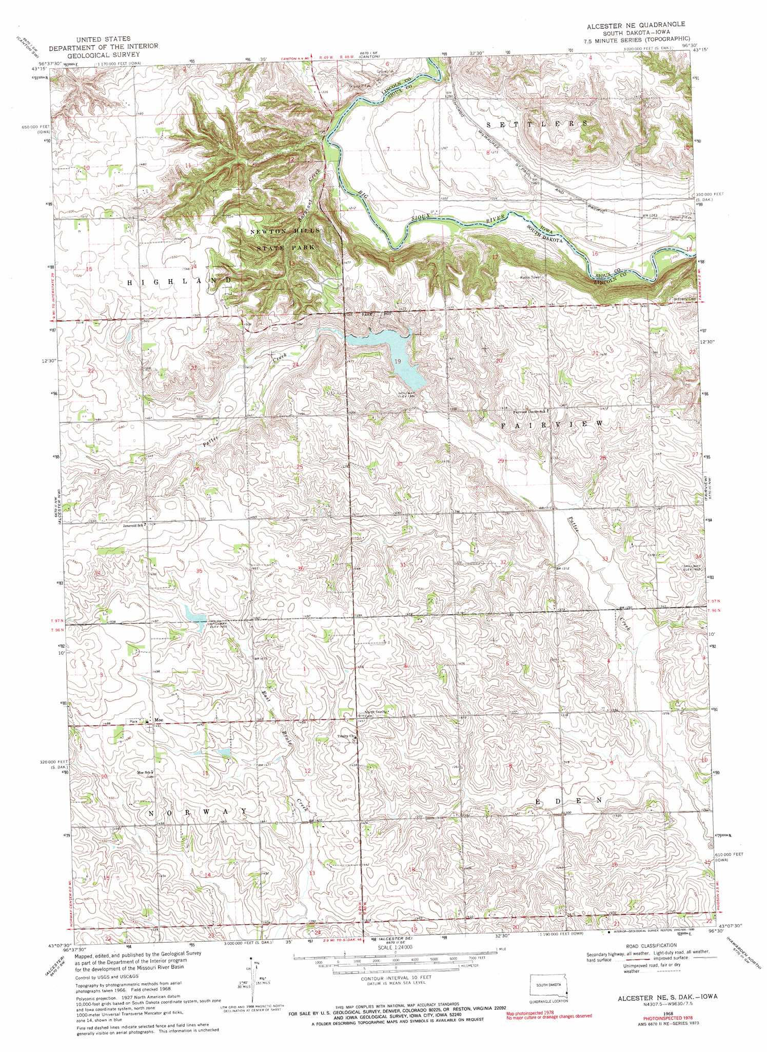
Alcester Ne Topo Map South Dakota
To zoom in, hover over the map of Alcester Ne
USGS Topo Quad 43096b5 - 1:24,000 scale
| Topo Map Name: | Alcester Ne |
| USGS Topo Quad ID: | 43096b5 |
| Print Size: | ca. 21 1/4" wide x 27" high |
| Southeast Coordinates: | 43.125° N latitude / 96.5° W longitude |
| Map Center Coordinates: | 43.1875° N latitude / 96.5625° W longitude |
| U.S. States: | SD, IA |
| Filename: | o43096b5.jpg |
| Download Map JPG Image: | Alcester Ne topo map 1:24,000 scale |
| Map Type: | Topographic |
| Topo Series: | 7.5´ |
| Map Scale: | 1:24,000 |
| Source of Map Images: | United States Geological Survey (USGS) |
| Alternate Map Versions: |
Alcester NE SD 1968, updated 1970 Download PDF Buy paper map Alcester NE SD 1968, updated 1990 Download PDF Buy paper map Alcester NE SD 2010 Download PDF Buy paper map Alcester NE SD 2012 Download PDF Buy paper map Alcester NE SD 2015 Download PDF Buy paper map |
1:24,000 Topo Quads surrounding Alcester Ne
Tea |
Harrisburg |
Klondike |
Larchwood |
Lester |
Worthing |
Canton Sw |
Canton |
Inwood |
Alvord |
Beresford Ne |
Alcester Nw |
Alcester Ne |
Fairview |
Rock Valley |
Beresford |
Alcester |
Alcester Se |
Hawarden North |
Lebanon |
Alsen |
Nora |
Chatsworth |
Hawarden South |
Ireton |
> Back to 43096a1 at 1:100,000 scale
> Back to 43096a1 at 1:250,000 scale
> Back to U.S. Topo Maps home
Alcester Ne topo map: Gazetteer
Alcester Ne: Dams
Pattee Creek Flood Control Dam elevation 401m 1315′Alcester Ne: Parks
Newton Hills State Park elevation 399m 1309′Alcester Ne: Populated Places
Moe elevation 454m 1489′Alcester Ne: Streams
Sargeant Creek elevation 368m 1207′Alcester Ne digital topo map on disk
Buy this Alcester Ne topo map showing relief, roads, GPS coordinates and other geographical features, as a high-resolution digital map file on DVD:
Eastern North Dakota & Eastern South Dakota
Buy digital topo maps: Eastern North Dakota & Eastern South Dakota