Doon Topo Map Iowa
To zoom in, hover over the map of Doon
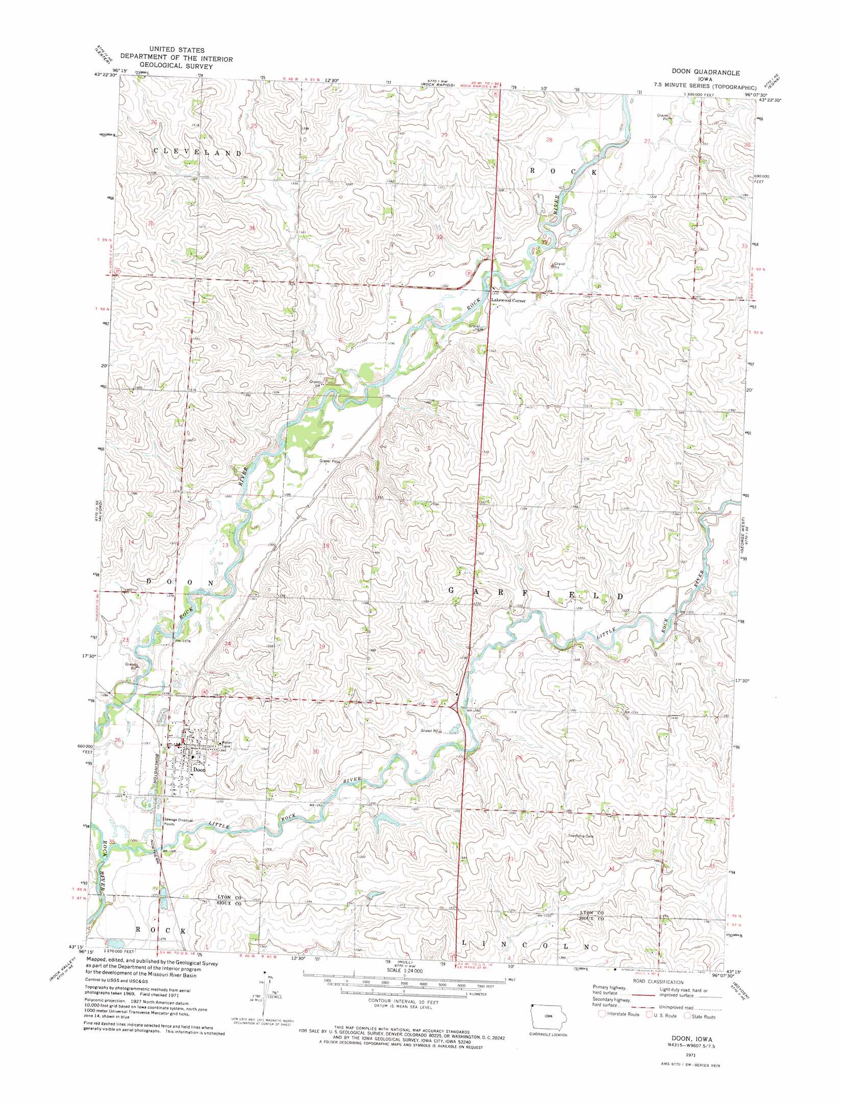
USGS Topo Quad 43096c2 - 1:24,000 scale
| Topo Map Name: | Doon |
| USGS Topo Quad ID: | 43096c2 |
| Print Size: | ca. 21 1/4" wide x 27" high |
| Southeast Coordinates: | 43.25° N latitude / 96.125° W longitude |
| Map Center Coordinates: | 43.3125° N latitude / 96.1875° W longitude |
| U.S. State: | IA |
| Filename: | o43096c2.jpg |
| Download Map JPG Image: | Doon topo map 1:24,000 scale |
| Map Type: | Topographic |
| Topo Series: | 7.5´ |
| Map Scale: | 1:24,000 |
| Source of Map Images: | United States Geological Survey (USGS) |
| Alternate Map Versions: |
Doon IA 1971, updated 1973 Download PDF Buy paper map Doon IA 2010 Download PDF Buy paper map Doon IA 2013 Download PDF Buy paper map Doon IA 2015 Download PDF Buy paper map |
1:24,000 Topo Quads surrounding Doon
Valley Springs |
Hills |
Ash Creek |
Ellsworth |
Adrian Sw |
Larchwood |
Lester |
Rock Rapids |
Edna |
Little Rock |
Inwood |
Alvord |
Doon |
George West |
George East |
Fairview |
Rock Valley |
Hull |
Boyden |
Matlock |
Hawarden North |
Lebanon |
Sioux Center |
Orange City |
Hospers |
> Back to 43096a1 at 1:100,000 scale
> Back to 43096a1 at 1:250,000 scale
> Back to U.S. Topo Maps home
Doon topo map: Gazetteer
Doon: Parks
Doon Wildlife Area elevation 387m 1269′Lakewood Corners Wildlife Area elevation 396m 1299′
Doon: Populated Places
Doon elevation 395m 1295′Lakewood (historical) elevation 401m 1315′
Lakewood Corner elevation 397m 1302′
Doon: Post Offices
Doon Post Office elevation 395m 1295′Lakewood Post Office (historical) elevation 401m 1315′
Smead Post Office (historical) elevation 396m 1299′
Doon: Streams
Little Rock River elevation 381m 1250′Little Rock River elevation 381m 1250′
Mud Creek elevation 384m 1259′
Mud Creek elevation 384m 1259′
Doon digital topo map on disk
Buy this Doon topo map showing relief, roads, GPS coordinates and other geographical features, as a high-resolution digital map file on DVD:
Eastern North Dakota & Eastern South Dakota
Buy digital topo maps: Eastern North Dakota & Eastern South Dakota