Rock Rapids Topo Map Iowa
To zoom in, hover over the map of Rock Rapids
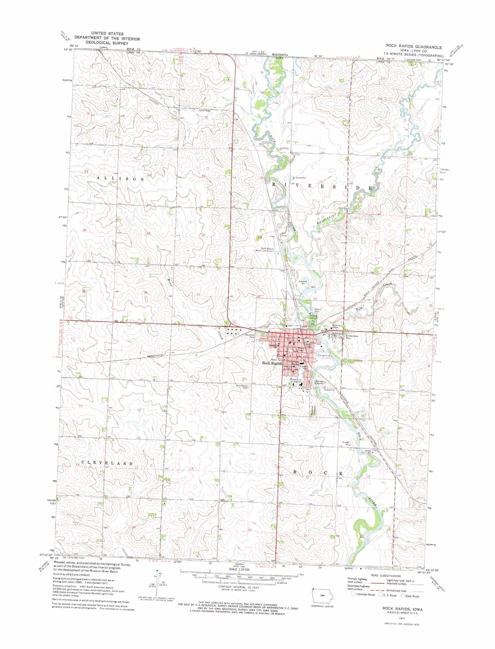
USGS Topo Quad 43096d2 - 1:24,000 scale
| Topo Map Name: | Rock Rapids |
| USGS Topo Quad ID: | 43096d2 |
| Print Size: | ca. 21 1/4" wide x 27" high |
| Southeast Coordinates: | 43.375° N latitude / 96.125° W longitude |
| Map Center Coordinates: | 43.4375° N latitude / 96.1875° W longitude |
| U.S. State: | IA |
| Filename: | o43096d2.jpg |
| Download Map JPG Image: | Rock Rapids topo map 1:24,000 scale |
| Map Type: | Topographic |
| Topo Series: | 7.5´ |
| Map Scale: | 1:24,000 |
| Source of Map Images: | United States Geological Survey (USGS) |
| Alternate Map Versions: |
Rock Rapids IA 1971, updated 1973 Download PDF Buy paper map Rock Rapids IA 2010 Download PDF Buy paper map Rock Rapids IA 2013 Download PDF Buy paper map Rock Rapids IA 2015 Download PDF Buy paper map |
1:24,000 Topo Quads surrounding Rock Rapids
Garretson East |
Hills Ne |
Luverne |
Magnolia |
Adrian |
Valley Springs |
Hills |
Ash Creek |
Ellsworth |
Adrian Sw |
Larchwood |
Lester |
Rock Rapids |
Edna |
Little Rock |
Inwood |
Alvord |
Doon |
George West |
George East |
Fairview |
Rock Valley |
Hull |
Boyden |
Matlock |
> Back to 43096a1 at 1:100,000 scale
> Back to 43096a1 at 1:250,000 scale
> Back to U.S. Topo Maps home
Rock Rapids topo map: Gazetteer
Rock Rapids: Airports
Merrill Pioneer Community Hospital Heliport elevation 419m 1374′Rock Rapids Municipal Airport elevation 413m 1354′
Rock Rapids: Bridges
Melan Bridge elevation 406m 1332′Rock Rapids: Parks
Emma Sater Park elevation 414m 1358′Island Park elevation 406m 1332′
Kiwanis Park elevation 410m 1345′
Site of First White Mans Home in Lyon County Historical Marker elevation 406m 1332′
Westside Park elevation 417m 1368′
Rock Rapids: Populated Places
Rock Rapids elevation 423m 1387′Rock Rapids: Post Offices
Rock Rapids Post Office elevation 411m 1348′Rock Rapids: Streams
Kanaranzi Creek elevation 405m 1328′Moon Creek elevation 404m 1325′
Tom Creek elevation 403m 1322′
Rock Rapids: Trails
Rock Rapids Trail elevation 409m 1341′Rock Rapids digital topo map on disk
Buy this Rock Rapids topo map showing relief, roads, GPS coordinates and other geographical features, as a high-resolution digital map file on DVD:
Eastern North Dakota & Eastern South Dakota
Buy digital topo maps: Eastern North Dakota & Eastern South Dakota