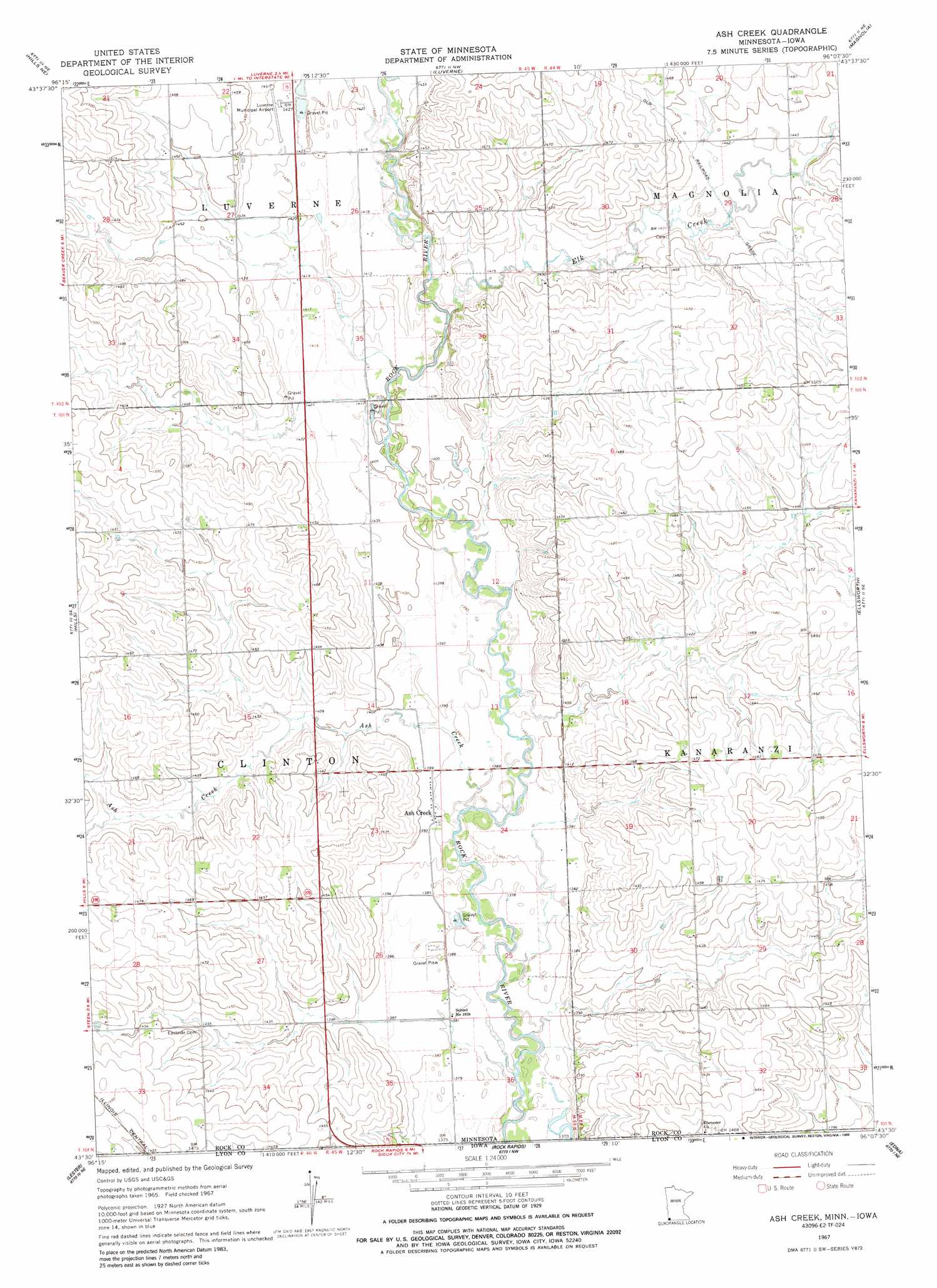
Ash Creek Topo Map Minnesota
To zoom in, hover over the map of Ash Creek
USGS Topo Quad 43096e2 - 1:24,000 scale
| Topo Map Name: | Ash Creek |
| USGS Topo Quad ID: | 43096e2 |
| Print Size: | ca. 21 1/4" wide x 27" high |
| Southeast Coordinates: | 43.5° N latitude / 96.125° W longitude |
| Map Center Coordinates: | 43.5625° N latitude / 96.1875° W longitude |
| U.S. States: | MN, IA |
| Filename: | o43096e2.jpg |
| Download Map JPG Image: | Ash Creek topo map 1:24,000 scale |
| Map Type: | Topographic |
| Topo Series: | 7.5´ |
| Map Scale: | 1:24,000 |
| Source of Map Images: | United States Geological Survey (USGS) |
| Alternate Map Versions: |
Ash Creek MN 1967, updated 1969 Download PDF Buy paper map Ash Creek MN 2010 Download PDF Buy paper map Ash Creek MN 2013 Download PDF Buy paper map Ash Creek MN 2016 Download PDF Buy paper map |
1:24,000 Topo Quads surrounding Ash Creek
Jasper |
Jasper Se |
Edgerton South |
Kenneth |
Slayton Sw |
Garretson East |
Hills Ne |
Luverne |
Magnolia |
Adrian |
Valley Springs |
Hills |
Ash Creek |
Ellsworth |
Adrian Sw |
Larchwood |
Lester |
Rock Rapids |
Edna |
Little Rock |
Inwood |
Alvord |
Doon |
George West |
George East |
> Back to 43096e1 at 1:100,000 scale
> Back to 43096a1 at 1:250,000 scale
> Back to U.S. Topo Maps home
Ash Creek topo map: Gazetteer
Ash Creek: Airports
Luverne Municipal Airport elevation 438m 1437′Ash Creek: Populated Places
Ash Creek elevation 425m 1394′Ash Creek: Post Offices
Ashcreek Post Office (historical) elevation 425m 1394′Ash Creek: Streams
Ash Creek elevation 421m 1381′Elk Creek elevation 434m 1423′
Ash Creek digital topo map on disk
Buy this Ash Creek topo map showing relief, roads, GPS coordinates and other geographical features, as a high-resolution digital map file on DVD:
Eastern North Dakota & Eastern South Dakota
Buy digital topo maps: Eastern North Dakota & Eastern South Dakota