Luverne Topo Map Minnesota
To zoom in, hover over the map of Luverne
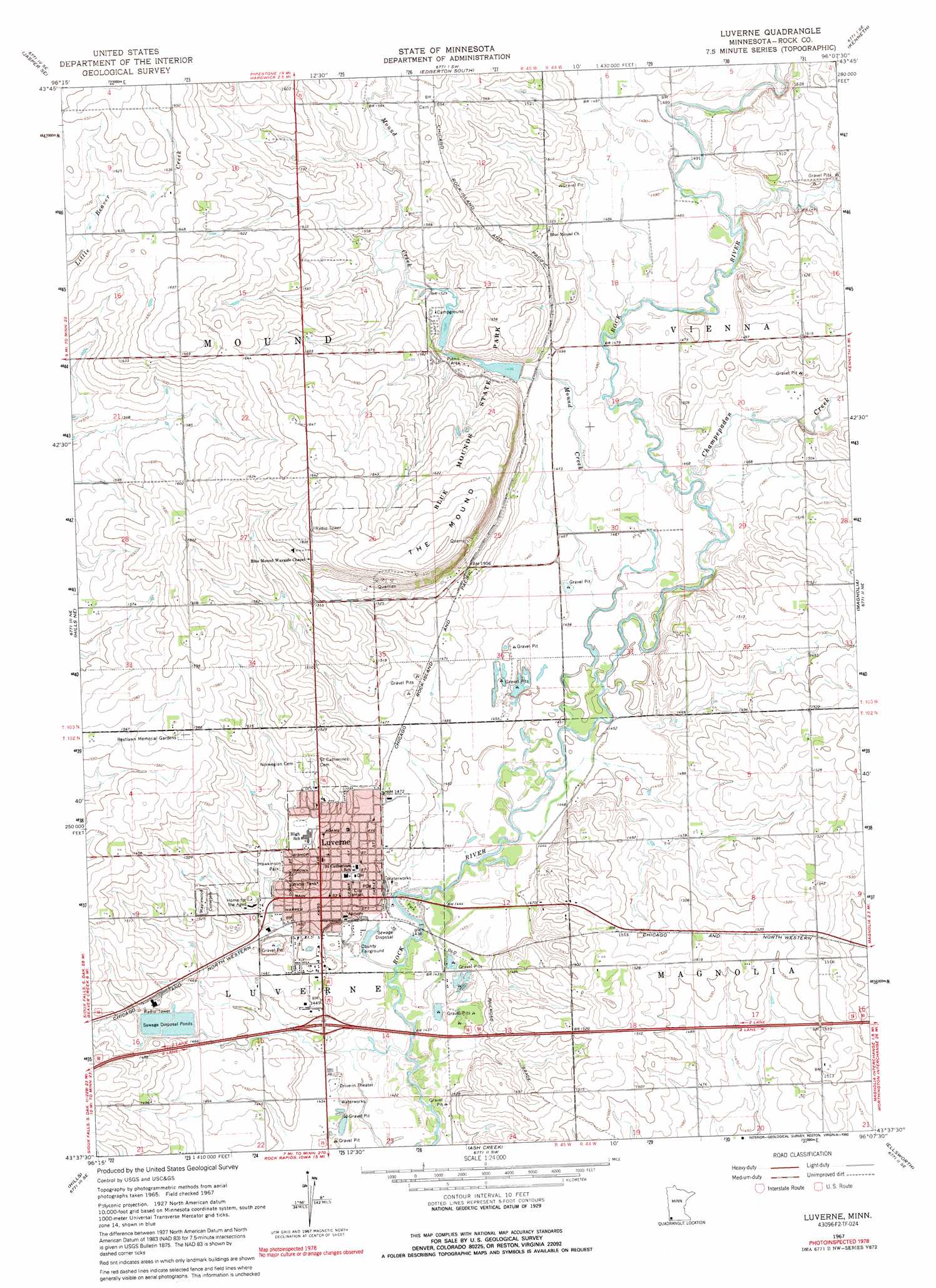
USGS Topo Quad 43096f2 - 1:24,000 scale
| Topo Map Name: | Luverne |
| USGS Topo Quad ID: | 43096f2 |
| Print Size: | ca. 21 1/4" wide x 27" high |
| Southeast Coordinates: | 43.625° N latitude / 96.125° W longitude |
| Map Center Coordinates: | 43.6875° N latitude / 96.1875° W longitude |
| U.S. State: | MN |
| Filename: | o43096f2.jpg |
| Download Map JPG Image: | Luverne topo map 1:24,000 scale |
| Map Type: | Topographic |
| Topo Series: | 7.5´ |
| Map Scale: | 1:24,000 |
| Source of Map Images: | United States Geological Survey (USGS) |
| Alternate Map Versions: |
Luverne MN 1967, updated 1969 Download PDF Buy paper map Luverne MN 1967, updated 1992 Download PDF Buy paper map Luverne MN 2010 Download PDF Buy paper map Luverne MN 2013 Download PDF Buy paper map Luverne MN 2016 Download PDF Buy paper map |
1:24,000 Topo Quads surrounding Luverne
Jasper Nw |
Pipestone South |
Edgerton North |
Edgerton Ne |
Chandler |
Jasper |
Jasper Se |
Edgerton South |
Kenneth |
Slayton Sw |
Garretson East |
Hills Ne |
Luverne |
Magnolia |
Adrian |
Valley Springs |
Hills |
Ash Creek |
Ellsworth |
Adrian Sw |
Larchwood |
Lester |
Rock Rapids |
Edna |
Little Rock |
> Back to 43096e1 at 1:100,000 scale
> Back to 43096a1 at 1:250,000 scale
> Back to U.S. Topo Maps home
Luverne topo map: Gazetteer
Luverne: Crossings
Interchange 12 elevation 441m 1446′Luverne: Dams
North Mound Creek Pool Dam elevation 463m 1519′Rock River Dam elevation 436m 1430′
South Mound Creek Pool Dam elevation 455m 1492′
Luverne: Parks
Blue Mounds State Park elevation 490m 1607′Hawkinson Park elevation 451m 1479′
Luverne City Park elevation 438m 1437′
Redbird Field elevation 438m 1437′
Schoeman Park elevation 436m 1430′
Luverne: Populated Places
Luverne elevation 447m 1466′Luverne: Post Offices
Luverne Post Office elevation 444m 1456′Luverne: Reservoirs
North Mound Creek Pool elevation 463m 1519′Rock River Reservoir elevation 436m 1430′
South Mound Creek Pool elevation 455m 1492′
Luverne: Streams
Champepadan Creek elevation 445m 1459′Mound Creek elevation 445m 1459′
Luverne: Summits
The Mound elevation 515m 1689′Luverne digital topo map on disk
Buy this Luverne topo map showing relief, roads, GPS coordinates and other geographical features, as a high-resolution digital map file on DVD:
Eastern North Dakota & Eastern South Dakota
Buy digital topo maps: Eastern North Dakota & Eastern South Dakota