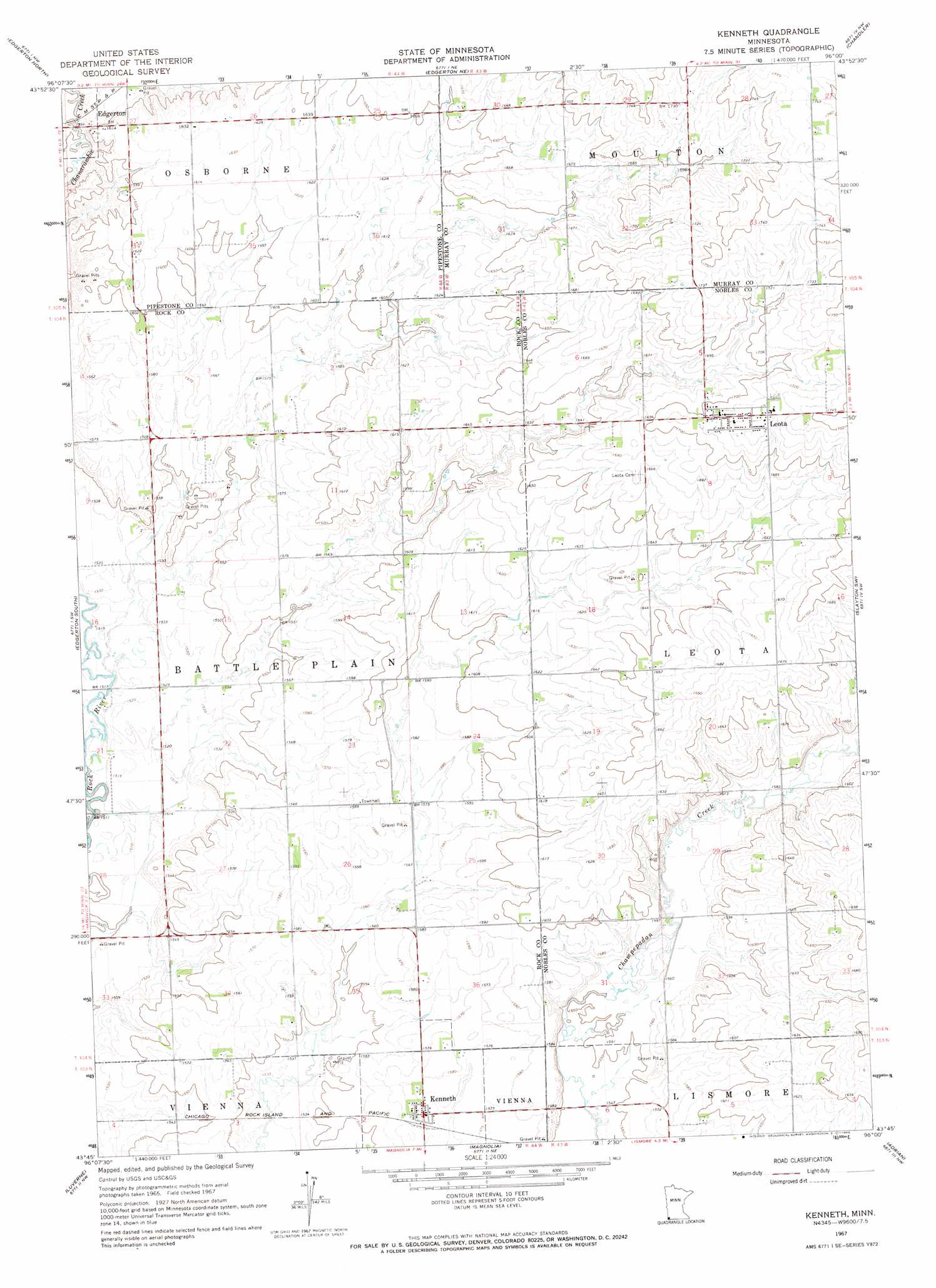
Kenneth Topo Map Minnesota
To zoom in, hover over the map of Kenneth
USGS Topo Quad 43096g1 - 1:24,000 scale
| Topo Map Name: | Kenneth |
| USGS Topo Quad ID: | 43096g1 |
| Print Size: | ca. 21 1/4" wide x 27" high |
| Southeast Coordinates: | 43.75° N latitude / 96° W longitude |
| Map Center Coordinates: | 43.8125° N latitude / 96.0625° W longitude |
| U.S. State: | MN |
| Filename: | o43096g1.jpg |
| Download Map JPG Image: | Kenneth topo map 1:24,000 scale |
| Map Type: | Topographic |
| Topo Series: | 7.5´ |
| Map Scale: | 1:24,000 |
| Source of Map Images: | United States Geological Survey (USGS) |
| Alternate Map Versions: |
Kenneth MN 1967, updated 1968 Download PDF Buy paper map Kenneth MN 2010 Download PDF Buy paper map Kenneth MN 2013 Download PDF Buy paper map Kenneth MN 2016 Download PDF Buy paper map |
1:24,000 Topo Quads surrounding Kenneth
Pipestone North |
Holland |
Woodstock |
Balaton Sw |
Hadley |
Pipestone South |
Edgerton North |
Edgerton Ne |
Chandler |
Slayton |
Jasper Se |
Edgerton South |
Kenneth |
Slayton Sw |
Wilmont |
Hills Ne |
Luverne |
Magnolia |
Adrian |
Adrian Ne |
Hills |
Ash Creek |
Ellsworth |
Adrian Sw |
Rushmore |
> Back to 43096e1 at 1:100,000 scale
> Back to 43096a1 at 1:250,000 scale
> Back to U.S. Topo Maps home
Kenneth topo map: Gazetteer
Kenneth: Populated Places
Kenneth elevation 481m 1578′Leota elevation 525m 1722′
Kenneth: Post Offices
Kenneth Post Office elevation 481m 1578′Leota Post Office elevation 525m 1722′
Kenneth digital topo map on disk
Buy this Kenneth topo map showing relief, roads, GPS coordinates and other geographical features, as a high-resolution digital map file on DVD:
Eastern North Dakota & Eastern South Dakota
Buy digital topo maps: Eastern North Dakota & Eastern South Dakota