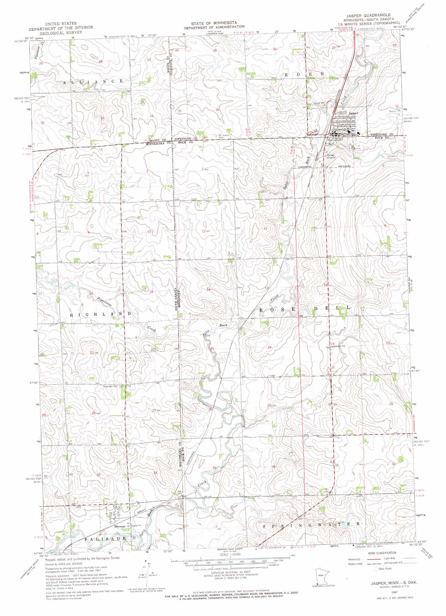
Jasper Topo Map Minnesota
To zoom in, hover over the map of Jasper
USGS Topo Quad 43096g4 - 1:24,000 scale
| Topo Map Name: | Jasper |
| USGS Topo Quad ID: | 43096g4 |
| Print Size: | ca. 21 1/4" wide x 27" high |
| Southeast Coordinates: | 43.75° N latitude / 96.375° W longitude |
| Map Center Coordinates: | 43.8125° N latitude / 96.4375° W longitude |
| U.S. States: | MN, SD |
| Filename: | o43096g4.jpg |
| Download Map JPG Image: | Jasper topo map 1:24,000 scale |
| Map Type: | Topographic |
| Topo Series: | 7.5´ |
| Map Scale: | 1:24,000 |
| Source of Map Images: | United States Geological Survey (USGS) |
| Alternate Map Versions: |
Jasper MN 1967, updated 1968 Download PDF Buy paper map Jasper MN 2010 Download PDF Buy paper map Jasper MN 2013 Download PDF Buy paper map Jasper MN 2016 Download PDF Buy paper map |
1:24,000 Topo Quads surrounding Jasper
Flandreau Sw |
Flandreau |
Elkton Sw |
Pipestone North |
Holland |
Trent |
Dell Rapids Ne |
Jasper Nw |
Pipestone South |
Edgerton North |
Dell Rapids |
Dell Rapids Se |
Jasper |
Jasper Se |
Edgerton South |
Renner |
Garretson West |
Garretson East |
Hills Ne |
Luverne |
Sioux Falls East |
Brandon |
Valley Springs |
Hills |
Ash Creek |
> Back to 43096e1 at 1:100,000 scale
> Back to 43096a1 at 1:250,000 scale
> Back to U.S. Topo Maps home
Jasper topo map: Gazetteer
Jasper: Dams
Minnesota Noname Number 1 Dam elevation 472m 1548′Jasper: Populated Places
Jasper elevation 474m 1555′Jasper Sunrise Village elevation 496m 1627′
Sherman elevation 457m 1499′
Jasper: Post Offices
Jasper Post Office elevation 479m 1571′Jasper: Streams
Pipestone Creek elevation 460m 1509′Pipestone Creek elevation 460m 1509′
Jasper digital topo map on disk
Buy this Jasper topo map showing relief, roads, GPS coordinates and other geographical features, as a high-resolution digital map file on DVD:
Eastern North Dakota & Eastern South Dakota
Buy digital topo maps: Eastern North Dakota & Eastern South Dakota