Dell Rapids Ne Topo Map South Dakota
To zoom in, hover over the map of Dell Rapids Ne
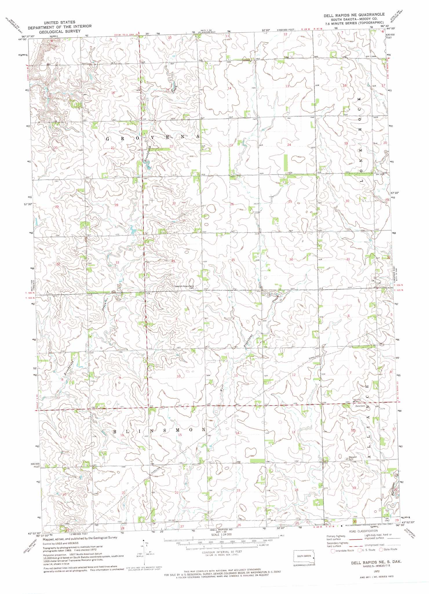
USGS Topo Quad 43096h5 - 1:24,000 scale
| Topo Map Name: | Dell Rapids Ne |
| USGS Topo Quad ID: | 43096h5 |
| Print Size: | ca. 21 1/4" wide x 27" high |
| Southeast Coordinates: | 43.875° N latitude / 96.5° W longitude |
| Map Center Coordinates: | 43.9375° N latitude / 96.5625° W longitude |
| U.S. State: | SD |
| Filename: | o43096h5.jpg |
| Download Map JPG Image: | Dell Rapids Ne topo map 1:24,000 scale |
| Map Type: | Topographic |
| Topo Series: | 7.5´ |
| Map Scale: | 1:24,000 |
| Source of Map Images: | United States Geological Survey (USGS) |
| Alternate Map Versions: |
Dell Rapids NE SD 1972, updated 1973 Download PDF Buy paper map Dell Rapids NE SD 2012 Download PDF Buy paper map Dell Rapids NE SD 2015 Download PDF Buy paper map |
1:24,000 Topo Quads surrounding Dell Rapids Ne
Medary |
Flandreau Nw |
Flandreau Ne |
Elkton |
Verdi |
Rutland Se |
Flandreau Sw |
Flandreau |
Elkton Sw |
Pipestone North |
Colman |
Trent |
Dell Rapids Ne |
Jasper Nw |
Pipestone South |
Colton Se |
Dell Rapids |
Dell Rapids Se |
Jasper |
Jasper Se |
Crooks |
Renner |
Garretson West |
Garretson East |
Hills Ne |
> Back to 43096e1 at 1:100,000 scale
> Back to 43096a1 at 1:250,000 scale
> Back to U.S. Topo Maps home
Dell Rapids Ne digital topo map on disk
Buy this Dell Rapids Ne topo map showing relief, roads, GPS coordinates and other geographical features, as a high-resolution digital map file on DVD:
Eastern North Dakota & Eastern South Dakota
Buy digital topo maps: Eastern North Dakota & Eastern South Dakota