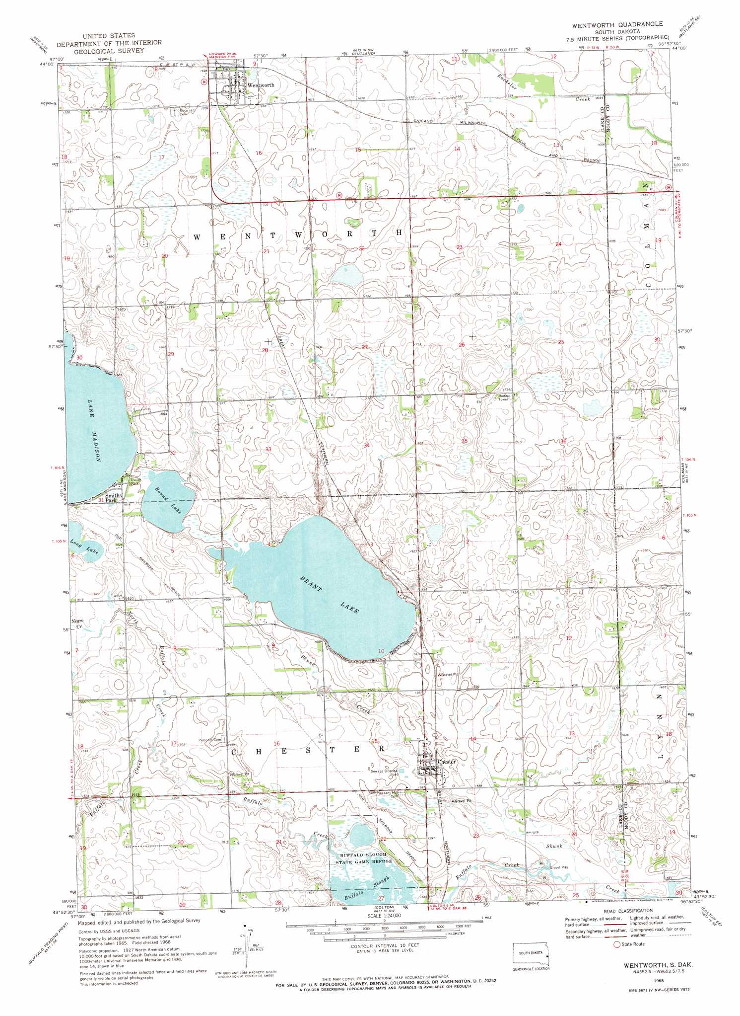
Wentworth Topo Map South Dakota
To zoom in, hover over the map of Wentworth
USGS Topo Quad 43096h8 - 1:24,000 scale
| Topo Map Name: | Wentworth |
| USGS Topo Quad ID: | 43096h8 |
| Print Size: | ca. 21 1/4" wide x 27" high |
| Southeast Coordinates: | 43.875° N latitude / 96.875° W longitude |
| Map Center Coordinates: | 43.9375° N latitude / 96.9375° W longitude |
| U.S. State: | SD |
| Filename: | o43096h8.jpg |
| Download Map JPG Image: | Wentworth topo map 1:24,000 scale |
| Map Type: | Topographic |
| Topo Series: | 7.5´ |
| Map Scale: | 1:24,000 |
| Source of Map Images: | United States Geological Survey (USGS) |
| Alternate Map Versions: |
Wentworth SD 1968, updated 1970 Download PDF Buy paper map Wentworth SD 2012 Download PDF Buy paper map Wentworth SD 2015 Download PDF Buy paper map |
1:24,000 Topo Quads surrounding Wentworth
Madison Nw |
Sinai |
Rutland Nw |
Medary |
Flandreau Nw |
Ramona |
Madison |
Rutland |
Rutland Se |
Flandreau Sw |
Lake Herman |
Lake Madison |
Wentworth |
Colman |
Trent |
Lake Madison Sw |
Buffalo Trading Post |
Colton |
Colton Se |
Dell Rapids |
Montrose |
Humboldt |
Hartford North |
Crooks |
Renner |
> Back to 43096e1 at 1:100,000 scale
> Back to 43096a1 at 1:250,000 scale
> Back to U.S. Topo Maps home
Wentworth topo map: Gazetteer
Wentworth: Lakes
Brant Lake elevation 486m 1594′Buffalo Slough elevation 479m 1571′
Round Lake elevation 486m 1594′
Wentworth: Parks
Buffalo Slough State Game Refuge elevation 481m 1578′Wentworth: Populated Places
Chester elevation 488m 1601′Smiths Park elevation 491m 1610′
Wentworth elevation 518m 1699′
Wentworth: Streams
Buffalo Creek elevation 482m 1581′Franklin Creek elevation 491m 1610′
North Buffalo Creek elevation 485m 1591′
Wentworth digital topo map on disk
Buy this Wentworth topo map showing relief, roads, GPS coordinates and other geographical features, as a high-resolution digital map file on DVD:
Eastern North Dakota & Eastern South Dakota
Buy digital topo maps: Eastern North Dakota & Eastern South Dakota