Spencer Topo Map South Dakota
To zoom in, hover over the map of Spencer
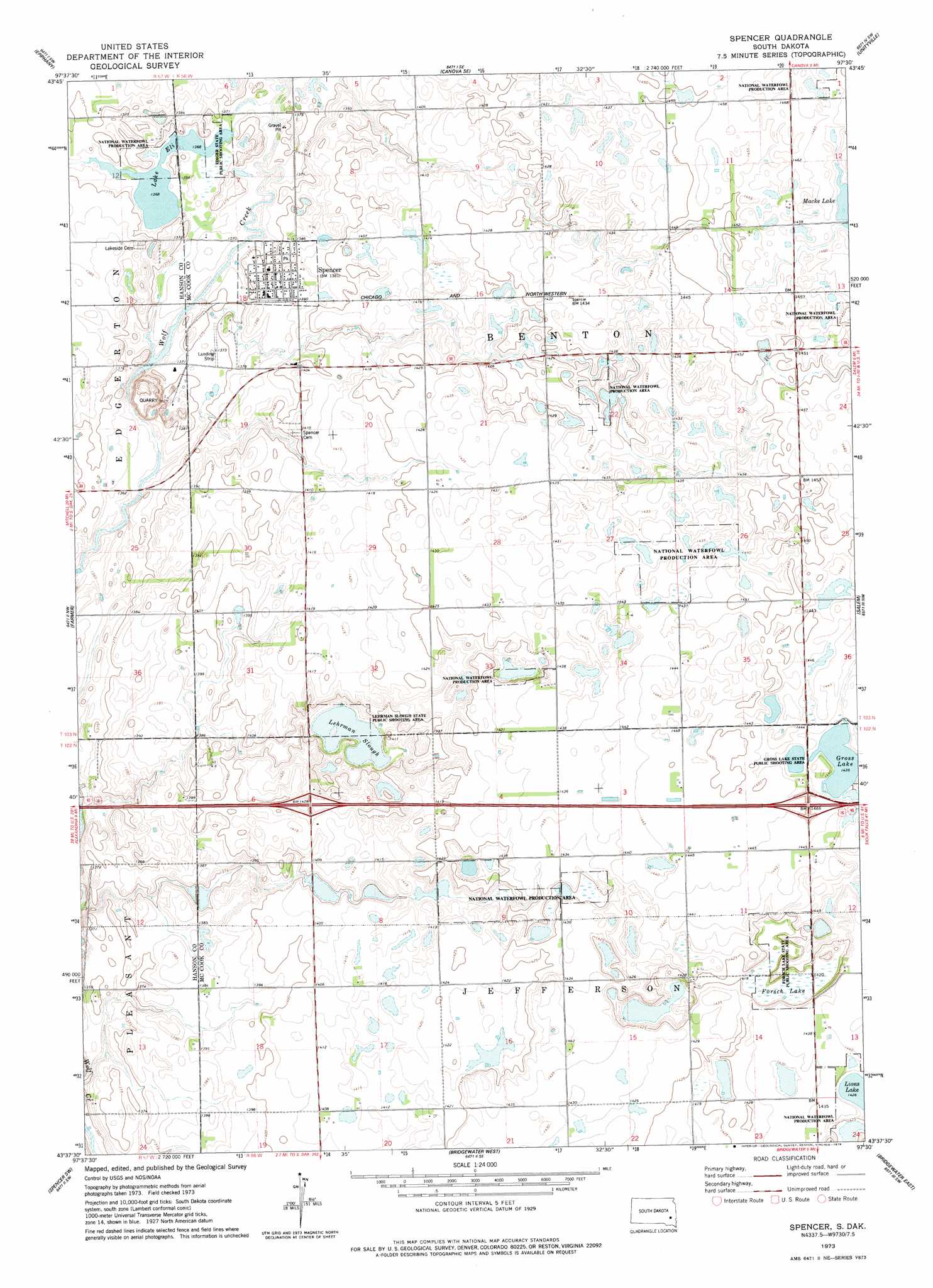
USGS Topo Quad 43097f5 - 1:24,000 scale
| Topo Map Name: | Spencer |
| USGS Topo Quad ID: | 43097f5 |
| Print Size: | ca. 21 1/4" wide x 27" high |
| Southeast Coordinates: | 43.625° N latitude / 97.5° W longitude |
| Map Center Coordinates: | 43.6875° N latitude / 97.5625° W longitude |
| U.S. State: | SD |
| Filename: | o43097f5.jpg |
| Download Map JPG Image: | Spencer topo map 1:24,000 scale |
| Map Type: | Topographic |
| Topo Series: | 7.5´ |
| Map Scale: | 1:24,000 |
| Source of Map Images: | United States Geological Survey (USGS) |
| Alternate Map Versions: |
Spencer SD 1973, updated 1978 Download PDF Buy paper map Spencer SD 2012 Download PDF Buy paper map Spencer SD 2015 Download PDF Buy paper map |
1:24,000 Topo Quads surrounding Spencer
Morris Lake |
Bitter Lake |
Canova West |
Canova East |
Winfred |
Ness Chain Lakes |
Epiphany |
Canova Se |
Unityville |
Winfred Se |
Alexandria |
Farmer |
Spencer |
Salem |
Salem Ne |
Rockport Colony |
Spencer Sw |
Bridgewater West |
Bridgewater East |
Canistota |
Milltown |
Clayton |
Clayton Ne |
Dolton |
Marion |
> Back to 43097e1 at 1:100,000 scale
> Back to 43096a1 at 1:250,000 scale
> Back to U.S. Topo Maps home
Spencer topo map: Gazetteer
Spencer: Lakes
Gross Lake elevation 438m 1437′Lake Eli elevation 417m 1368′
Lehrman Slough elevation 418m 1371′
Lions Lake elevation 432m 1417′
Macke Lake elevation 444m 1456′
Spencer: Parks
Ediger State Public Shooting Area elevation 417m 1368′Forsch Lake State Public Shooting Area elevation 434m 1423′
Gross Lake State Public Shooting Area elevation 440m 1443′
Lehrman Slough State Public Shooting Area elevation 418m 1371′
Spencer: Populated Places
Spencer elevation 422m 1384′Spencer: Swamps
Forsch Lake elevation 430m 1410′Spencer digital topo map on disk
Buy this Spencer topo map showing relief, roads, GPS coordinates and other geographical features, as a high-resolution digital map file on DVD:
Eastern North Dakota & Eastern South Dakota
Buy digital topo maps: Eastern North Dakota & Eastern South Dakota