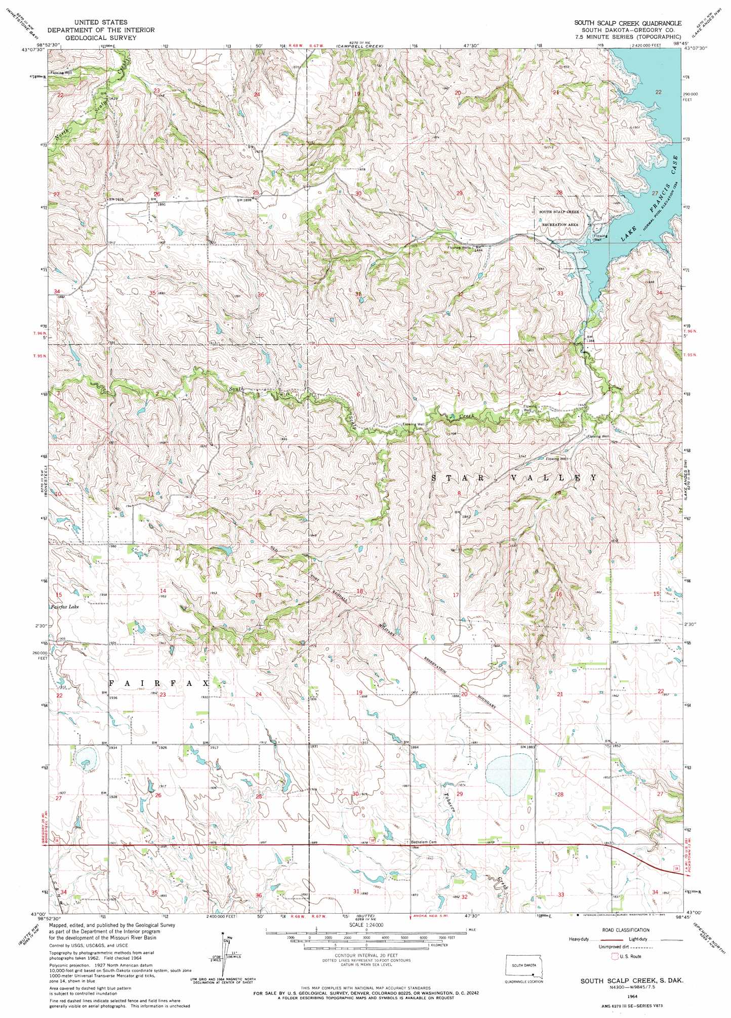
South Scalp Creek Topo Map South Dakota
To zoom in, hover over the map of South Scalp Creek
USGS Topo Quad 43098a7 - 1:24,000 scale
| Topo Map Name: | South Scalp Creek |
| USGS Topo Quad ID: | 43098a7 |
| Print Size: | ca. 21 1/4" wide x 27" high |
| Southeast Coordinates: | 43° N latitude / 98.75° W longitude |
| Map Center Coordinates: | 43.0625° N latitude / 98.8125° W longitude |
| U.S. State: | SD |
| Filename: | o43098a7.jpg |
| Download Map JPG Image: | South Scalp Creek topo map 1:24,000 scale |
| Map Type: | Topographic |
| Topo Series: | 7.5´ |
| Map Scale: | 1:24,000 |
| Source of Map Images: | United States Geological Survey (USGS) |
| Alternate Map Versions: |
South Scalp Creek SD 1964, updated 1965 Download PDF Buy paper map South Scalp Creek SD 2012 Download PDF Buy paper map South Scalp Creek SD 2015 Download PDF Buy paper map |
1:24,000 Topo Quads surrounding South Scalp Creek
Lucas Se |
Castalia |
Bovee |
Geddes |
Geddes Se |
Herrick Ne |
Whetstone Bay |
Campbell Creek |
Lake Andes Nw |
Lake Andes |
Saint Charles |
Bonesteel |
South Scalp Creek |
Lake Andes Sw |
Fort Randall Dam |
Naper |
Butte Nw |
Butte |
Spencer North |
Gross |
Dustin |
Butte Sw |
Butte Se |
Spencer South |
Bristow |
> Back to 43098a1 at 1:100,000 scale
> Back to 43098a1 at 1:250,000 scale
> Back to U.S. Topo Maps home
South Scalp Creek topo map: Gazetteer
South Scalp Creek: Parks
South Scalp Creek Recreation Area elevation 446m 1463′South Scalp Creek: Streams
South Scalp Creek elevation 413m 1354′South Scalp Creek digital topo map on disk
Buy this South Scalp Creek topo map showing relief, roads, GPS coordinates and other geographical features, as a high-resolution digital map file on DVD:
Eastern North Dakota & Eastern South Dakota
Buy digital topo maps: Eastern North Dakota & Eastern South Dakota