Bonesteel Topo Map South Dakota
To zoom in, hover over the map of Bonesteel
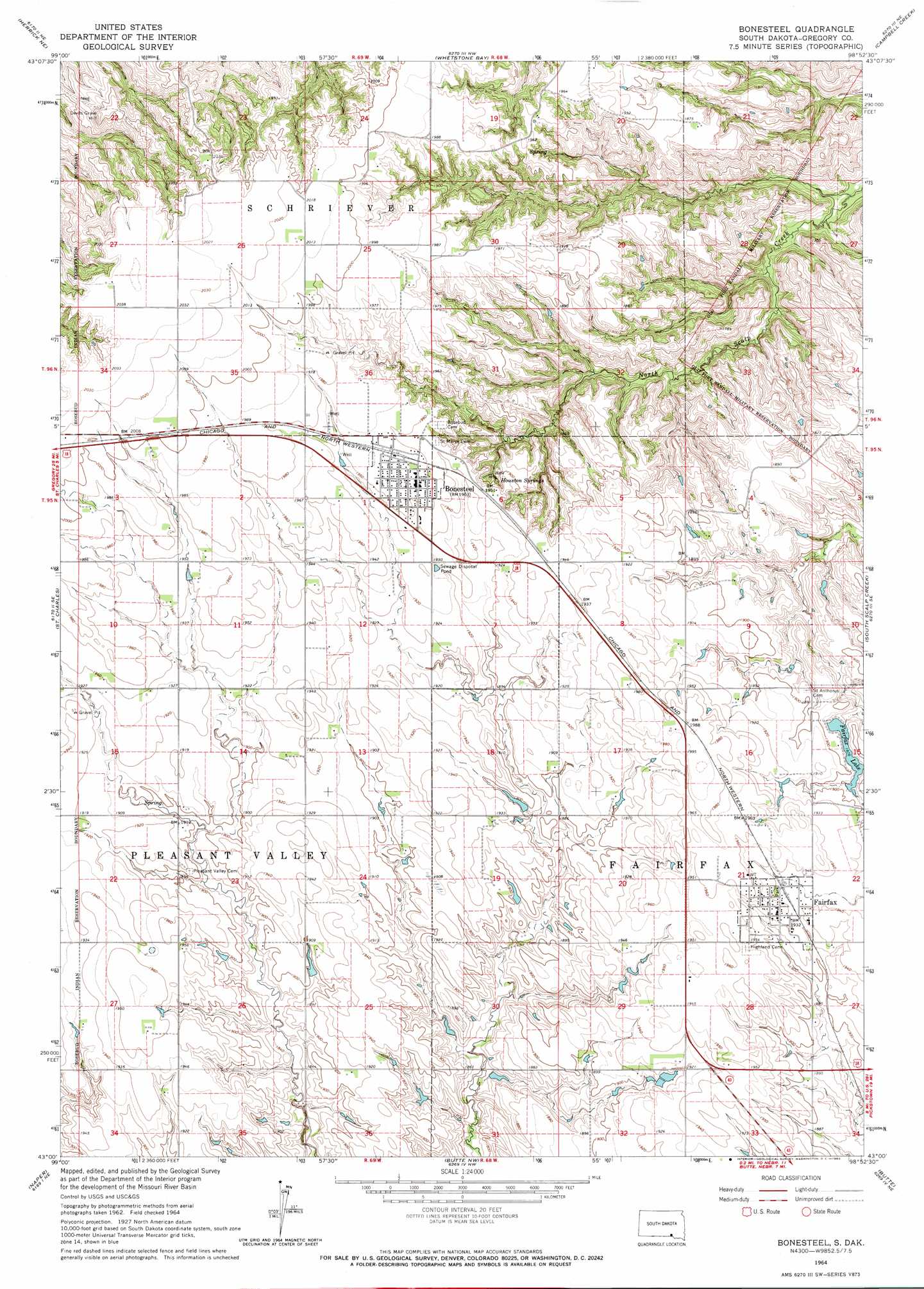
USGS Topo Quad 43098a8 - 1:24,000 scale
| Topo Map Name: | Bonesteel |
| USGS Topo Quad ID: | 43098a8 |
| Print Size: | ca. 21 1/4" wide x 27" high |
| Southeast Coordinates: | 43° N latitude / 98.875° W longitude |
| Map Center Coordinates: | 43.0625° N latitude / 98.9375° W longitude |
| U.S. State: | SD |
| Filename: | o43098a8.jpg |
| Download Map JPG Image: | Bonesteel topo map 1:24,000 scale |
| Map Type: | Topographic |
| Topo Series: | 7.5´ |
| Map Scale: | 1:24,000 |
| Source of Map Images: | United States Geological Survey (USGS) |
| Alternate Map Versions: |
Bonesteel SD 1964, updated 1965 Download PDF Buy paper map Bonesteel SD 2012 Download PDF Buy paper map Bonesteel SD 2015 Download PDF Buy paper map |
1:24,000 Topo Quads surrounding Bonesteel
Lucas |
Lucas Se |
Castalia |
Bovee |
Geddes |
Herrick Nw |
Herrick Ne |
Whetstone Bay |
Campbell Creek |
Lake Andes Nw |
Herrick |
Saint Charles |
Bonesteel |
South Scalp Creek |
Lake Andes Sw |
Naper Nw |
Naper |
Butte Nw |
Butte |
Spencer North |
Naper Sw |
Dustin |
Butte Sw |
Butte Se |
Spencer South |
> Back to 43098a1 at 1:100,000 scale
> Back to 43098a1 at 1:250,000 scale
> Back to U.S. Topo Maps home
Bonesteel topo map: Gazetteer
Bonesteel: Dams
Fairfax Lake Dam elevation 573m 1879′Bonesteel: Lakes
Fairfax Lake elevation 573m 1879′Bonesteel: Populated Places
Bonesteel elevation 599m 1965′Fairfax elevation 594m 1948′
Bonesteel: Springs
Houston Springs elevation 568m 1863′Bonesteel: Summits
Devils Grave Hill elevation 600m 1968′Bonesteel digital topo map on disk
Buy this Bonesteel topo map showing relief, roads, GPS coordinates and other geographical features, as a high-resolution digital map file on DVD:
Eastern North Dakota & Eastern South Dakota
Buy digital topo maps: Eastern North Dakota & Eastern South Dakota