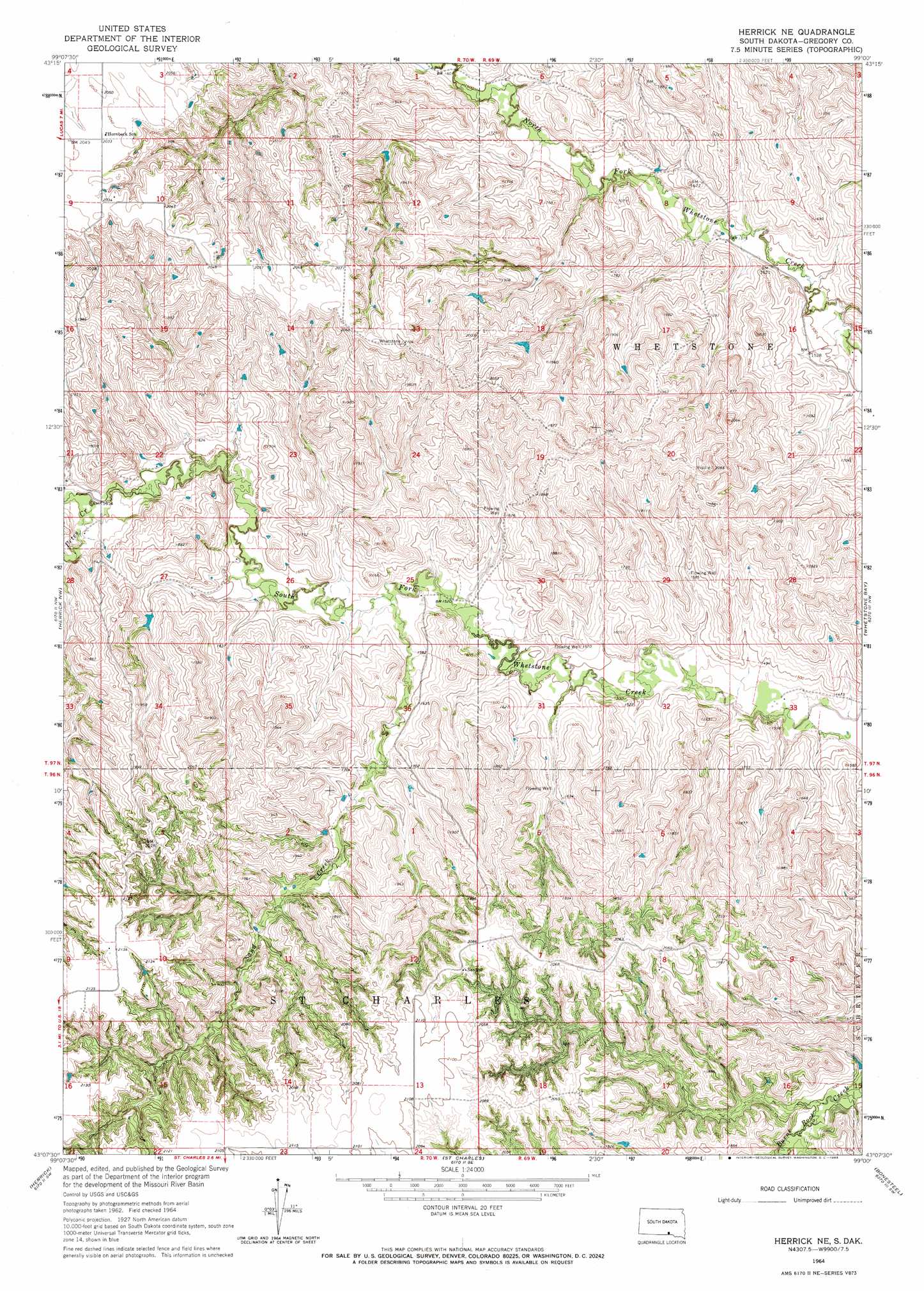
Herrick Ne Topo Map South Dakota
To zoom in, hover over the map of Herrick Ne
USGS Topo Quad 43099b1 - 1:24,000 scale
| Topo Map Name: | Herrick Ne |
| USGS Topo Quad ID: | 43099b1 |
| Print Size: | ca. 21 1/4" wide x 27" high |
| Southeast Coordinates: | 43.125° N latitude / 99° W longitude |
| Map Center Coordinates: | 43.1875° N latitude / 99.0625° W longitude |
| U.S. State: | SD |
| Filename: | o43099b1.jpg |
| Download Map JPG Image: | Herrick Ne topo map 1:24,000 scale |
| Map Type: | Topographic |
| Topo Series: | 7.5´ |
| Map Scale: | 1:24,000 |
| Source of Map Images: | United States Geological Survey (USGS) |
| Alternate Map Versions: |
Herrick NE SD 1964, updated 1965 Download PDF Buy paper map Herrick NE SD 2012 Download PDF Buy paper map Herrick NE SD 2015 Download PDF Buy paper map |
1:24,000 Topo Quads surrounding Herrick Ne
Dixon Ne |
Lucas Nw |
Academy |
Lake George |
Platte |
Dixon Se |
Lucas |
Lucas Se |
Castalia |
Bovee |
Burke |
Herrick Nw |
Herrick Ne |
Whetstone Bay |
Campbell Creek |
Gregory Se |
Herrick |
Saint Charles |
Bonesteel |
South Scalp Creek |
Jamison |
Naper Nw |
Naper |
Butte Nw |
Butte |
> Back to 43099a1 at 1:100,000 scale
> Back to 43098a1 at 1:250,000 scale
> Back to U.S. Topo Maps home
Herrick Ne topo map: Gazetteer
Herrick Ne: Dams
Fred Kerner Number 1 Dam elevation 515m 1689′Herrick Ne: Streams
Petes Creek elevation 487m 1597′Sand Creek elevation 465m 1525′
Herrick Ne digital topo map on disk
Buy this Herrick Ne topo map showing relief, roads, GPS coordinates and other geographical features, as a high-resolution digital map file on DVD:
Eastern North Dakota & Eastern South Dakota
Buy digital topo maps: Eastern North Dakota & Eastern South Dakota