Eagle Topo Map South Dakota
To zoom in, hover over the map of Eagle
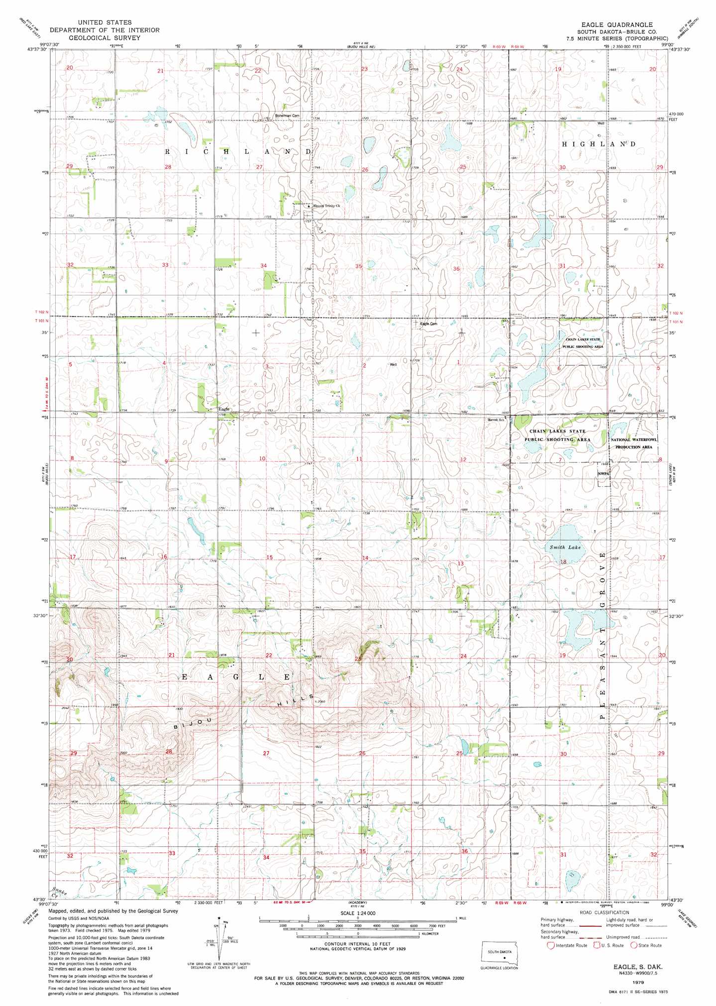
USGS Topo Quad 43099e1 - 1:24,000 scale
| Topo Map Name: | Eagle |
| USGS Topo Quad ID: | 43099e1 |
| Print Size: | ca. 21 1/4" wide x 27" high |
| Southeast Coordinates: | 43.5° N latitude / 99° W longitude |
| Map Center Coordinates: | 43.5625° N latitude / 99.0625° W longitude |
| U.S. State: | SD |
| Filename: | o43099e1.jpg |
| Download Map JPG Image: | Eagle topo map 1:24,000 scale |
| Map Type: | Topographic |
| Topo Series: | 7.5´ |
| Map Scale: | 1:24,000 |
| Source of Map Images: | United States Geological Survey (USGS) |
| Alternate Map Versions: |
Eagle SD 1979, updated 1980 Download PDF Buy paper map Eagle SD 2012 Download PDF Buy paper map Eagle SD 2015 Download PDF Buy paper map |
1:24,000 Topo Quads surrounding Eagle
Chamberlain |
Pukwana |
Pukwana Se |
Wilson Dam |
|
Red Lake West |
Red Lake East |
Bijou Hills Ne |
Kimball South |
Platte Lake |
Bond Bottom |
Bijou Hills |
Eagle |
Snow Lake |
Cedar Grove Colony |
Dixon Ne |
Lucas Nw |
Academy |
Lake George |
Platte |
Dixon Se |
Lucas |
Lucas Se |
Castalia |
Bovee |
> Back to 43099e1 at 1:100,000 scale
> Back to 43098a1 at 1:250,000 scale
> Back to U.S. Topo Maps home
Eagle topo map: Gazetteer
Eagle: Lakes
Smith Lake elevation 498m 1633′Eagle: Parks
Chain Lakes State Public Shooting Area elevation 502m 1646′Eagle: Populated Places
Eagle elevation 534m 1751′Eagle digital topo map on disk
Buy this Eagle topo map showing relief, roads, GPS coordinates and other geographical features, as a high-resolution digital map file on DVD:
Eastern North Dakota & Eastern South Dakota
Buy digital topo maps: Eastern North Dakota & Eastern South Dakota