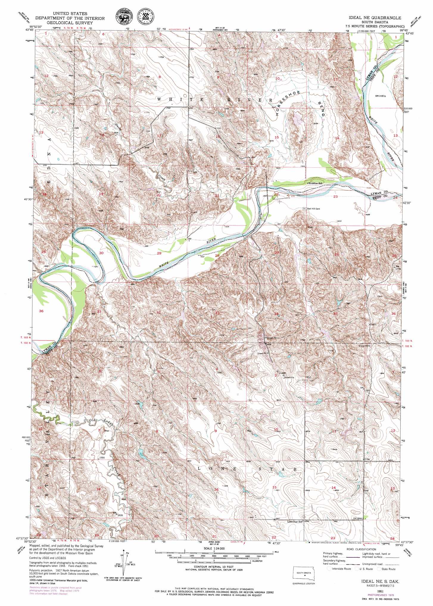
Ideal Ne Topo Map South Dakota
To zoom in, hover over the map of Ideal Ne
USGS Topo Quad 43099f7 - 1:24,000 scale
| Topo Map Name: | Ideal Ne |
| USGS Topo Quad ID: | 43099f7 |
| Print Size: | ca. 21 1/4" wide x 27" high |
| Southeast Coordinates: | 43.625° N latitude / 99.75° W longitude |
| Map Center Coordinates: | 43.6875° N latitude / 99.8125° W longitude |
| U.S. State: | SD |
| Filename: | o43099f7.jpg |
| Download Map JPG Image: | Ideal Ne topo map 1:24,000 scale |
| Map Type: | Topographic |
| Topo Series: | 7.5´ |
| Map Scale: | 1:24,000 |
| Source of Map Images: | United States Geological Survey (USGS) |
| Alternate Map Versions: |
Ideal NE SD 1951, updated 1953 Download PDF Buy paper map Ideal NE SD 1951, updated 1979 Download PDF Buy paper map Ideal NE SD 2012 Download PDF Buy paper map Ideal NE SD 2015 Download PDF Buy paper map |
1:24,000 Topo Quads surrounding Ideal Ne
Presho |
Brakke Dam |
Kennebec |
Lyman |
Reliance |
Presho Se |
Kennebec Sw |
Kennebec Se |
Reliance Sw |
Reliance Se |
Presho 4 Ne |
Ideal Nw |
Ideal Ne |
Hamill Nw |
Hamill Ne |
Presho 4 Se |
Ideal |
King Dam |
Hamill |
Hamill Se |
Witten |
Miller Hill |
Winner North |
Rattlesnake Butte West |
Rattlesnake Butte East |
> Back to 43099e1 at 1:100,000 scale
> Back to 43098a1 at 1:250,000 scale
> Back to U.S. Topo Maps home
Ideal Ne topo map: Gazetteer
Ideal Ne: Bends
Horseshoe Bend elevation 471m 1545′Ideal Ne: Dams
DeJong Brothers Number 2 Dam elevation 515m 1689′DeJong Brothers Number 3 Dam elevation 505m 1656′
DeJong Brothers Number 4 Dam elevation 493m 1617′
DeJong Brothers Number 5 Dam elevation 498m 1633′
Frantz Farms 3 Dam elevation 510m 1673′
Jim Schuyler Number 1 Dam elevation 532m 1745′
Ideal Ne: Streams
Davis Creek elevation 457m 1499′Thunder Creek elevation 467m 1532′
Ideal Ne digital topo map on disk
Buy this Ideal Ne topo map showing relief, roads, GPS coordinates and other geographical features, as a high-resolution digital map file on DVD:
Eastern North Dakota & Eastern South Dakota
Buy digital topo maps: Eastern North Dakota & Eastern South Dakota