Pukwana Se Topo Map South Dakota
To zoom in, hover over the map of Pukwana Se
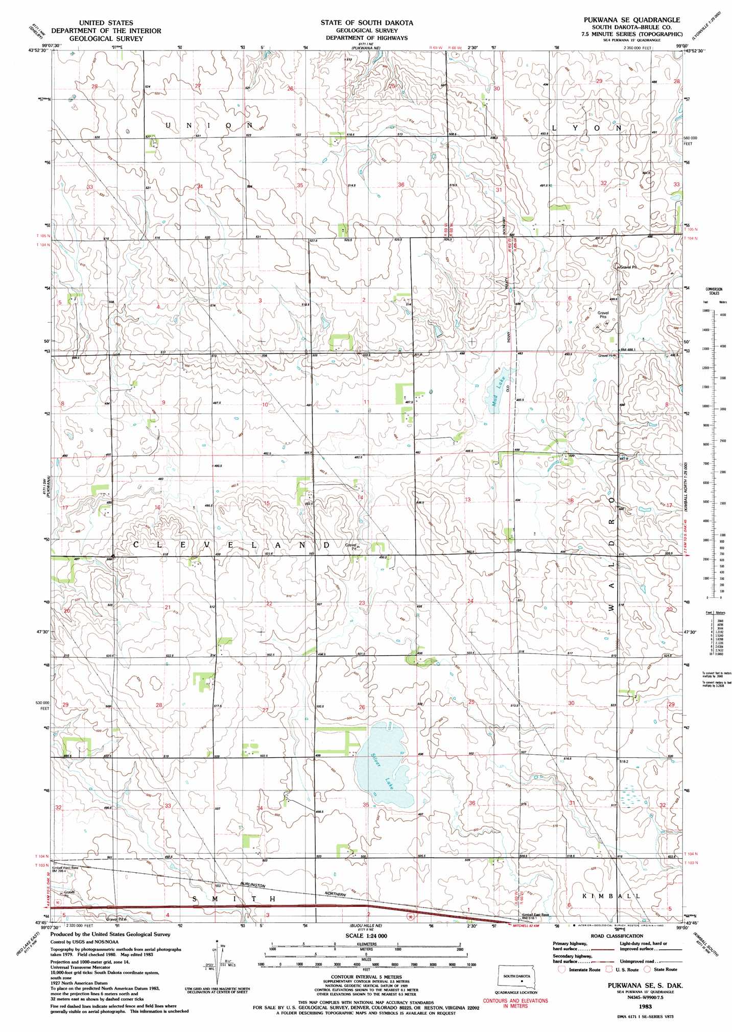
USGS Topo Quad 43099g1 - 1:24,000 scale
| Topo Map Name: | Pukwana Se |
| USGS Topo Quad ID: | 43099g1 |
| Print Size: | ca. 21 1/4" wide x 27" high |
| Southeast Coordinates: | 43.75° N latitude / 99° W longitude |
| Map Center Coordinates: | 43.8125° N latitude / 99.0625° W longitude |
| U.S. State: | SD |
| Filename: | o43099g1.jpg |
| Download Map JPG Image: | Pukwana Se topo map 1:24,000 scale |
| Map Type: | Topographic |
| Topo Series: | 7.5´ |
| Map Scale: | 1:24,000 |
| Source of Map Images: | United States Geological Survey (USGS) |
| Alternate Map Versions: |
Pukwana SE SD 1983, updated 1983 Download PDF Buy paper map Pukwana SE SD 2012 Download PDF Buy paper map Pukwana SE SD 2015 Download PDF Buy paper map |
1:24,000 Topo Quads surrounding Pukwana Se
Big Bend Dam Se |
Big Bend Dam 4 Sw |
Big Bend Dam 4 Se |
Gannvalley |
Gannvalley Se |
Bedashosha Lake |
Shelby |
Pukwana Ne |
Isham Lake |
|
Chamberlain |
Pukwana |
Pukwana Se |
Wilson Dam |
|
Red Lake West |
Red Lake East |
Bijou Hills Ne |
Kimball South |
Platte Lake |
Bond Bottom |
Bijou Hills |
Eagle |
Snow Lake |
Cedar Grove Colony |
> Back to 43099e1 at 1:100,000 scale
> Back to 43098a1 at 1:250,000 scale
> Back to U.S. Topo Maps home
Pukwana Se topo map: Gazetteer
Pukwana Se: Lakes
Mud Lake elevation 482m 1581′Silver Lake elevation 494m 1620′
Pukwana Se digital topo map on disk
Buy this Pukwana Se topo map showing relief, roads, GPS coordinates and other geographical features, as a high-resolution digital map file on DVD:
Eastern North Dakota & Eastern South Dakota
Buy digital topo maps: Eastern North Dakota & Eastern South Dakota