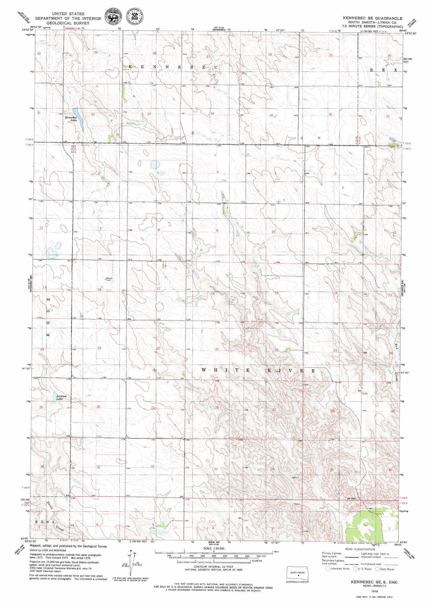
Kennebec Se Topo Map South Dakota
To zoom in, hover over the map of Kennebec Se
USGS Topo Quad 43099g7 - 1:24,000 scale
| Topo Map Name: | Kennebec Se |
| USGS Topo Quad ID: | 43099g7 |
| Print Size: | ca. 21 1/4" wide x 27" high |
| Southeast Coordinates: | 43.75° N latitude / 99.75° W longitude |
| Map Center Coordinates: | 43.8125° N latitude / 99.8125° W longitude |
| U.S. State: | SD |
| Filename: | o43099g7.jpg |
| Download Map JPG Image: | Kennebec Se topo map 1:24,000 scale |
| Map Type: | Topographic |
| Topo Series: | 7.5´ |
| Map Scale: | 1:24,000 |
| Source of Map Images: | United States Geological Survey (USGS) |
| Alternate Map Versions: |
Kennebec SE SD 1978, updated 1979 Download PDF Buy paper map Kennebec SE SD 2012 Download PDF Buy paper map Kennebec SE SD 2015 Download PDF Buy paper map |
1:24,000 Topo Quads surrounding Kennebec Se
Fort George Butte Se |
Joe Creek Sw |
Joe Creek Se |
Lower Brule Sw |
Lower Brule |
Presho |
Brakke Dam |
Kennebec |
Lyman |
Reliance |
Presho Se |
Kennebec Sw |
Kennebec Se |
Reliance Sw |
Reliance Se |
Presho 4 Ne |
Ideal Nw |
Ideal Ne |
Hamill Nw |
Hamill Ne |
Presho 4 Se |
Ideal |
King Dam |
Hamill |
Hamill Se |
> Back to 43099e1 at 1:100,000 scale
> Back to 43098a1 at 1:250,000 scale
> Back to U.S. Topo Maps home
Kennebec Se topo map: Gazetteer
Kennebec Se: Dams
DeJong Brothers 12 Dam elevation 489m 1604′DeJong Brothers 7 Dam elevation 474m 1555′
DeJongs Brothers 8 Dam elevation 495m 1624′
Jackson Dam elevation 527m 1729′
Kennebec Se: Lakes
Billman Lake elevation 515m 1689′Jackson Lake elevation 527m 1729′
Kennebec Lake elevation 529m 1735′
Kennebec Se digital topo map on disk
Buy this Kennebec Se topo map showing relief, roads, GPS coordinates and other geographical features, as a high-resolution digital map file on DVD:
Eastern North Dakota & Eastern South Dakota
Buy digital topo maps: Eastern North Dakota & Eastern South Dakota