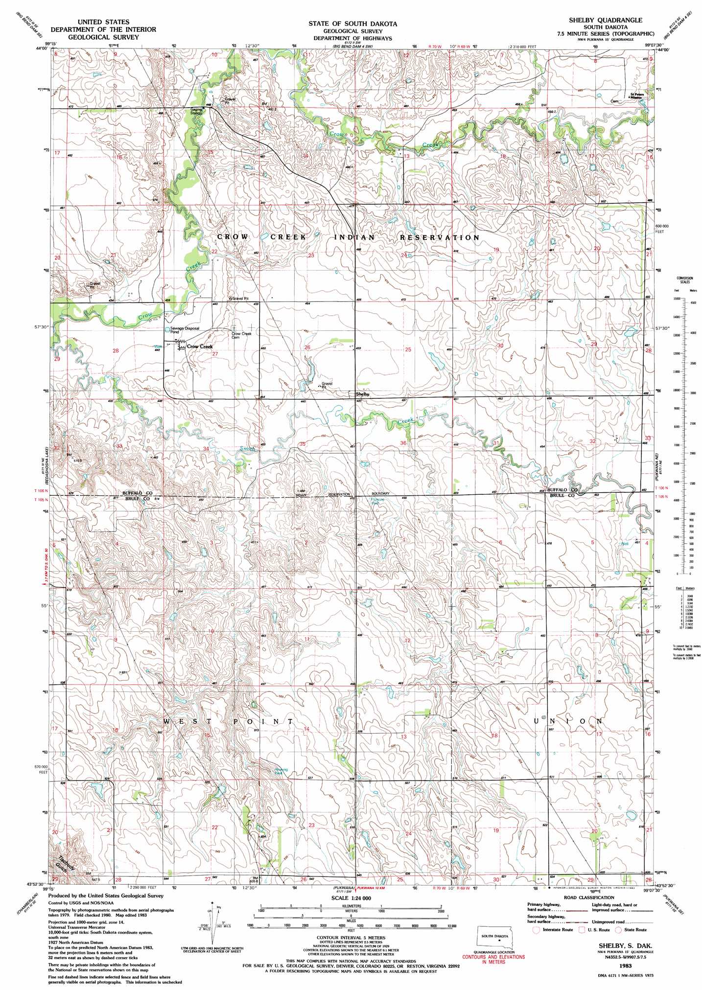
Shelby Topo Map South Dakota
To zoom in, hover over the map of Shelby
USGS Topo Quad 43099h2 - 1:24,000 scale
| Topo Map Name: | Shelby |
| USGS Topo Quad ID: | 43099h2 |
| Print Size: | ca. 21 1/4" wide x 27" high |
| Southeast Coordinates: | 43.875° N latitude / 99.125° W longitude |
| Map Center Coordinates: | 43.9375° N latitude / 99.1875° W longitude |
| U.S. State: | SD |
| Filename: | o43099h2.jpg |
| Download Map JPG Image: | Shelby topo map 1:24,000 scale |
| Map Type: | Topographic |
| Topo Series: | 7.5´ |
| Map Scale: | 1:24,000 |
| Source of Map Images: | United States Geological Survey (USGS) |
| Alternate Map Versions: |
Shelby SD 1983, updated 1983 Download PDF Buy paper map Shelby SD 2012 Download PDF Buy paper map Shelby SD 2015 Download PDF Buy paper map |
1:24,000 Topo Quads surrounding Shelby
Stephan |
Big Bend Dam Ne |
Big Bend Dam 4 Nw |
Big Bend Dam 4 Ne |
Mittelstedt Slough |
Big Bend Dam |
Big Bend Dam Se |
Big Bend Dam 4 Sw |
Big Bend Dam 4 Se |
Gannvalley |
Short Creek |
Bedashosha Lake |
Shelby |
Pukwana Ne |
|
Oacoma |
Chamberlain |
Pukwana |
Pukwana Se |
|
Iona Nw |
Red Lake West |
Red Lake East |
Bijou Hills Ne |
Kimball South |
> Back to 43099e1 at 1:100,000 scale
> Back to 43098a1 at 1:250,000 scale
> Back to U.S. Topo Maps home
Shelby topo map: Gazetteer
Shelby: Dams
Disseau Dam 2 elevation 523m 1715′Larson Dam elevation 462m 1515′
Mayer Dam elevation 455m 1492′
Schaub Dam elevation 497m 1630′
Turgeon Dam elevation 471m 1545′
Shelby: Populated Places
Crow Creek elevation 442m 1450′Shelby elevation 450m 1476′
Shelby: Streams
Elm Creek elevation 455m 1492′Smith Creek elevation 431m 1414′
Shelby digital topo map on disk
Buy this Shelby topo map showing relief, roads, GPS coordinates and other geographical features, as a high-resolution digital map file on DVD:
Eastern North Dakota & Eastern South Dakota
Buy digital topo maps: Eastern North Dakota & Eastern South Dakota