Saint Francis Se Topo Map South Dakota
To zoom in, hover over the map of Saint Francis Se
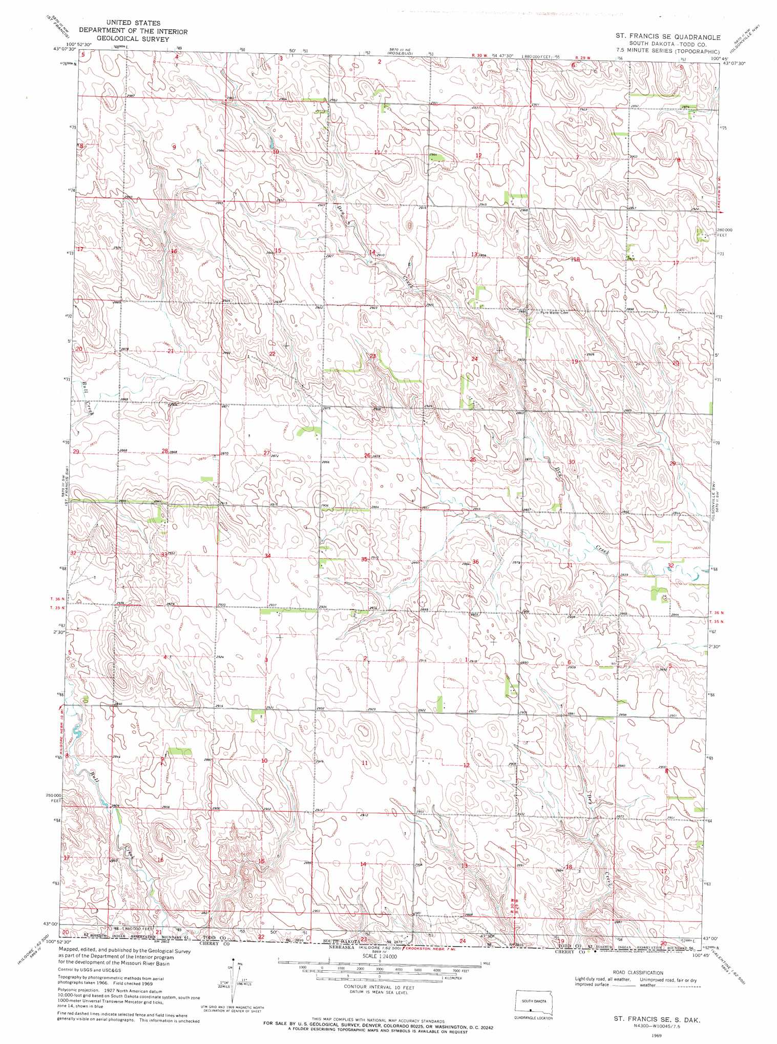
USGS Topo Quad 43100a7 - 1:24,000 scale
| Topo Map Name: | Saint Francis Se |
| USGS Topo Quad ID: | 43100a7 |
| Print Size: | ca. 21 1/4" wide x 27" high |
| Southeast Coordinates: | 43° N latitude / 100.75° W longitude |
| Map Center Coordinates: | 43.0625° N latitude / 100.8125° W longitude |
| U.S. State: | SD |
| Filename: | o43100a7.jpg |
| Download Map JPG Image: | Saint Francis Se topo map 1:24,000 scale |
| Map Type: | Topographic |
| Topo Series: | 7.5´ |
| Map Scale: | 1:24,000 |
| Source of Map Images: | United States Geological Survey (USGS) |
| Alternate Map Versions: |
St. Francis SE SD 1969, updated 1972 Download PDF Buy paper map Saint Francis SE SD 2012 Download PDF Buy paper map Saint Francis SE SD 2015 Download PDF Buy paper map |
1:24,000 Topo Quads surrounding Saint Francis Se
Parmelee |
Soldier Creek |
Soldier Creek Se |
Mission |
Mission Se |
Iron Shell Flat East |
Saint Francis |
Rosebud |
Olsonville Nw |
Olsonville |
Spring Creek |
Saint Francis Sw |
Saint Francis Se |
Olsonville Sw |
Olsonville Se |
Nenzel |
Kilgore |
Crookston West |
Crookston East |
Valentine North |
Cody Se |
Cooper Canyon |
Kilgore Se |
Valentine Sw |
Valentine South |
> Back to 43100a1 at 1:100,000 scale
> Back to 43100a1 at 1:250,000 scale
> Back to U.S. Topo Maps home
No gazetteer data is available for the Saint Francis Se topo map sheet.
Saint Francis Se digital topo map on disk
Buy this Saint Francis Se topo map showing relief, roads, GPS coordinates and other geographical features, as a high-resolution digital map file on DVD:
Eastern North Dakota & Eastern South Dakota
Buy digital topo maps: Eastern North Dakota & Eastern South Dakota