Mosher Topo Map South Dakota
To zoom in, hover over the map of Mosher
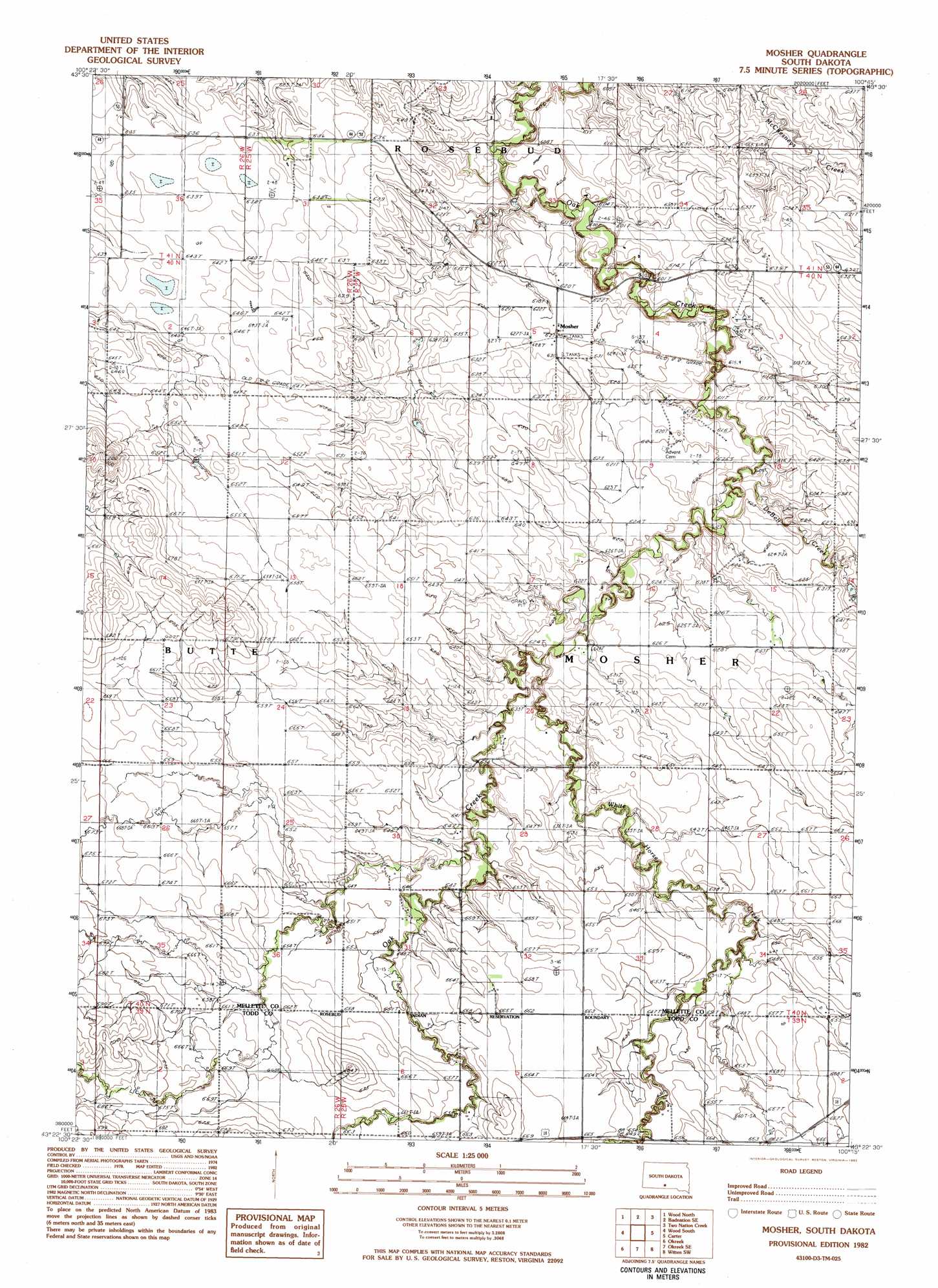
USGS Topo Quad 43100d3 - 1:25,000 scale
| Topo Map Name: | Mosher |
| USGS Topo Quad ID: | 43100d3 |
| Print Size: | ca. 21 1/4" wide x 27" high |
| Southeast Coordinates: | 43.375° N latitude / 100.25° W longitude |
| Map Center Coordinates: | 43.4375° N latitude / 100.3125° W longitude |
| U.S. State: | SD |
| Filename: | l43100d3.jpg |
| Download Map JPG Image: | Mosher topo map 1:25,000 scale |
| Map Type: | Topographic |
| Topo Series: | 7.5´ |
| Map Scale: | 1:25,000 |
| Source of Map Images: | United States Geological Survey (USGS) |
| Alternate Map Versions: |
1:24,000 Topo Quads surrounding Mosher
White River Ne |
Badnation Nw |
Badnation |
Presho 4 Nw |
Presho 4 Ne |
White River Se |
Wood North |
Badnation Se |
Two Nation Creek |
Presho 4 Se |
Mission Ne |
Wood South |
Mosher |
Carter |
Witten |
Mission Se |
Okreek |
Okreek Se |
Witten Sw |
Witten Se |
Olsonville |
Hidden Timber |
Hidden Timber Ne |
Keyapaha Nw |
Clearfield |
> Back to 43100a1 at 1:100,000 scale
> Back to 43100a1 at 1:250,000 scale
> Back to U.S. Topo Maps home
Mosher topo map: Gazetteer
Mosher: Dams
Richtor Dam elevation 600m 1968′Mosher: Populated Places
Mosher elevation 628m 2060′Mosher: Streams
Butte Creek elevation 590m 1935′De Bell Creek elevation 604m 1981′
White Horse Creek elevation 619m 2030′
Mosher digital topo map on disk
Buy this Mosher topo map showing relief, roads, GPS coordinates and other geographical features, as a high-resolution digital map file on DVD:
Eastern North Dakota & Eastern South Dakota
Buy digital topo maps: Eastern North Dakota & Eastern South Dakota