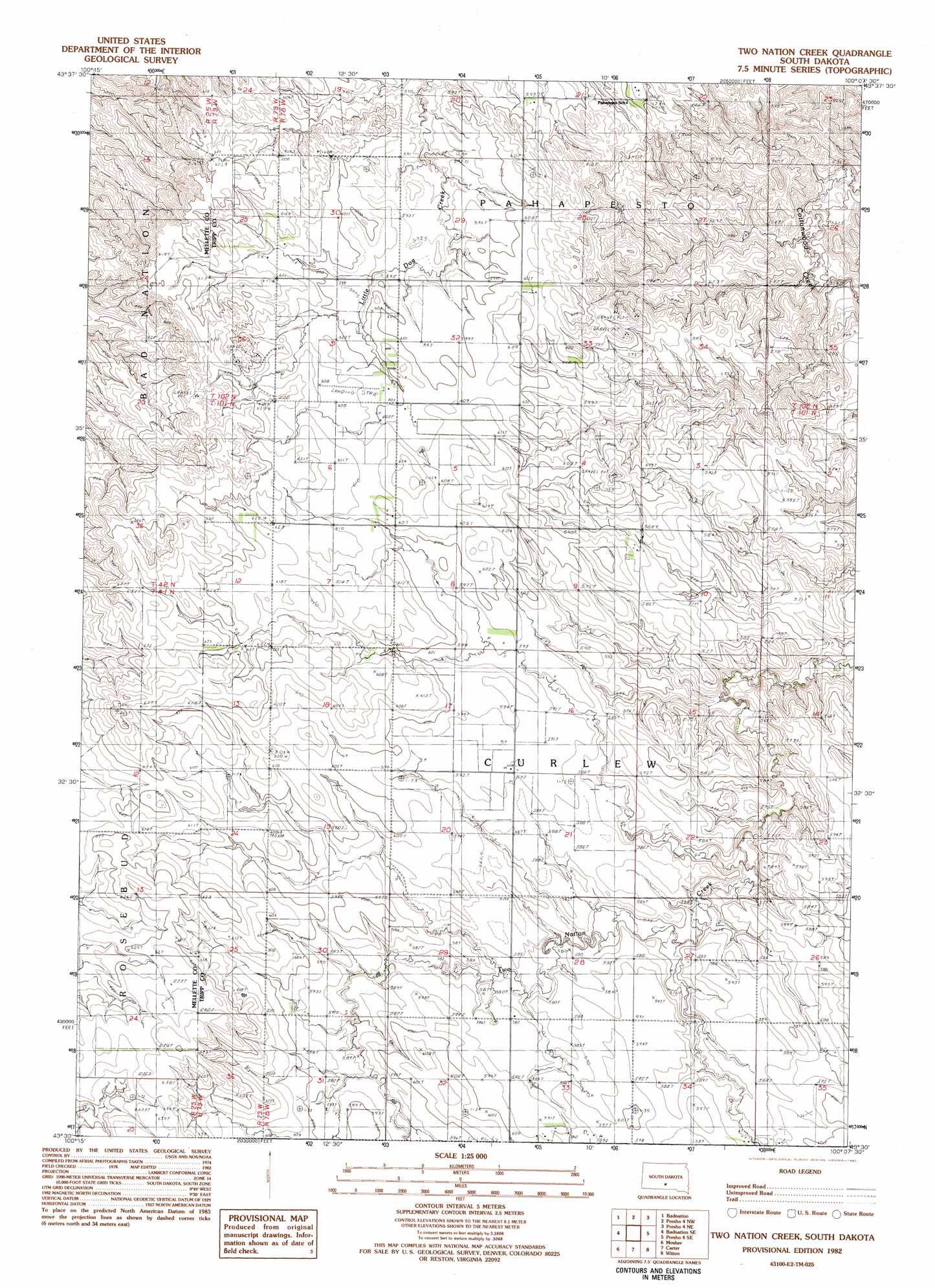
Two Nation Creek Topo Map South Dakota
To zoom in, hover over the map of Two Nation Creek
USGS Topo Quad 43100e2 - 1:25,000 scale
| Topo Map Name: | Two Nation Creek |
| USGS Topo Quad ID: | 43100e2 |
| Print Size: | ca. 21 1/4" wide x 27" high |
| Southeast Coordinates: | 43.5° N latitude / 100.125° W longitude |
| Map Center Coordinates: | 43.5625° N latitude / 100.1875° W longitude |
| U.S. State: | SD |
| Filename: | l43100e2.jpg |
| Download Map JPG Image: | Two Nation Creek topo map 1:25,000 scale |
| Map Type: | Topographic |
| Topo Series: | 7.5´ |
| Map Scale: | 1:25,000 |
| Source of Map Images: | United States Geological Survey (USGS) |
| Alternate Map Versions: |
1:24,000 Topo Quads surrounding Two Nation Creek
Vivian Sw |
Vivian Se |
Presho Sw |
Presho Se |
Kennebec Sw |
Badnation Nw |
Badnation |
Presho 4 Nw |
Presho 4 Ne |
Ideal Nw |
Wood North |
Badnation Se |
Two Nation Creek |
Presho 4 Se |
Ideal |
Wood South |
Mosher |
Carter |
Witten |
Miller Hill |
Okreek |
Okreek Se |
Witten Sw |
Witten Se |
Dog Ear Buttes |
> Back to 43100e1 at 1:100,000 scale
> Back to 43100a1 at 1:250,000 scale
> Back to U.S. Topo Maps home
Two Nation Creek topo map: Gazetteer
Two Nation Creek: Dams
Herman Moeller 1 Dam elevation 554m 1817′Richtor Howard Number 1 Dam elevation 625m 2050′
Two Nation Creek digital topo map on disk
Buy this Two Nation Creek topo map showing relief, roads, GPS coordinates and other geographical features, as a high-resolution digital map file on DVD:
Eastern North Dakota & Eastern South Dakota
Buy digital topo maps: Eastern North Dakota & Eastern South Dakota