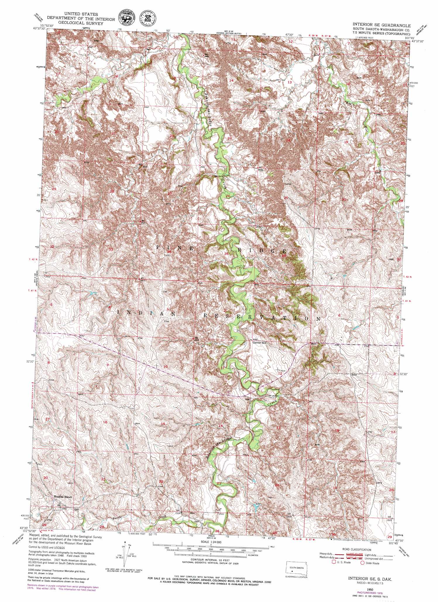
Interior Se Topo Map South Dakota
To zoom in, hover over the map of Interior Se
USGS Topo Quad 43101e7 - 1:24,000 scale
| Topo Map Name: | Interior Se |
| USGS Topo Quad ID: | 43101e7 |
| Print Size: | ca. 21 1/4" wide x 27" high |
| Southeast Coordinates: | 43.5° N latitude / 101.75° W longitude |
| Map Center Coordinates: | 43.5625° N latitude / 101.8125° W longitude |
| U.S. State: | SD |
| Filename: | o43101e7.jpg |
| Download Map JPG Image: | Interior Se topo map 1:24,000 scale |
| Map Type: | Topographic |
| Topo Series: | 7.5´ |
| Map Scale: | 1:24,000 |
| Source of Map Images: | United States Geological Survey (USGS) |
| Alternate Map Versions: |
Interior SE SD 1950, updated 1952 Download PDF Buy paper map Interior SE SD 1950, updated 1979 Download PDF Buy paper map Interior SE SD 2012 Download PDF Buy paper map Interior SE SD 2015 Download PDF Buy paper map |
1:24,000 Topo Quads surrounding Interior Se
Wall Se |
Cottonwood Sw |
Cottonwood Se |
Weta |
Kadoka |
Conata Ne |
Interior |
School Section Butte |
Wanblee Nw |
Wanblee Ne |
Conata Se |
Potato Creek |
Interior Se |
Wanblee |
Broken Leg Dam |
Kyle Ne |
Hisle |
Buzzard Butte |
||
Yellow Bear Camp |
Allen Se |
Patricia |
> Back to 43101e1 at 1:100,000 scale
> Back to 43100a1 at 1:250,000 scale
> Back to U.S. Topo Maps home
Interior Se topo map: Gazetteer
Interior Se: Streams
Corn Creek elevation 793m 2601′Turtle Creek elevation 784m 2572′
Interior Se digital topo map on disk
Buy this Interior Se topo map showing relief, roads, GPS coordinates and other geographical features, as a high-resolution digital map file on DVD:
Eastern North Dakota & Eastern South Dakota
Buy digital topo maps: Eastern North Dakota & Eastern South Dakota