Cedar Butte Ne Topo Map South Dakota
To zoom in, hover over the map of Cedar Butte Ne
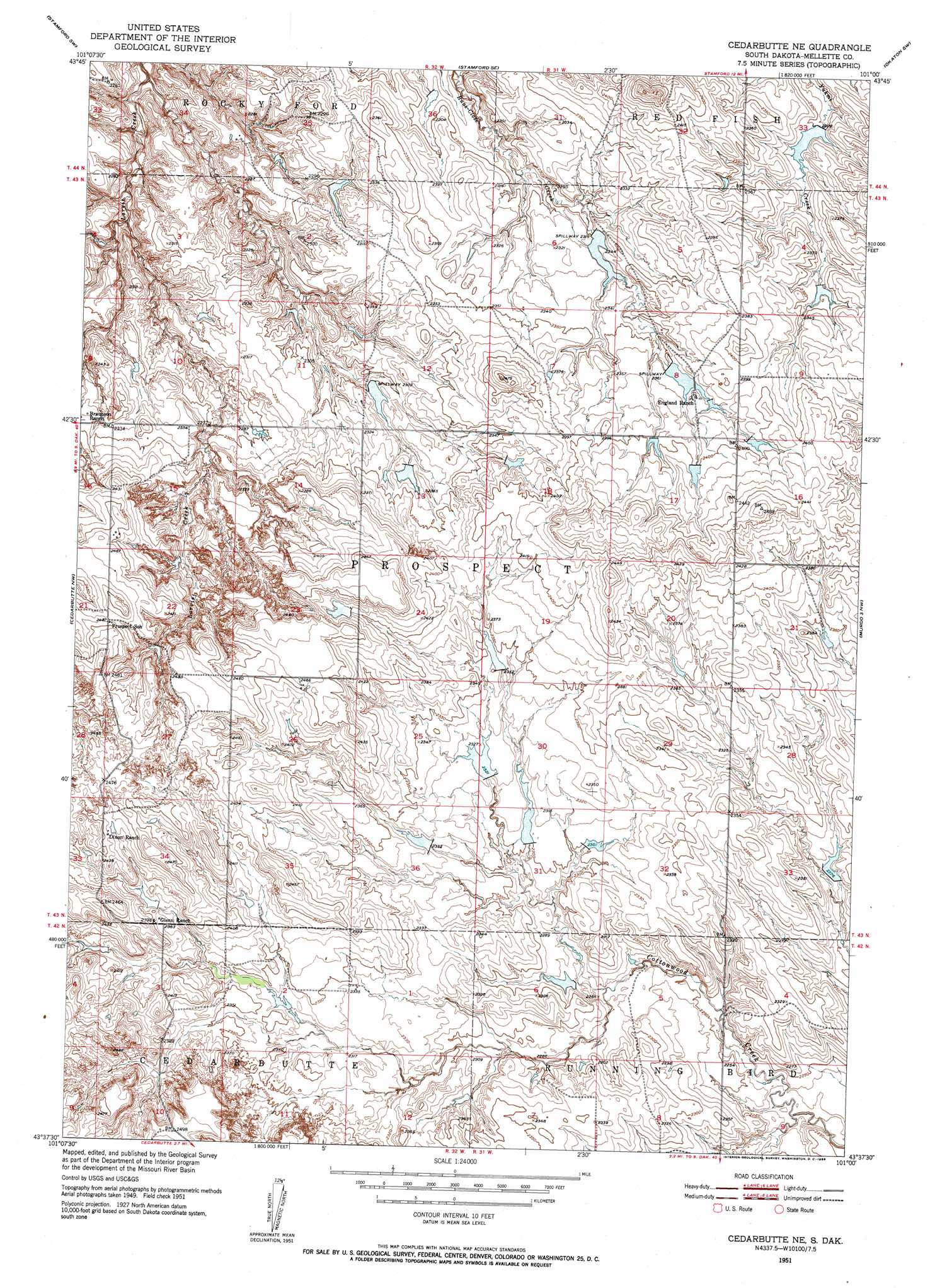
USGS Topo Quad 43101f1 - 1:24,000 scale
| Topo Map Name: | Cedar Butte Ne |
| USGS Topo Quad ID: | 43101f1 |
| Print Size: | ca. 21 1/4" wide x 27" high |
| Southeast Coordinates: | 43.625° N latitude / 101° W longitude |
| Map Center Coordinates: | 43.6875° N latitude / 101.0625° W longitude |
| U.S. State: | SD |
| Filename: | o43101f1.jpg |
| Download Map JPG Image: | Cedar Butte Ne topo map 1:24,000 scale |
| Map Type: | Topographic |
| Topo Series: | 7.5´ |
| Map Scale: | 1:24,000 |
| Source of Map Images: | United States Geological Survey (USGS) |
| Alternate Map Versions: |
Cedar Butte NE SD 1951, updated 1953 Download PDF Buy paper map Cedar Butte NE SD 2012 Download PDF Buy paper map Cedar Butte NE SD 2015 Download PDF Buy paper map |
1:24,000 Topo Quads surrounding Cedar Butte Ne
Belvidere Ne |
Stamford Nw |
Stamford |
Okaton |
Okaton Ne |
Belvidere |
Stamford Sw |
Stamford Se |
Okaton Sw |
Okaton Se |
Pass Creek Ne |
Cedar Butte Nw |
Cedar Butte Ne |
Murdo 3 Nw |
Murdo 3 Ne |
Short Bow Creek East |
Cedarbutte |
Murdo 3 Sw |
White River West |
|
Long Valley Nw |
Norris |
Parmelee Ne |
Soldier Creek Nw |
Soldier Creek Ne |
> Back to 43101e1 at 1:100,000 scale
> Back to 43100a1 at 1:250,000 scale
> Back to U.S. Topo Maps home
Cedar Butte Ne topo map: Gazetteer
Cedar Butte Ne: Dams
England Number 2 Dam elevation 699m 2293′England Number 3 Dam elevation 711m 2332′
England Number 5 Dam elevation 700m 2296′
England Number 5 Dam elevation 714m 2342′
England Number 6 Dam elevation 709m 2326′
England Number 6 Dam elevation 705m 2312′
England Number 6 Dam elevation 707m 2319′
Cedar Butte Ne digital topo map on disk
Buy this Cedar Butte Ne topo map showing relief, roads, GPS coordinates and other geographical features, as a high-resolution digital map file on DVD:
Eastern North Dakota & Eastern South Dakota
Buy digital topo maps: Eastern North Dakota & Eastern South Dakota