Wanblee Ne Topo Map South Dakota
To zoom in, hover over the map of Wanblee Ne
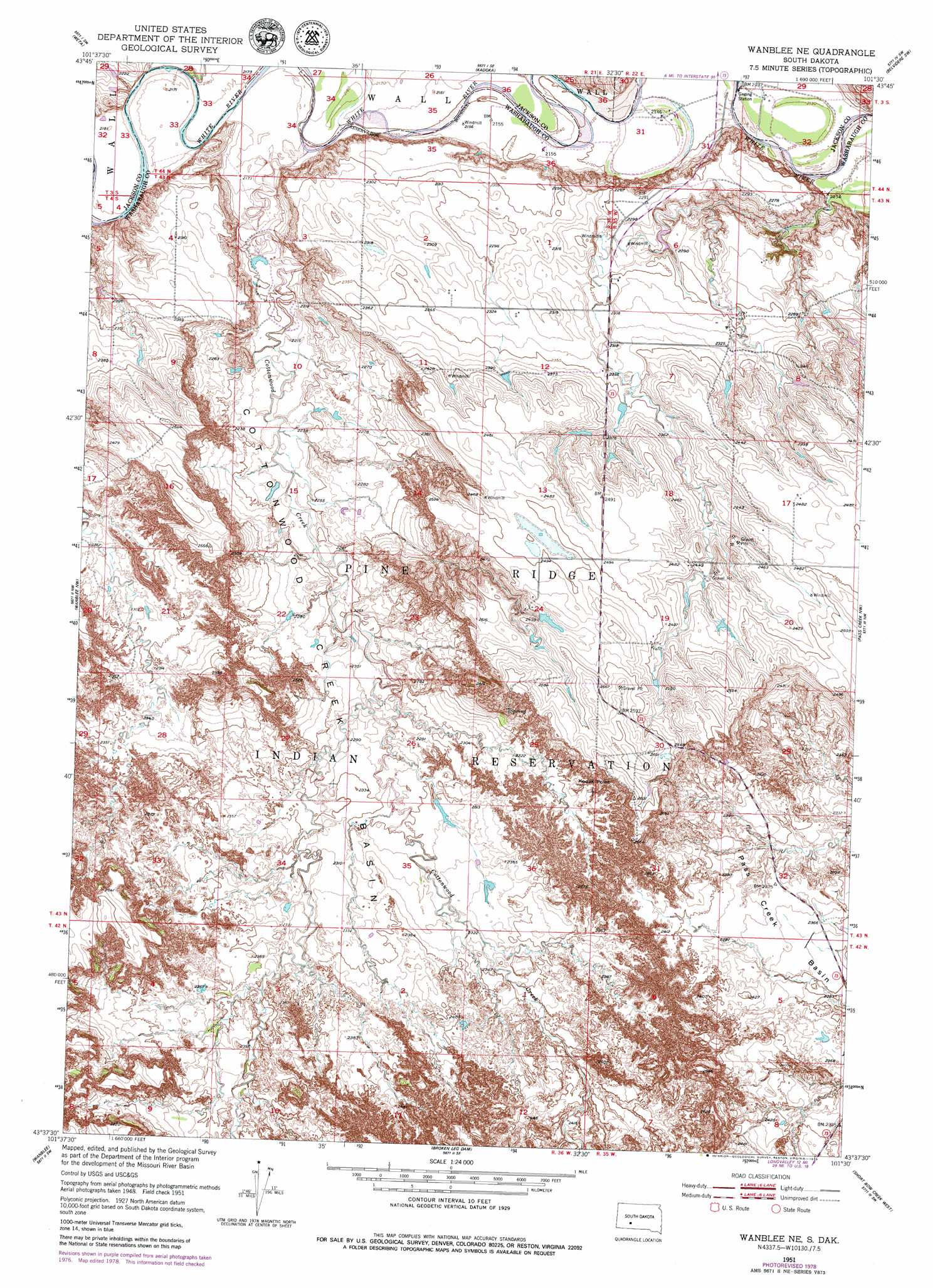
USGS Topo Quad 43101f5 - 1:24,000 scale
| Topo Map Name: | Wanblee Ne |
| USGS Topo Quad ID: | 43101f5 |
| Print Size: | ca. 21 1/4" wide x 27" high |
| Southeast Coordinates: | 43.625° N latitude / 101.5° W longitude |
| Map Center Coordinates: | 43.6875° N latitude / 101.5625° W longitude |
| U.S. State: | SD |
| Filename: | o43101f5.jpg |
| Download Map JPG Image: | Wanblee Ne topo map 1:24,000 scale |
| Map Type: | Topographic |
| Topo Series: | 7.5´ |
| Map Scale: | 1:24,000 |
| Source of Map Images: | United States Geological Survey (USGS) |
| Alternate Map Versions: |
Wanblee NE SD 1951, updated 1953 Download PDF Buy paper map Wanblee NE SD 1951, updated 1979 Download PDF Buy paper map Wanblee NE SD 2012 Download PDF Buy paper map Wanblee NE SD 2015 Download PDF Buy paper map |
| FStopo: | US Forest Service topo Wanblee NE is available: Download FStopo PDF Download FStopo TIF |
1:24,000 Topo Quads surrounding Wanblee Ne
Cottonwood Ne |
Philip Junction |
Kadoka Ne |
Belvidere Nw |
Belvidere Ne |
Cottonwood Se |
Weta |
Kadoka |
Belvidere Sw |
Belvidere |
School Section Butte |
Wanblee Nw |
Wanblee Ne |
Pass Creek Nw |
Pass Creek Ne |
Interior Se |
Wanblee |
Broken Leg Dam |
Short Bow Creek East |
|
Hisle |
Buzzard Butte |
Long Valley Nw |
> Back to 43101e1 at 1:100,000 scale
> Back to 43100a1 at 1:250,000 scale
> Back to U.S. Topo Maps home
Wanblee Ne topo map: Gazetteer
Wanblee Ne: Cliffs
Kodak Point elevation 794m 2604′Wanblee Ne: Streams
Cottonwood Creek elevation 659m 2162′East Cottonwood Creek elevation 687m 2253′
West Cottonwood Creek elevation 687m 2253′
Wanblee Ne: Valleys
Cottonwood Creek Basin elevation 668m 2191′Wanblee Ne digital topo map on disk
Buy this Wanblee Ne topo map showing relief, roads, GPS coordinates and other geographical features, as a high-resolution digital map file on DVD:
Eastern North Dakota & Eastern South Dakota
Buy digital topo maps: Eastern North Dakota & Eastern South Dakota