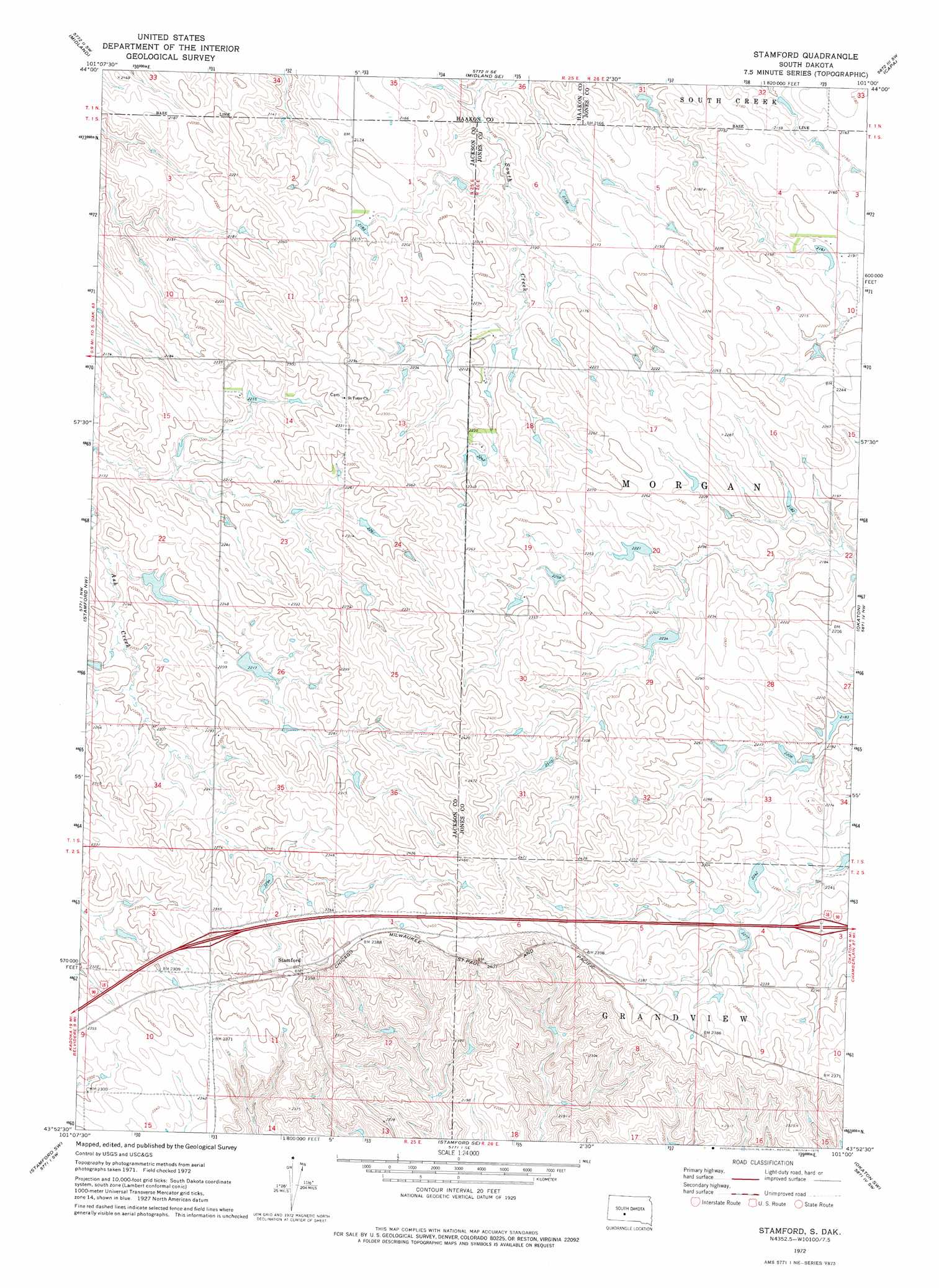
Stamford Topo Map South Dakota
To zoom in, hover over the map of Stamford
USGS Topo Quad 43101h1 - 1:24,000 scale
| Topo Map Name: | Stamford |
| USGS Topo Quad ID: | 43101h1 |
| Print Size: | ca. 21 1/4" wide x 27" high |
| Southeast Coordinates: | 43.875° N latitude / 101° W longitude |
| Map Center Coordinates: | 43.9375° N latitude / 101.0625° W longitude |
| U.S. State: | SD |
| Filename: | o43101h1.jpg |
| Download Map JPG Image: | Stamford topo map 1:24,000 scale |
| Map Type: | Topographic |
| Topo Series: | 7.5´ |
| Map Scale: | 1:24,000 |
| Source of Map Images: | United States Geological Survey (USGS) |
| Alternate Map Versions: |
Stamford SD 2012 Download PDF Buy paper map Stamford SD 2015 Download PDF Buy paper map |
1:24,000 Topo Quads surrounding Stamford
Ottumwa |
Midland Nw |
Midland Ne |
Capa Nw |
Van Metre |
Nowlin |
Midland |
Midland Se |
Capa |
Capa Se |
Belvidere Ne |
Stamford Nw |
Stamford |
Okaton |
Okaton Ne |
Belvidere |
Stamford Sw |
Stamford Se |
Okaton Sw |
Okaton Se |
Pass Creek Ne |
Cedar Butte Nw |
Cedar Butte Ne |
Murdo 3 Nw |
Murdo 3 Ne |
> Back to 43101e1 at 1:100,000 scale
> Back to 43100a1 at 1:250,000 scale
> Back to U.S. Topo Maps home
Stamford topo map: Gazetteer
Stamford: Dams
Barton Number 1 Dam elevation 681m 2234′Barton Number 2 Dam elevation 681m 2234′
Barton Number 3 Dam elevation 670m 2198′
Bork Number 1 Dam elevation 671m 2201′
CNV Ranch Number 1 Dam elevation 702m 2303′
Perault Number 2 Dam elevation 656m 2152′
Perault Number 3 Dam elevation 658m 2158′
Rieman Number 1 Dam elevation 652m 2139′
Sanderson Number 1 Dam elevation 672m 2204′
Sanderson Number 2 Dam elevation 684m 2244′
Sanderson Number 3 Dam elevation 694m 2276′
Stamford: Populated Places
Stamford elevation 736m 2414′Stamford digital topo map on disk
Buy this Stamford topo map showing relief, roads, GPS coordinates and other geographical features, as a high-resolution digital map file on DVD:
Eastern North Dakota & Eastern South Dakota
Buy digital topo maps: Eastern North Dakota & Eastern South Dakota