Stamford Nw Topo Map South Dakota
To zoom in, hover over the map of Stamford Nw
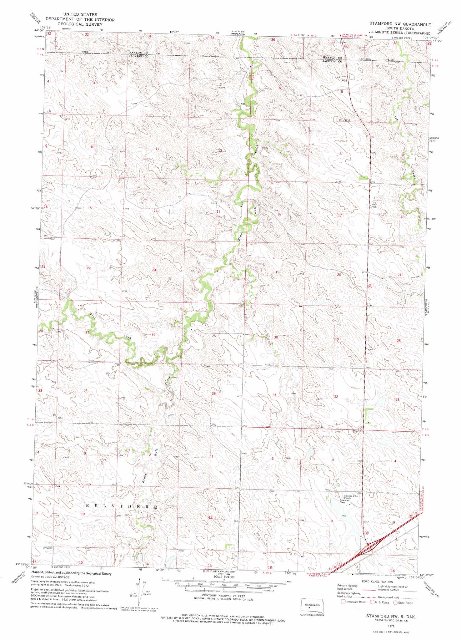
USGS Topo Quad 43101h2 - 1:24,000 scale
| Topo Map Name: | Stamford Nw |
| USGS Topo Quad ID: | 43101h2 |
| Print Size: | ca. 21 1/4" wide x 27" high |
| Southeast Coordinates: | 43.875° N latitude / 101.125° W longitude |
| Map Center Coordinates: | 43.9375° N latitude / 101.1875° W longitude |
| U.S. State: | SD |
| Filename: | o43101h2.jpg |
| Download Map JPG Image: | Stamford Nw topo map 1:24,000 scale |
| Map Type: | Topographic |
| Topo Series: | 7.5´ |
| Map Scale: | 1:24,000 |
| Source of Map Images: | United States Geological Survey (USGS) |
| Alternate Map Versions: |
Stamford NW SD 1972, updated 1975 Download PDF Buy paper map Stamford NW SD 2012 Download PDF Buy paper map Stamford NW SD 2015 Download PDF Buy paper map |
1:24,000 Topo Quads surrounding Stamford Nw
Powell Nw |
Ottumwa |
Midland Nw |
Midland Ne |
Capa Nw |
Powell |
Nowlin |
Midland |
Midland Se |
Capa |
Belvidere Nw |
Belvidere Ne |
Stamford Nw |
Stamford |
Okaton |
Belvidere Sw |
Belvidere |
Stamford Sw |
Stamford Se |
Okaton Sw |
Pass Creek Nw |
Pass Creek Ne |
Cedar Butte Nw |
Cedar Butte Ne |
Murdo 3 Nw |
> Back to 43101e1 at 1:100,000 scale
> Back to 43100a1 at 1:250,000 scale
> Back to U.S. Topo Maps home
Stamford Nw topo map: Gazetteer
Stamford Nw: Dams
Freeman Dam elevation 678m 2224′Stamford Nw: Streams
West Fork Brave Bull Creek elevation 634m 2080′Stamford Nw digital topo map on disk
Buy this Stamford Nw topo map showing relief, roads, GPS coordinates and other geographical features, as a high-resolution digital map file on DVD:
Eastern North Dakota & Eastern South Dakota
Buy digital topo maps: Eastern North Dakota & Eastern South Dakota