Belvidere Nw Topo Map South Dakota
To zoom in, hover over the map of Belvidere Nw
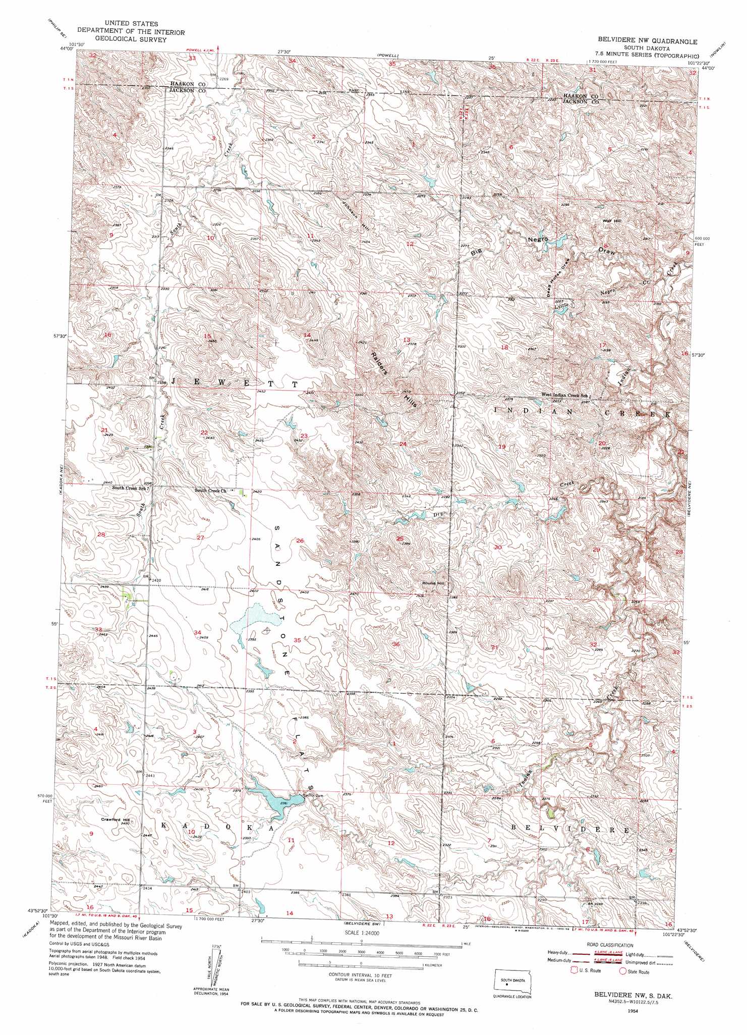
USGS Topo Quad 43101h4 - 1:24,000 scale
| Topo Map Name: | Belvidere Nw |
| USGS Topo Quad ID: | 43101h4 |
| Print Size: | ca. 21 1/4" wide x 27" high |
| Southeast Coordinates: | 43.875° N latitude / 101.375° W longitude |
| Map Center Coordinates: | 43.9375° N latitude / 101.4375° W longitude |
| U.S. State: | SD |
| Filename: | o43101h4.jpg |
| Download Map JPG Image: | Belvidere Nw topo map 1:24,000 scale |
| Map Type: | Topographic |
| Topo Series: | 7.5´ |
| Map Scale: | 1:24,000 |
| Source of Map Images: | United States Geological Survey (USGS) |
| Alternate Map Versions: |
Belvidere NW SD 1954, updated 1955 Download PDF Buy paper map Belvidere NW SD 2012 Download PDF Buy paper map Belvidere NW SD 2015 Download PDF Buy paper map |
1:24,000 Topo Quads surrounding Belvidere Nw
Elevenmile Corner |
Lucerne |
Powell Nw |
Ottumwa |
Midland Nw |
Philip |
Philip Se |
Powell |
Nowlin |
Midland |
Philip Junction |
Kadoka Ne |
Belvidere Nw |
Belvidere Ne |
Stamford Nw |
Weta |
Kadoka |
Belvidere Sw |
Belvidere |
Stamford Sw |
Wanblee Nw |
Wanblee Ne |
Pass Creek Nw |
Pass Creek Ne |
Cedar Butte Nw |
> Back to 43101e1 at 1:100,000 scale
> Back to 43100a1 at 1:250,000 scale
> Back to U.S. Topo Maps home
Belvidere Nw topo map: Gazetteer
Belvidere Nw: Dams
Bachin Dam elevation 720m 2362′Belvidere Nw: Flats
Sandstone Flat elevation 731m 2398′Belvidere Nw: Ranges
Raiders Hills elevation 752m 2467′Belvidere Nw: Streams
Dry Creek elevation 654m 2145′Little Negro Creek elevation 637m 2089′
Belvidere Nw: Summits
Crawford Hill elevation 759m 2490′Johnson Hill elevation 743m 2437′
Round Hill elevation 735m 2411′
Wolf Hill elevation 691m 2267′
Belvidere Nw: Valleys
Big Negro Draw elevation 640m 2099′Dead Horse Draw elevation 659m 2162′
Belvidere Nw digital topo map on disk
Buy this Belvidere Nw topo map showing relief, roads, GPS coordinates and other geographical features, as a high-resolution digital map file on DVD:
Eastern North Dakota & Eastern South Dakota
Buy digital topo maps: Eastern North Dakota & Eastern South Dakota