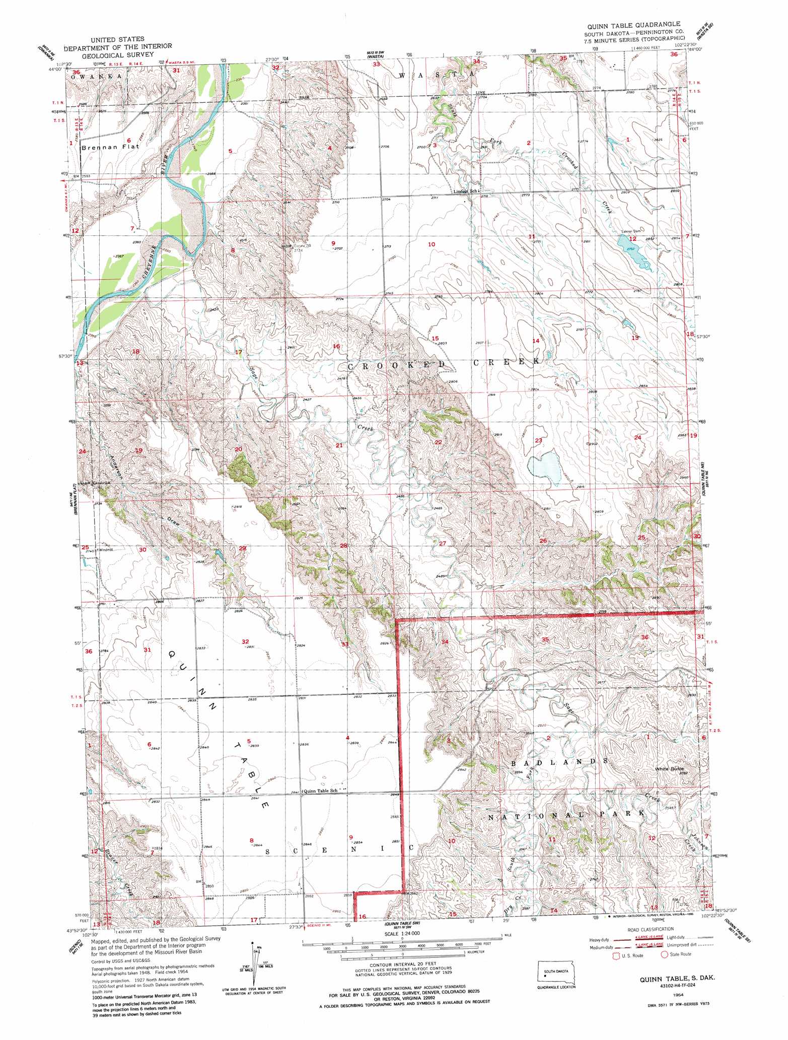
Quinn Table Topo Map South Dakota
To zoom in, hover over the map of Quinn Table
USGS Topo Quad 43102h4 - 1:24,000 scale
| Topo Map Name: | Quinn Table |
| USGS Topo Quad ID: | 43102h4 |
| Print Size: | ca. 21 1/4" wide x 27" high |
| Southeast Coordinates: | 43.875° N latitude / 102.375° W longitude |
| Map Center Coordinates: | 43.9375° N latitude / 102.4375° W longitude |
| U.S. State: | SD |
| Filename: | o43102h4.jpg |
| Download Map JPG Image: | Quinn Table topo map 1:24,000 scale |
| Map Type: | Topographic |
| Topo Series: | 7.5´ |
| Map Scale: | 1:24,000 |
| Source of Map Images: | United States Geological Survey (USGS) |
| Alternate Map Versions: |
Quinn Table SD 1954, updated 1956 Download PDF Buy paper map Quinn Table SD 1954, updated 1986 Download PDF Buy paper map Quinn Table SD 2012 Download PDF Buy paper map Quinn Table SD 2015 Download PDF Buy paper map |
| FStopo: | US Forest Service topo Quinn Table is available: Download FStopo PDF Download FStopo TIF |
1:24,000 Topo Quads surrounding Quinn Table
Owanka Nw |
Owanka Ne |
Wasta Nw |
Wasta Ne |
Pedrow 4 Nw |
Owanka Sw |
Owanka |
Wasta |
Wasta Se |
Lake Hill |
Creston |
Brennan Flat |
Quinn Table |
Quinn Table Ne |
Wall |
Scenic Sw |
Scenic |
Quinn Table Sw |
Quinn Table Se |
Wall Sw |
Heutmacher Table |
Sheep Mountain Table |
Imlay |
Bouquet Table |
Conata |
> Back to 43102e1 at 1:100,000 scale
> Back to 43102a1 at 1:250,000 scale
> Back to U.S. Topo Maps home
Quinn Table topo map: Gazetteer
Quinn Table: Dams
Lakner Dam elevation 842m 2762′Percy Dam elevation 861m 2824′
Quinn Table: Post Offices
Camp Judson Post Office (historical) elevation 814m 2670′Quinn Table: Streams
Dry Creek elevation 784m 2572′Middle Fork Sage Creek elevation 774m 2539′
Sage Creek elevation 717m 2352′
South Fork Sage Creek elevation 765m 2509′
Quinn Table: Summits
Quinn Table elevation 866m 2841′White Butte elevation 848m 2782′
Quinn Table digital topo map on disk
Buy this Quinn Table topo map showing relief, roads, GPS coordinates and other geographical features, as a high-resolution digital map file on DVD:
Eastern Wyoming & Western South Dakota
Buy digital topo maps: Eastern Wyoming & Western South Dakota