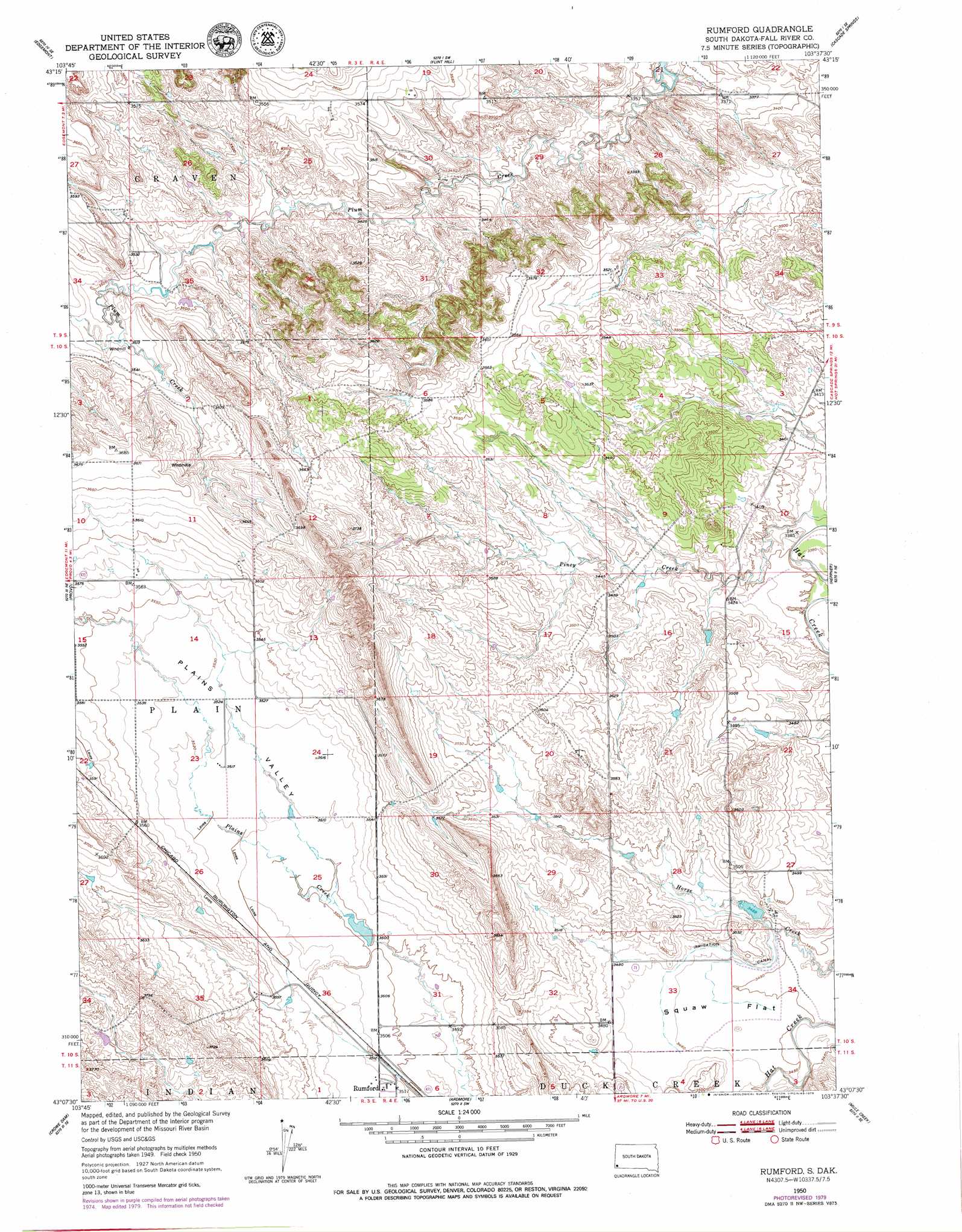
Rumford Topo Map South Dakota
To zoom in, hover over the map of Rumford
USGS Topo Quad 43103b6 - 1:24,000 scale
| Topo Map Name: | Rumford |
| USGS Topo Quad ID: | 43103b6 |
| Print Size: | ca. 21 1/4" wide x 27" high |
| Southeast Coordinates: | 43.125° N latitude / 103.625° W longitude |
| Map Center Coordinates: | 43.1875° N latitude / 103.6875° W longitude |
| U.S. State: | SD |
| Filename: | o43103b6.jpg |
| Download Map JPG Image: | Rumford topo map 1:24,000 scale |
| Map Type: | Topographic |
| Topo Series: | 7.5´ |
| Map Scale: | 1:24,000 |
| Source of Map Images: | United States Geological Survey (USGS) |
| Alternate Map Versions: |
Rumford SD 1950, updated 1952 Download PDF Buy paper map Rumford SD 2012 Download PDF Buy paper map Rumford SD 2015 Download PDF Buy paper map |
| FStopo: | US Forest Service topo Rumford is available: Download FStopo PDF Download FStopo TIF |
1:24,000 Topo Quads surrounding Rumford
Burdock |
Edgemont Ne |
Minnekahta |
Minnekahta Ne |
Hot Springs |
Edgemont Sw |
Edgemont |
Flint Hill |
Cascade Springs |
Angostura Reservoir |
Phister Ranch |
Provo |
Rumford |
Heppner |
Lone Well Creek West |
Wallace Ranch |
Crowe Dam |
Ardmore |
Ardmore Se |
Black Banks Creek West |
Story |
Story Ne |
Montrose |
Orella |
Wolf Butte |
> Back to 43103a1 at 1:100,000 scale
> Back to 43102a1 at 1:250,000 scale
> Back to U.S. Topo Maps home
Rumford topo map: Gazetteer
Rumford: Dams
Fishko Dam Number 2 elevation 1050m 3444′Fishko Dam Number 3 elevation 1067m 3500′
Helsels Plum Creek Dam elevation 1061m 3480′
J Chlecq Dam elevation 1086m 3562′
Rumford: Flats
Hat Creek Flat elevation 1053m 3454′Rumford: Populated Places
Rumford elevation 1072m 3517′Rumford: Valleys
Plains Valley elevation 1064m 3490′Rumford digital topo map on disk
Buy this Rumford topo map showing relief, roads, GPS coordinates and other geographical features, as a high-resolution digital map file on DVD:
Eastern Wyoming & Western South Dakota
Buy digital topo maps: Eastern Wyoming & Western South Dakota