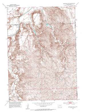
Smithwick Ne Topo Map South Dakota
To zoom in, hover over the map of Smithwick Ne
USGS Topo Quad 43103d1 - 1:24,000 scale
| Topo Map Name: | Smithwick Ne |
| USGS Topo Quad ID: | 43103d1 |
| Print Size: | ca. 21 1/4" wide x 27" high |
| Southeast Coordinates: | 43.375° N latitude / 103° W longitude |
| Map Center Coordinates: | 43.4375° N latitude / 103.0625° W longitude |
| U.S. State: | SD |
| Filename: | o43103d1.jpg |
| Download Map JPG Image: | Smithwick Ne topo map 1:24,000 scale |
| Map Type: | Topographic |
| Topo Series: | 7.5´ |
| Map Scale: | 1:24,000 |
| Source of Map Images: | United States Geological Survey (USGS) |
| Alternate Map Versions: |
Smithwick NE SD 1951, updated 1953 Download PDF Buy paper map Smithwick NE SD 2012 Download PDF Buy paper map Smithwick NE SD 2015 Download PDF Buy paper map |
| FStopo: | US Forest Service topo Smithwick NE is available: Download FStopo PDF Download FStopo TIF |
1:24,000 Topo Quads surrounding Smithwick Ne
> Back to 43103a1 at 1:100,000 scale
> Back to 43102a1 at 1:250,000 scale
> Back to U.S. Topo Maps home
Smithwick Ne topo map: Gazetteer
Smithwick Ne: Canals
Angostura Canal elevation 919m 3015′Smithwick Ne: Dams
Barta Crooked Dam elevation 979m 3211′County Line Dam elevation 979m 3211′
Hay Canyon Dam elevation 996m 3267′
South Dam elevation 887m 2910′
Smithwick Ne: Forests
Buffalo Gap National Grassland elevation 949m 3113′Smithwick Ne: Streams
Lame Johnny Creek elevation 865m 2837′Smithwick Ne: Valleys
First Black Canyon elevation 860m 2821′Hay Canyon elevation 872m 2860′
Jim Wilson Canyon elevation 861m 2824′
Smithwick Ne digital topo map on disk
Buy this Smithwick Ne topo map showing relief, roads, GPS coordinates and other geographical features, as a high-resolution digital map file on DVD:
Eastern Wyoming & Western South Dakota
Buy digital topo maps: Eastern Wyoming & Western South Dakota


