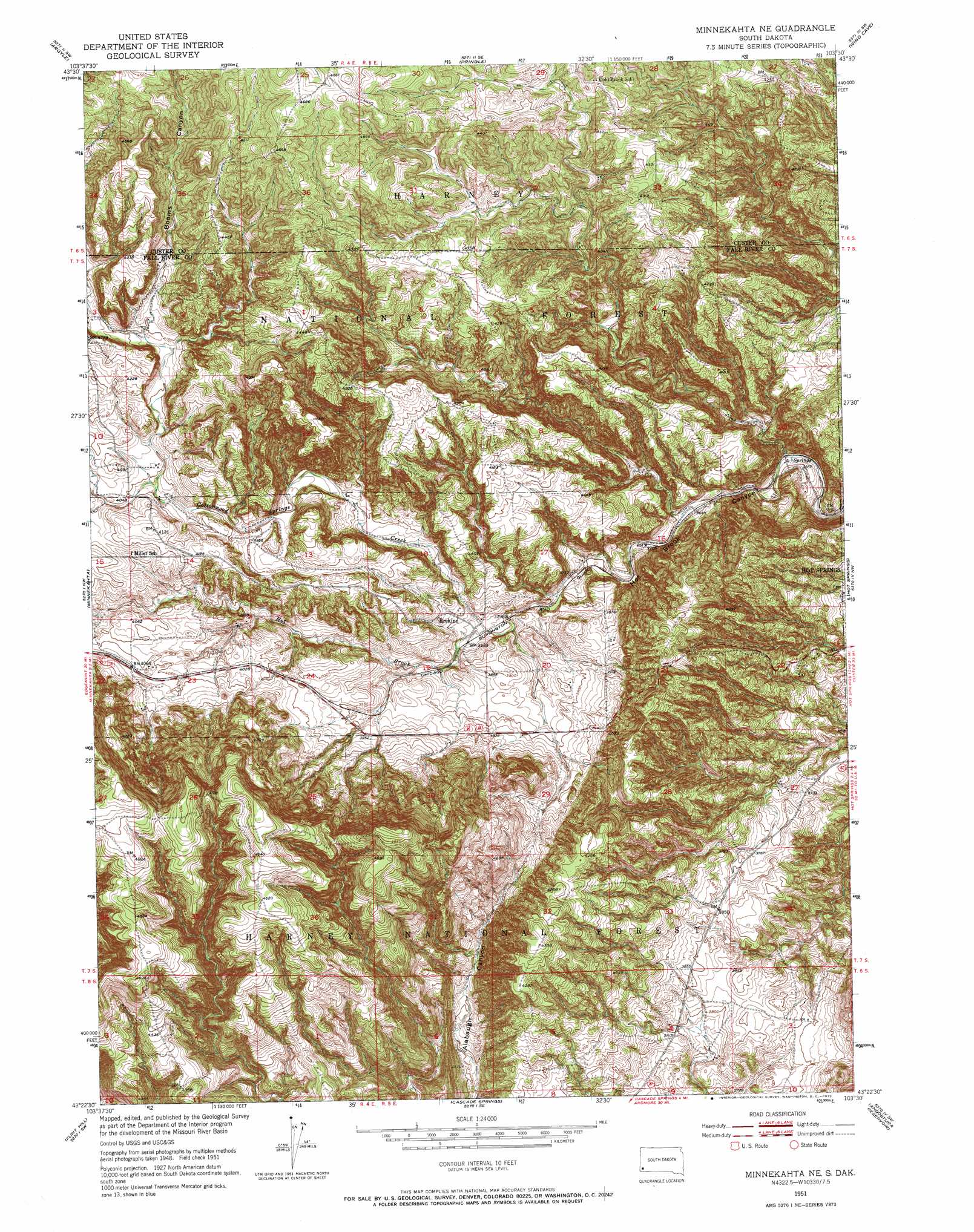
Minnekahta Ne Topo Map South Dakota
To zoom in, hover over the map of Minnekahta Ne
USGS Topo Quad 43103d5 - 1:24,000 scale
| Topo Map Name: | Minnekahta Ne |
| USGS Topo Quad ID: | 43103d5 |
| Print Size: | ca. 21 1/4" wide x 27" high |
| Southeast Coordinates: | 43.375° N latitude / 103.5° W longitude |
| Map Center Coordinates: | 43.4375° N latitude / 103.5625° W longitude |
| U.S. State: | SD |
| Filename: | o43103d5.jpg |
| Download Map JPG Image: | Minnekahta Ne topo map 1:24,000 scale |
| Map Type: | Topographic |
| Topo Series: | 7.5´ |
| Map Scale: | 1:24,000 |
| Source of Map Images: | United States Geological Survey (USGS) |
| Alternate Map Versions: |
Minnekahta NE SD 1951, updated 1953 Download PDF Buy paper map Minnekahta NE SD 1951, updated 1973 Download PDF Buy paper map Minnekahta NE SD 2012 Download PDF Buy paper map Minnekahta NE SD 2015 Download PDF Buy paper map |
| FStopo: | US Forest Service topo Minnekahta NE is available: Download FStopo PDF Download FStopo TIF |
1:24,000 Topo Quads surrounding Minnekahta Ne
Jewel Cave |
Fourmile |
Cicero Peak |
Mount Coolidge |
Butcher Hill |
Jewel Cave Se |
Argyle |
Pringle |
Wind Cave |
Boland Ridge |
Edgemont Ne |
Minnekahta |
Minnekahta Ne |
Hot Springs |
Buffalo Gap |
Edgemont |
Flint Hill |
Cascade Springs |
Angostura Reservoir |
Hot Springs Se |
Provo |
Rumford |
Heppner |
Lone Well Creek West |
Lone Well Creek East |
> Back to 43103a1 at 1:100,000 scale
> Back to 43102a1 at 1:250,000 scale
> Back to U.S. Topo Maps home
Minnekahta Ne topo map: Gazetteer
Minnekahta Ne: Dams
Cottonwood Springs Dam elevation 1171m 3841′Minnekahta Ne: Populated Places
Erskine elevation 1175m 3854′Minnekahta Ne: Reservoirs
Cottonwood Springs Lake elevation 1171m 3841′Minnekahta Ne: Streams
Cottonwood Springs Creek elevation 1161m 3809′Minnekahta Ne: Valleys
Booms Canyon elevation 1261m 4137′Minnekahta Ne digital topo map on disk
Buy this Minnekahta Ne topo map showing relief, roads, GPS coordinates and other geographical features, as a high-resolution digital map file on DVD:
Eastern Wyoming & Western South Dakota
Buy digital topo maps: Eastern Wyoming & Western South Dakota