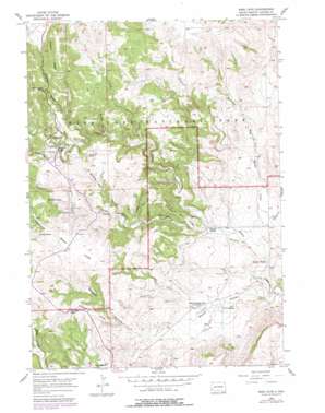
Wind Cave Topo Map South Dakota
To zoom in, hover over the map of Wind Cave
USGS Topo Quad 43103e4 - 1:24,000 scale
| Topo Map Name: | Wind Cave |
| USGS Topo Quad ID: | 43103e4 |
| Print Size: | ca. 21 1/4" wide x 27" high |
| Southeast Coordinates: | 43.5° N latitude / 103.375° W longitude |
| Map Center Coordinates: | 43.5625° N latitude / 103.4375° W longitude |
| U.S. State: | SD |
| Filename: | o43103e4.jpg |
| Download Map JPG Image: | Wind Cave topo map 1:24,000 scale |
| Map Type: | Topographic |
| Topo Series: | 7.5´ |
| Map Scale: | 1:24,000 |
| Source of Map Images: | United States Geological Survey (USGS) |
| Alternate Map Versions: |
Wind Cave SD 1957, updated 1958 Download PDF Buy paper map Wind Cave SD 1957, updated 1962 Download PDF Buy paper map Wind Cave SD 1957, updated 1979 Download PDF Buy paper map Wind Cave SD 1957, updated 1979 Download PDF Buy paper map Wind Cave SD 2012 Download PDF Buy paper map Wind Cave SD 2015 Download PDF Buy paper map |
| FStopo: | US Forest Service topo Wind Cave is available: Download FStopo PDF Download FStopo TIF |
1:24,000 Topo Quads surrounding Wind Cave
> Back to 43103e1 at 1:100,000 scale
> Back to 43102a1 at 1:250,000 scale
> Back to U.S. Topo Maps home
Wind Cave topo map: Gazetteer
Wind Cave: Bridges
Pigtail Bridge elevation 1369m 4491′Wind Cave: Capes
Lookout Point elevation 1342m 4402′Windy Point elevation 1350m 4429′
Wind Cave: Dams
Nobeck Dam elevation 1294m 4245′Wind Cave: Flats
Bison Flats elevation 1270m 4166′Wind Cave: Gaps
Gobbler Pass elevation 1292m 4238′Wind Cave: Parks
Wind Cave National Park elevation 1239m 4064′Wind Cave: Reservoirs
Norbeck Lake elevation 1294m 4245′Wind Cave: Ridges
Gobbler Ridge elevation 1251m 4104′Negro Wool Ridge elevation 1195m 3920′
Rankin Ridge elevation 1464m 4803′
Wind Cave: Streams
Cold Spring Creek elevation 1260m 4133′Cottonwood Creek elevation 1098m 3602′
Dry Creek elevation 1084m 3556′
Highland Creek elevation 1106m 3628′
Wind Cave: Summits
Elk Mountain elevation 1373m 4504′Wind Cave: Valleys
Curley Canyon elevation 1238m 4061′Gobbler Canyon elevation 1122m 3681′
Limestone Canyon elevation 1206m 3956′
Martin Valley elevation 1061m 3480′
Negro Canyon elevation 1172m 3845′
Prairie Dog Canyon elevation 1196m 3923′
Reaves Gulch elevation 1252m 4107′
Red Valley elevation 1095m 3592′
Wildcat Canyon elevation 1191m 3907′
Wind Cave Canyon elevation 1103m 3618′
Wind Cave digital topo map on disk
Buy this Wind Cave topo map showing relief, roads, GPS coordinates and other geographical features, as a high-resolution digital map file on DVD:
Eastern Wyoming & Western South Dakota
Buy digital topo maps: Eastern Wyoming & Western South Dakota


