Fairburn Ne Topo Map South Dakota
To zoom in, hover over the map of Fairburn Ne
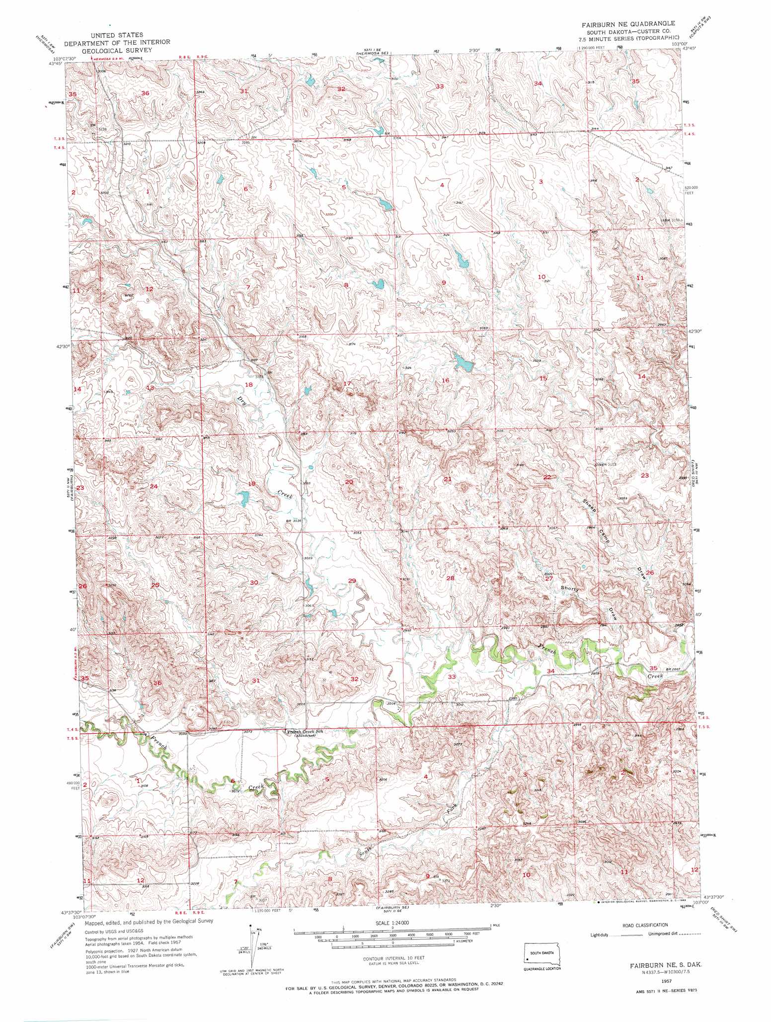
USGS Topo Quad 43103f1 - 1:24,000 scale
| Topo Map Name: | Fairburn Ne |
| USGS Topo Quad ID: | 43103f1 |
| Print Size: | ca. 21 1/4" wide x 27" high |
| Southeast Coordinates: | 43.625° N latitude / 103° W longitude |
| Map Center Coordinates: | 43.6875° N latitude / 103.0625° W longitude |
| U.S. State: | SD |
| Filename: | o43103f1.jpg |
| Download Map JPG Image: | Fairburn Ne topo map 1:24,000 scale |
| Map Type: | Topographic |
| Topo Series: | 7.5´ |
| Map Scale: | 1:24,000 |
| Source of Map Images: | United States Geological Survey (USGS) |
| Alternate Map Versions: |
Fairburn NE SD 1957, updated 1958 Download PDF Buy paper map Fairburn NE SD 1957, updated 1969 Download PDF Buy paper map Fairburn NE SD 2012 Download PDF Buy paper map Fairburn NE SD 2015 Download PDF Buy paper map |
| FStopo: | US Forest Service topo Fairburn NE is available: Download FStopo PDF Download FStopo TIF |
1:24,000 Topo Quads surrounding Fairburn Ne
Rockerville |
Hermosa Nw |
Hermosa Ne |
Caputa |
Caputa Ne |
Hayward |
Hermosa |
Hermosa Se |
Caputa Sw |
Folsom |
Butcher Hill |
Fairburn |
Fairburn Ne |
Red Shirt |
Red Shirt Ne |
Boland Ridge |
Fairburn Sw |
Fairburn Se |
Red Shirt Sw |
Cuny Table West |
Buffalo Gap |
Smithwick Nw |
Smithwick Ne |
Willow Creek Nw |
Willow Creek Ne |
> Back to 43103e1 at 1:100,000 scale
> Back to 43102a1 at 1:250,000 scale
> Back to U.S. Topo Maps home
Fairburn Ne topo map: Gazetteer
Fairburn Ne: Dams
Brophy Big Dam elevation 946m 3103′Triple Seven Number 1 Dam elevation 937m 3074′
Fairburn Ne: Streams
Dry Creek elevation 905m 2969′South Fork French Creek elevation 890m 2919′
Fairburn Ne: Valleys
Sheep Camp Draw elevation 869m 2851′Shorty Draw elevation 880m 2887′
Fairburn Ne digital topo map on disk
Buy this Fairburn Ne topo map showing relief, roads, GPS coordinates and other geographical features, as a high-resolution digital map file on DVD:
Eastern Wyoming & Western South Dakota
Buy digital topo maps: Eastern Wyoming & Western South Dakota