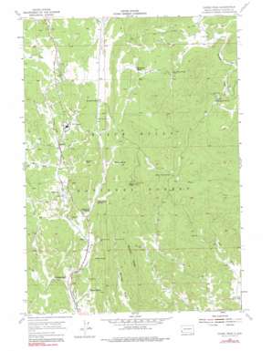
Cicero Peak Topo Map South Dakota
To zoom in, hover over the map of Cicero Peak
USGS Topo Quad 43103f5 - 1:24,000 scale
| Topo Map Name: | Cicero Peak |
| USGS Topo Quad ID: | 43103f5 |
| Print Size: | ca. 21 1/4" wide x 27" high |
| Southeast Coordinates: | 43.625° N latitude / 103.5° W longitude |
| Map Center Coordinates: | 43.6875° N latitude / 103.5625° W longitude |
| U.S. State: | SD |
| Filename: | o43103f5.jpg |
| Download Map JPG Image: | Cicero Peak topo map 1:24,000 scale |
| Map Type: | Topographic |
| Topo Series: | 7.5´ |
| Map Scale: | 1:24,000 |
| Source of Map Images: | United States Geological Survey (USGS) |
| Alternate Map Versions: |
Cicero Peak SD 1955, updated 1956 Download PDF Buy paper map Cicero Peak SD 1955, updated 1973 Download PDF Buy paper map Cicero Peak SD 1955, updated 1979 Download PDF Buy paper map Cicero Peak SD 2012 Download PDF Buy paper map Cicero Peak SD 2015 Download PDF Buy paper map |
| FStopo: | US Forest Service topo Cicero Peak is available: Download FStopo PDF Download FStopo TIF |
1:24,000 Topo Quads surrounding Cicero Peak
> Back to 43103e1 at 1:100,000 scale
> Back to 43102a1 at 1:250,000 scale
> Back to U.S. Topo Maps home
Cicero Peak topo map: Gazetteer
Cicero Peak: Airports
Custer County Airfield elevation 1696m 5564′Cicero Peak: Lakes
Lake of the Pines elevation 1581m 5187′Cicero Peak: Mines
Bare Top Number 2 Lode Mine elevation 1619m 5311′Beck Lode Mine elevation 1583m 5193′
Beecher Number Two Mine elevation 1704m 5590′
Bull Moose Lode Mine elevation 1594m 5229′
Burgess Mica Prospect Mine elevation 1686m 5531′
Burt Mica Mine elevation 1596m 5236′
Flora Lode Mine elevation 1589m 5213′
Gladys Nells Mine elevation 1580m 5183′
Heidepriem and Cattles Mine elevation 1669m 5475′
Hot Shot Mine elevation 1561m 5121′
Lee Burrows Dike Mine elevation 1547m 5075′
Linwood Mine elevation 1558m 5111′
Lucky Spar Lode Mine elevation 1686m 5531′
Lucky Star Prospect Mine elevation 1671m 5482′
Lucky Strike Mine elevation 1593m 5226′
Mica King Mine elevation 1537m 5042′
Mica King Number 3 Claim Mine elevation 1542m 5059′
Mitchell Number 1 Lode Mine elevation 1562m 5124′
Rambler Lode Mine elevation 1683m 5521′
Rose Quartz Mine elevation 1556m 5104′
Saint Louis Mine elevation 1536m 5039′
Sonny Boy Lode Mine elevation 1588m 5209′
Star and Blue Bonnet Claims Mine elevation 1551m 5088′
Tinsley Mine elevation 1584m 5196′
Triangle A Mine elevation 1550m 5085′
Wayside Lode Mine elevation 1576m 5170′
White Elephant Mine elevation 1638m 5374′
Cicero Peak: Pillars
Beecher Rock elevation 1696m 5564′Cicero Peak: Populated Places
Nihart elevation 1552m 5091′Sanator elevation 1613m 5291′
Cicero Peak: Ridges
Bowman Ridge elevation 1671m 5482′Cicero Peak: Springs
Flynn Creek Spring elevation 1654m 5426′Haselrodt Spring elevation 1524m 5000′
Nihart Spring elevation 1587m 5206′
Sutherland Spring elevation 1617m 5305′
Cicero Peak: Streams
Glen Erin Creek elevation 1529m 5016′Sidney Creek elevation 1628m 5341′
Well Pole Creek elevation 1609m 5278′
Cicero Peak: Summits
Cicero Peak elevation 1880m 6167′Cicero Peak: Valleys
Echo Valley elevation 1596m 5236′Haven Canyon elevation 1438m 4717′
Cicero Peak digital topo map on disk
Buy this Cicero Peak topo map showing relief, roads, GPS coordinates and other geographical features, as a high-resolution digital map file on DVD:
Eastern Wyoming & Western South Dakota
Buy digital topo maps: Eastern Wyoming & Western South Dakota


