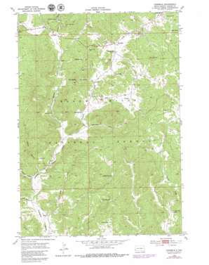
Fourmile Topo Map South Dakota
To zoom in, hover over the map of Fourmile
USGS Topo Quad 43103f6 - 1:24,000 scale
| Topo Map Name: | Fourmile |
| USGS Topo Quad ID: | 43103f6 |
| Print Size: | ca. 21 1/4" wide x 27" high |
| Southeast Coordinates: | 43.625° N latitude / 103.625° W longitude |
| Map Center Coordinates: | 43.6875° N latitude / 103.6875° W longitude |
| U.S. State: | SD |
| Filename: | o43103f6.jpg |
| Download Map JPG Image: | Fourmile topo map 1:24,000 scale |
| Map Type: | Topographic |
| Topo Series: | 7.5´ |
| Map Scale: | 1:24,000 |
| Source of Map Images: | United States Geological Survey (USGS) |
| Alternate Map Versions: |
Fourmile SD 1954, updated 1955 Download PDF Buy paper map Fourmile SD 1954, updated 1973 Download PDF Buy paper map Fourmile SD 1954, updated 1979 Download PDF Buy paper map Fourmile SD 1954, updated 1979 Download PDF Buy paper map Fourmile SD 2012 Download PDF Buy paper map Fourmile SD 2015 Download PDF Buy paper map |
| FStopo: | US Forest Service topo Fourmile is available: Download FStopo PDF Download FStopo TIF |
1:24,000 Topo Quads surrounding Fourmile
> Back to 43103e1 at 1:100,000 scale
> Back to 43102a1 at 1:250,000 scale
> Back to U.S. Topo Maps home
Fourmile topo map: Gazetteer
Fourmile: Dams
McClure Dam elevation 1564m 5131′Fourmile: Mines
Bebington Group Mine elevation 1668m 5472′Dubuque Claim elevation 1714m 5623′
Helen Beryl Mine elevation 1622m 5321′
Keystone Lode Mine elevation 1755m 5757′
New York Mine elevation 1614m 5295′
Rainbow Number Four Mine elevation 1691m 5547′
Red Spar Mine elevation 1585m 5200′
Rocky Ridge Mine elevation 1701m 5580′
Royal Flush Claim Mine elevation 1702m 5583′
Tin Mountain Mine elevation 1732m 5682′
Tiptop Mine elevation 1640m 5380′
Warren Draw Mine elevation 1704m 5590′
White Spar Mine elevation 1681m 5515′
Fourmile: Pillars
Castle Rock elevation 1694m 5557′Fourmile: Populated Places
Fourmile elevation 1634m 5360′Fourmile: Reservoirs
Ventling Reservoir elevation 1624m 5328′Ward Reservoir elevation 1583m 5193′
Fourmile: Springs
Carroll Creek Spring elevation 1523m 4996′Spar Spring elevation 1670m 5479′
Fourmile: Streams
Fourmile Creek elevation 1536m 5039′Hay Creek elevation 1572m 5157′
Lightning Creek elevation 1536m 5039′
Fourmile: Summits
Twin Sisters elevation 1759m 5770′Fourmile: Valleys
Griffis Canyon elevation 1507m 4944′Layton Canyon elevation 1500m 4921′
Long Draw elevation 1470m 4822′
Ninemile Draw elevation 1557m 5108′
S and G Canyon elevation 1479m 4852′
Warren Gulch elevation 1656m 5433′
Fourmile: Wells
Griffis Well elevation 1537m 5042′Fourmile digital topo map on disk
Buy this Fourmile topo map showing relief, roads, GPS coordinates and other geographical features, as a high-resolution digital map file on DVD:
Eastern Wyoming & Western South Dakota
Buy digital topo maps: Eastern Wyoming & Western South Dakota


