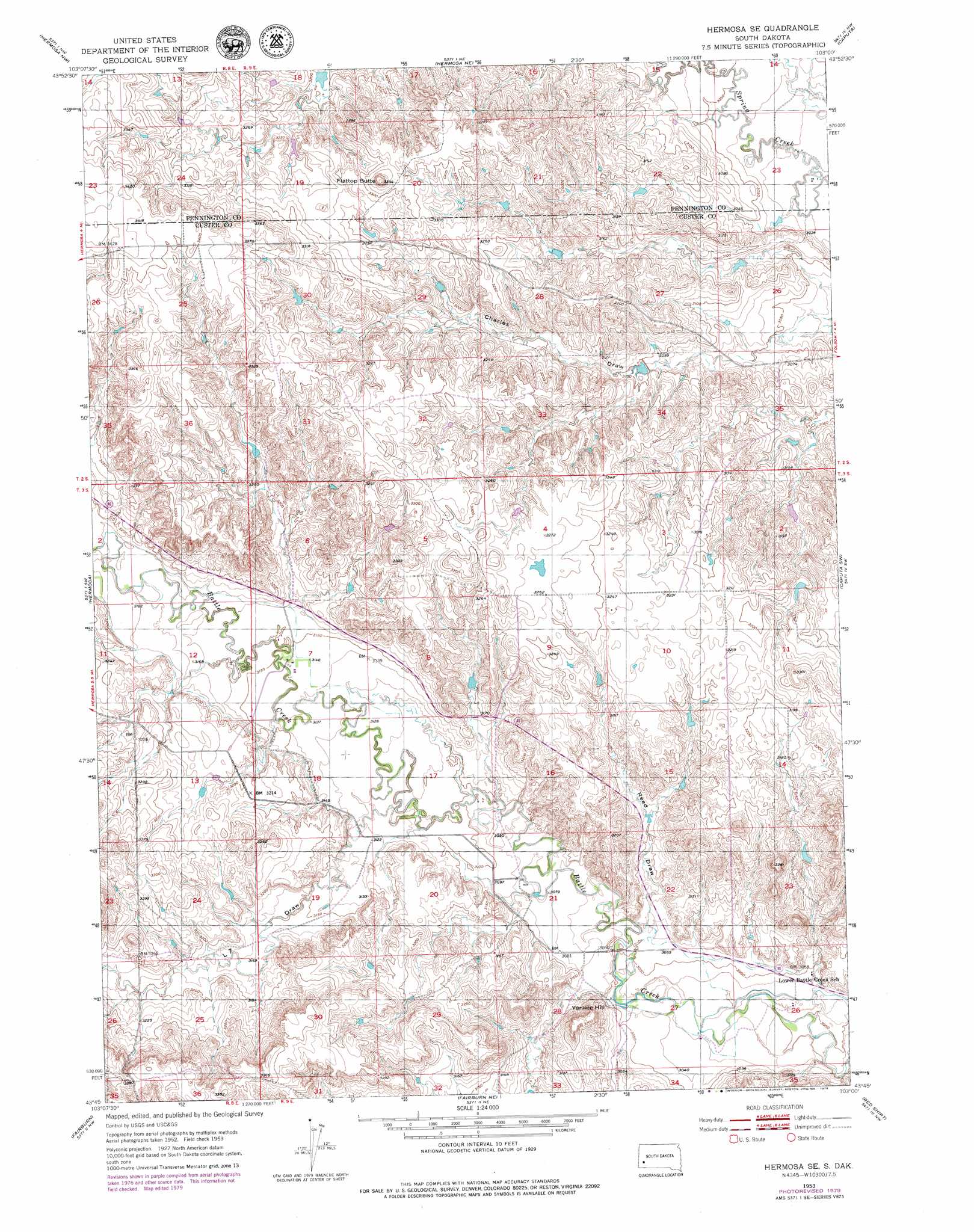
Hermosa Se Topo Map South Dakota
To zoom in, hover over the map of Hermosa Se
USGS Topo Quad 43103g1 - 1:24,000 scale
| Topo Map Name: | Hermosa Se |
| USGS Topo Quad ID: | 43103g1 |
| Print Size: | ca. 21 1/4" wide x 27" high |
| Southeast Coordinates: | 43.75° N latitude / 103° W longitude |
| Map Center Coordinates: | 43.8125° N latitude / 103.0625° W longitude |
| U.S. State: | SD |
| Filename: | o43103g1.jpg |
| Download Map JPG Image: | Hermosa Se topo map 1:24,000 scale |
| Map Type: | Topographic |
| Topo Series: | 7.5´ |
| Map Scale: | 1:24,000 |
| Source of Map Images: | United States Geological Survey (USGS) |
| Alternate Map Versions: |
Hermosa SE SD 1953, updated 1955 Download PDF Buy paper map Hermosa SE SD 1953, updated 1976 Download PDF Buy paper map Hermosa SE SD 2012 Download PDF Buy paper map Hermosa SE SD 2015 Download PDF Buy paper map |
1:24,000 Topo Quads surrounding Hermosa Se
Rapid City West |
Rapid City East |
Box Elder |
New Underwood Sw |
New Underwood |
Rockerville |
Hermosa Nw |
Hermosa Ne |
Caputa |
Caputa Ne |
Hayward |
Hermosa |
Hermosa Se |
Caputa Sw |
Folsom |
Butcher Hill |
Fairburn |
Fairburn Ne |
Red Shirt |
Red Shirt Ne |
Boland Ridge |
Fairburn Sw |
Fairburn Se |
Red Shirt Sw |
Cuny Table West |
> Back to 43103e1 at 1:100,000 scale
> Back to 43102a1 at 1:250,000 scale
> Back to U.S. Topo Maps home
Hermosa Se topo map: Gazetteer
Hermosa Se: Dams
Evans Number 1 Dam elevation 945m 3100′Hermosa Se: Summits
Flattop Butte elevation 1036m 3398′Yankee Hill elevation 986m 3234′
Hermosa Se: Valleys
L Seven Draw elevation 951m 3120′Reed Draw elevation 933m 3061′
Hermosa Se digital topo map on disk
Buy this Hermosa Se topo map showing relief, roads, GPS coordinates and other geographical features, as a high-resolution digital map file on DVD:
Eastern Wyoming & Western South Dakota
Buy digital topo maps: Eastern Wyoming & Western South Dakota