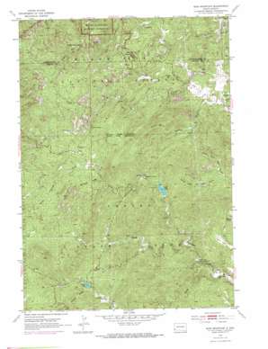
Iron Mountain Topo Map South Dakota
To zoom in, hover over the map of Iron Mountain
USGS Topo Quad 43103g4 - 1:24,000 scale
| Topo Map Name: | Iron Mountain |
| USGS Topo Quad ID: | 43103g4 |
| Print Size: | ca. 21 1/4" wide x 27" high |
| Southeast Coordinates: | 43.75° N latitude / 103.375° W longitude |
| Map Center Coordinates: | 43.8125° N latitude / 103.4375° W longitude |
| U.S. State: | SD |
| Filename: | o43103g4.jpg |
| Download Map JPG Image: | Iron Mountain topo map 1:24,000 scale |
| Map Type: | Topographic |
| Topo Series: | 7.5´ |
| Map Scale: | 1:24,000 |
| Source of Map Images: | United States Geological Survey (USGS) |
| Alternate Map Versions: |
Iron Mountain SD 1954, updated 1955 Download PDF Buy paper map Iron Mountain SD 1954, updated 1965 Download PDF Buy paper map Iron Mountain SD 1954, updated 1972 Download PDF Buy paper map Iron Mountain SD 1954, updated 1976 Download PDF Buy paper map Iron Mountain SD 1954, updated 1976 Download PDF Buy paper map Iron Mountain SD 1998, updated 2001 Download PDF Buy paper map Iron Mountain SD 2012 Download PDF Buy paper map Iron Mountain SD 2015 Download PDF Buy paper map |
| FStopo: | US Forest Service topo Iron Mountain is available: Download FStopo PDF Download FStopo TIF |
1:24,000 Topo Quads surrounding Iron Mountain
> Back to 43103e1 at 1:100,000 scale
> Back to 43102a1 at 1:250,000 scale
> Back to U.S. Topo Maps home
Iron Mountain topo map: Gazetteer
Iron Mountain: Dams
Center Lake Dam elevation 1430m 4691′Lakota Dam elevation 1364m 4475′
Legion Lake Dam elevation 1430m 4691′
Iron Mountain: Falls
Grizzly Bear Falls elevation 1510m 4954′Iron Mountain: Flats
Clark Park elevation 1399m 4589′Iron Mountain: Mines
Beryl Feldspar Mine elevation 1407m 4616′Big Chief Mine elevation 1340m 4396′
Big Smoke Mine elevation 1392m 4566′
Champion Mine elevation 1391m 4563′
Cuyahogo Mine elevation 1472m 4829′
Dike Mine elevation 1418m 4652′
Eclipse Group Mine elevation 1344m 4409′
Eureka Mine elevation 1338m 4389′
Fern Cliff Prospect Mine elevation 1407m 4616′
Formosa Mine elevation 1619m 5311′
Glendale Mine elevation 1325m 4347′
Hugo Mine elevation 1473m 4832′
Josie Mine elevation 1397m 4583′
Jumbo Lode Mine elevation 1381m 4530′
King Lithia Prospect Mine elevation 1343m 4406′
Maryland Lode Mine elevation 1543m 5062′
New England Mine elevation 1353m 4438′
Otlershagen Prospect Mine elevation 1286m 4219′
Pink Elephant Beryl Prospect Mine elevation 1389m 4557′
Put Mine elevation 1433m 4701′
Queen Claim Mine elevation 1279m 4196′
Soda Spar Mine elevation 1414m 4639′
Spokane Mine elevation 1384m 4540′
Iron Mountain: Parks
Norbeck Wildlife Preserve elevation 1607m 5272′Iron Mountain: Populated Places
Spokane elevation 1378m 4520′State Game Lodge elevation 1364m 4475′
Iron Mountain: Reservoirs
Center Lake elevation 1429m 4688′Center Lake elevation 1430m 4691′
Lakota Lake elevation 1364m 4475′
Legion Lake elevation 1528m 5013′
Iron Mountain: Ridges
Woodpecker Ridge elevation 1678m 5505′Iron Mountain: Streams
Badger Clark Creek elevation 1333m 4373′Toll Gate Creek elevation 1371m 4498′
Iron Mountain: Summits
Iron Mountain elevation 1660m 5446′Iron Mountain: Trails
Blackberry Trail elevation 1537m 5042′Grizzly Creek Trail elevation 1616m 5301′
Iron Creek Trail elevation 1424m 4671′
Iron Mountain Trail elevation 1489m 4885′
Norbeck Trail elevation 1557m 5108′
Iron Mountain: Valleys
Greyhound Gulch elevation 1279m 4196′Norbeck Draw elevation 1509m 4950′
North Fork Bear Gulch elevation 1344m 4409′
Potato Gulch elevation 1463m 4799′
Sheep Draw elevation 1512m 4960′
South Fork Bear Gulch elevation 1344m 4409′
Iron Mountain digital topo map on disk
Buy this Iron Mountain topo map showing relief, roads, GPS coordinates and other geographical features, as a high-resolution digital map file on DVD:
Eastern Wyoming & Western South Dakota
Buy digital topo maps: Eastern Wyoming & Western South Dakota


