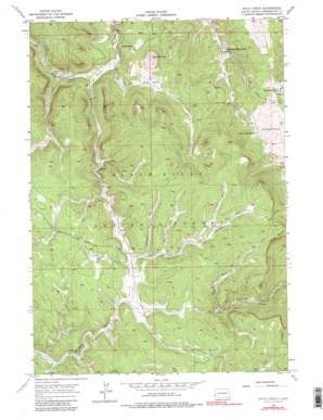
Ditch Creek Topo Map South Dakota
To zoom in, hover over the map of Ditch Creek
USGS Topo Quad 43103h7 - 1:24,000 scale
| Topo Map Name: | Ditch Creek |
| USGS Topo Quad ID: | 43103h7 |
| Print Size: | ca. 21 1/4" wide x 27" high |
| Southeast Coordinates: | 43.875° N latitude / 103.75° W longitude |
| Map Center Coordinates: | 43.9375° N latitude / 103.8125° W longitude |
| U.S. State: | SD |
| Filename: | o43103h7.jpg |
| Download Map JPG Image: | Ditch Creek topo map 1:24,000 scale |
| Map Type: | Topographic |
| Topo Series: | 7.5´ |
| Map Scale: | 1:24,000 |
| Source of Map Images: | United States Geological Survey (USGS) |
| Alternate Map Versions: |
Ditch Creek SD 1956, updated 1958 Download PDF Buy paper map Ditch Creek SD 1956, updated 1965 Download PDF Buy paper map Ditch Creek SD 1956, updated 1977 Download PDF Buy paper map Ditch Creek SD 1956, updated 1981 Download PDF Buy paper map Ditch Creek SD 1956, updated 1981 Download PDF Buy paper map Ditch Creek SD 2012 Download PDF Buy paper map Ditch Creek SD 2015 Download PDF Buy paper map |
| FStopo: | US Forest Service topo Ditch Creek is available: Download FStopo PDF Download FStopo TIF |
1:24,000 Topo Quads surrounding Ditch Creek
> Back to 43103e1 at 1:100,000 scale
> Back to 43102a1 at 1:250,000 scale
> Back to U.S. Topo Maps home
Ditch Creek topo map: Gazetteer
Ditch Creek: Flats
Fox Flat elevation 2068m 6784′Ditch Creek: Mines
Accidental Mine elevation 1906m 6253′Copper Mountain Gravel Pit elevation 2140m 7020′
Silica Sand Mine elevation 1905m 6250′
Stan-Penn Lodge Mine elevation 1971m 6466′
Ditch Creek: Springs
Green Mountain Spring elevation 2159m 7083′Sixmile Spring elevation 2100m 6889′
Spring Creek Spring elevation 1985m 6512′
Ditch Creek: Streams
Ditch Creek elevation 1859m 6099′Heely Creek elevation 1850m 6069′
Pole Creek elevation 1887m 6190′
Stone Draw elevation 1868m 6128′
Ditch Creek: Summits
Green Mountain elevation 2186m 7171′Hat Mountain elevation 2048m 6719′
Odakota Mountain elevation 2194m 7198′
Ditch Creek: Valleys
Grand Vista Draw elevation 1978m 6489′Hay Draw elevation 2020m 6627′
Long Draw elevation 1989m 6525′
Sawmill Draw elevation 2046m 6712′
Sixmile Draw elevation 1998m 6555′
Smith Draw elevation 1944m 6377′
Williams Draw elevation 2011m 6597′
Windmill Draw elevation 2070m 6791′
Ditch Creek: Wells
Four Corners Well elevation 1998m 6555′Gillette Well elevation 2027m 6650′
Ditch Creek digital topo map on disk
Buy this Ditch Creek topo map showing relief, roads, GPS coordinates and other geographical features, as a high-resolution digital map file on DVD:
Eastern Wyoming & Western South Dakota
Buy digital topo maps: Eastern Wyoming & Western South Dakota


