Preacher Spring Topo Map South Dakota
To zoom in, hover over the map of Preacher Spring
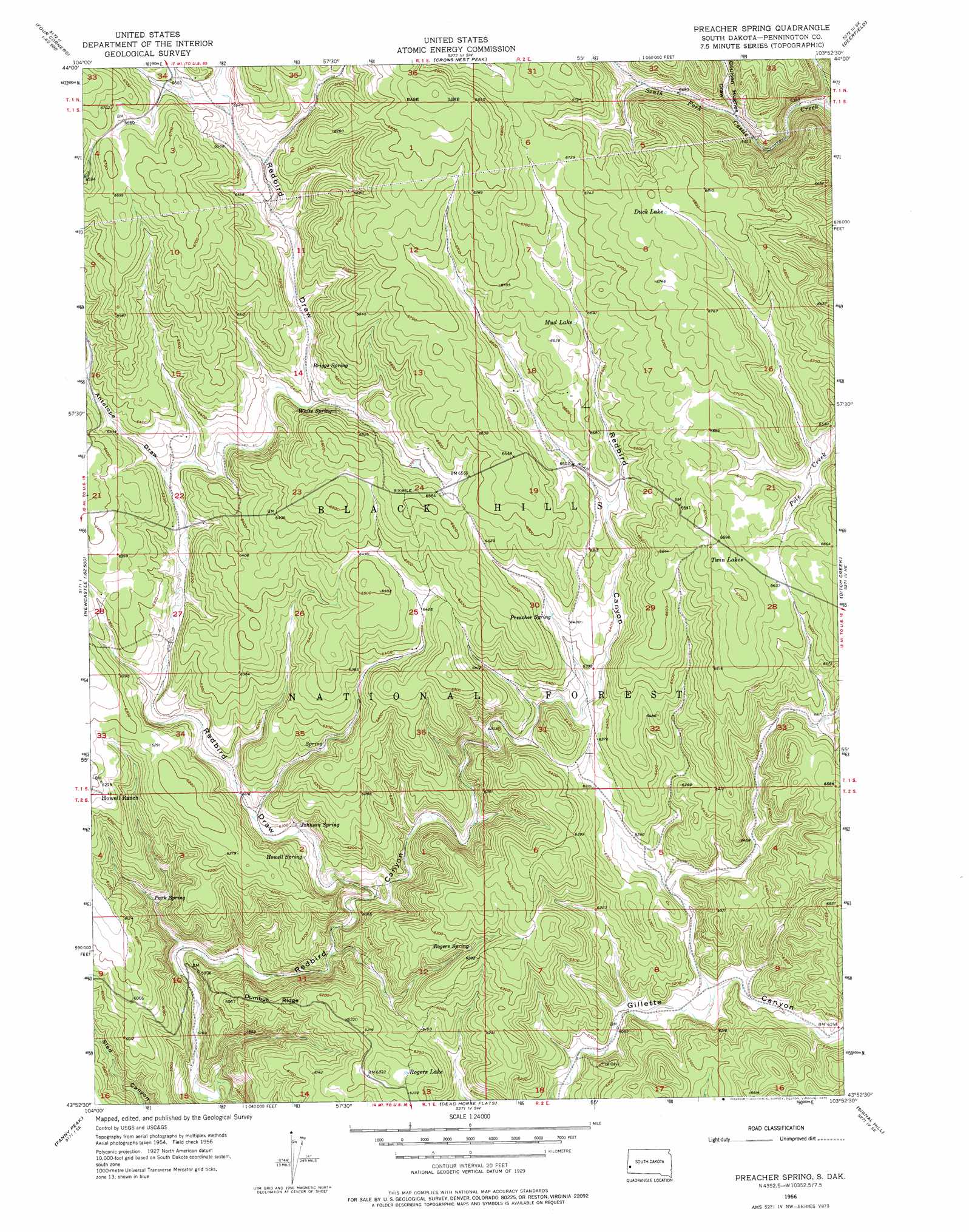
USGS Topo Quad 43103h8 - 1:24,000 scale
| Topo Map Name: | Preacher Spring |
| USGS Topo Quad ID: | 43103h8 |
| Print Size: | ca. 21 1/4" wide x 27" high |
| Southeast Coordinates: | 43.875° N latitude / 103.875° W longitude |
| Map Center Coordinates: | 43.9375° N latitude / 103.9375° W longitude |
| U.S. State: | SD |
| Filename: | o43103h8.jpg |
| Download Map JPG Image: | Preacher Spring topo map 1:24,000 scale |
| Map Type: | Topographic |
| Topo Series: | 7.5´ |
| Map Scale: | 1:24,000 |
| Source of Map Images: | United States Geological Survey (USGS) |
| Alternate Map Versions: |
Preacher Spring SD 1956, updated 1958 Download PDF Buy paper map Preacher Spring SD 1956, updated 1970 Download PDF Buy paper map Preacher Spring SD 1956, updated 1974 Download PDF Buy paper map Preacher Spring SD 1956, updated 1975 Download PDF Buy paper map Preacher Spring SD 2012 Download PDF Buy paper map Preacher Spring SD 2015 Download PDF Buy paper map |
| FStopo: | US Forest Service topo Preacher Spring is available: Download FStopo PDF Download FStopo TIF |
1:24,000 Topo Quads surrounding Preacher Spring
Dry Draw |
Buckhorn |
Crooks Tower |
Nahant |
Minnesota Ridge |
Four Corners |
Parmlee Canyon |
Crows Nest Peak |
Deerfield |
Rochford |
Cambria |
Moon |
Preacher Spring |
Ditch Creek |
Medicine Mountain |
Newcastle |
Fanny Peak |
Dead Horse Flats |
Signal Hill |
Berne |
Owens |
Clifton |
Jewel Cave Nw |
Jewel Cave |
Fourmile |
> Back to 43103e1 at 1:100,000 scale
> Back to 43102a1 at 1:250,000 scale
> Back to U.S. Topo Maps home
Preacher Spring topo map: Gazetteer
Preacher Spring: Lakes
Cameron Pond elevation 1968m 6456′Duck Lake elevation 2069m 6788′
Mud Lake elevation 2023m 6637′
Pole Creek Pond Lake elevation 1993m 6538′
Rogers Lake elevation 1905m 6250′
Twin Lakes elevation 2038m 6686′
Preacher Spring: Reservoirs
Boggy Reservoir elevation 2020m 6627′Redbank Spring Reservoir elevation 2012m 6601′
Willow Springs Reservoir elevation 2006m 6581′
Preacher Spring: Ridges
Dumbuk Ridge elevation 1859m 6099′Preacher Spring: Springs
Briggs Spring elevation 1957m 6420′Howell Spring elevation 1862m 6108′
Johnson Spring elevation 1861m 6105′
Park Spring elevation 1811m 5941′
Preacher Spring elevation 1962m 6437′
Rogers Spring elevation 1900m 6233′
White Spring elevation 1962m 6437′
Preacher Spring: Valleys
Antelope Draw elevation 1885m 6184′Cameron Draw elevation 1878m 6161′
Coulsen Hughes Draw elevation 1967m 6453′
Redbird Draw elevation 1825m 5987′
Trail Draw elevation 1940m 6364′
Preacher Spring digital topo map on disk
Buy this Preacher Spring topo map showing relief, roads, GPS coordinates and other geographical features, as a high-resolution digital map file on DVD:
Eastern Wyoming & Western South Dakota
Buy digital topo maps: Eastern Wyoming & Western South Dakota