Dewey Sw Topo Map Wyoming
To zoom in, hover over the map of Dewey Sw
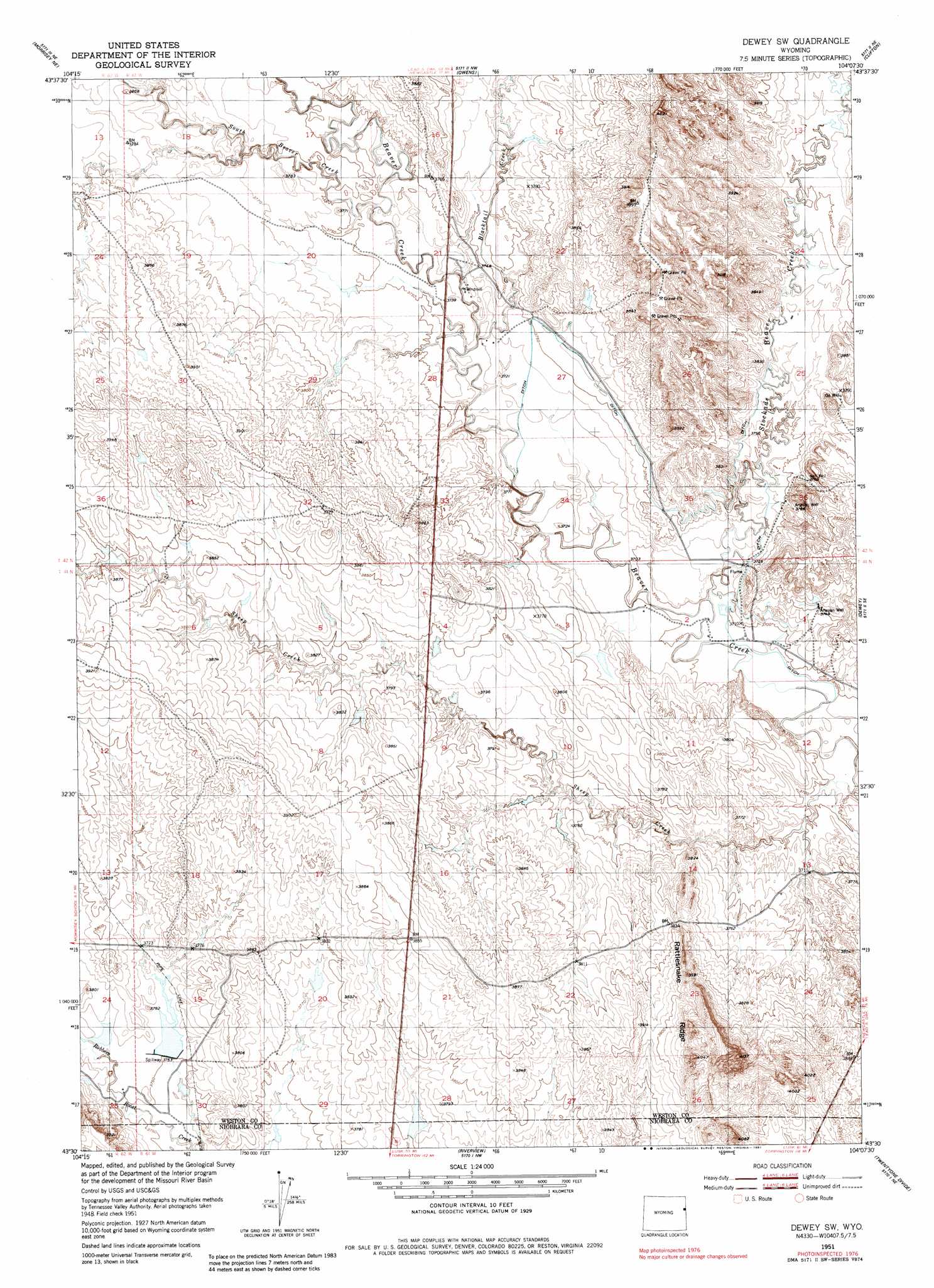
USGS Topo Quad 43104e2 - 1:24,000 scale
| Topo Map Name: | Dewey Sw |
| USGS Topo Quad ID: | 43104e2 |
| Print Size: | ca. 21 1/4" wide x 27" high |
| Southeast Coordinates: | 43.5° N latitude / 104.125° W longitude |
| Map Center Coordinates: | 43.5625° N latitude / 104.1875° W longitude |
| U.S. State: | WY |
| Filename: | o43104e2.jpg |
| Download Map JPG Image: | Dewey Sw topo map 1:24,000 scale |
| Map Type: | Topographic |
| Topo Series: | 7.5´ |
| Map Scale: | 1:24,000 |
| Source of Map Images: | United States Geological Survey (USGS) |
| Alternate Map Versions: |
Dewey SW WY 1951, updated 1953 Download PDF Buy paper map Dewey SW WY 1951, updated 1981 Download PDF Buy paper map Dewey SW WY 2012 Download PDF Buy paper map Dewey SW WY 2015 Download PDF Buy paper map |
1:24,000 Topo Quads surrounding Dewey Sw
Klodt Reservoir |
Osage Se |
Newcastle |
Fanny Peak |
Dead Horse Flats |
Timber Creek |
Morrisey Ne |
Owens |
Clifton |
Jewel Cave Nw |
Morrisey |
Morrisey Se |
Dewey Sw |
Dewey |
Jewel Cave Sw |
Threemile Butte |
Little Alkali Creek |
Riverview |
Twentyone Divide |
Burdock |
Greasewood Creek |
Bowen Flat |
Mule Creek |
Mule Creek Se |
Edgemont Sw |
> Back to 43104e1 at 1:100,000 scale
> Back to 43104a1 at 1:250,000 scale
> Back to U.S. Topo Maps home
Dewey Sw topo map: Gazetteer
Dewey Sw: Dams
Fillinger Dam elevation 1144m 3753′M W Dam elevation 1166m 3825′
Slide Dam elevation 1162m 3812′
Dewey Sw: Mines
Gerald Barrow Number One Mine elevation 1173m 3848′Gerald Barrow Number Two Mine elevation 1170m 3838′
Gerald Darrow Number Three Mine elevation 1153m 3782′
Sheep Creek Mine elevation 1134m 3720′
Dewey Sw: Reservoirs
Fillinger Reservoir elevation 1144m 3753′M W Reservoir elevation 1166m 3825′
Slide Reservoir elevation 1162m 3812′
Dewey Sw: Ridges
Rattlesnake Ridge elevation 1202m 3943′Dewey Sw: Streams
Blacktail Creek elevation 1138m 3733′Sheep Creek elevation 1120m 3674′
South Beaver Creek elevation 1138m 3733′
Stockade Beaver Creek elevation 1126m 3694′
Dewey Sw digital topo map on disk
Buy this Dewey Sw topo map showing relief, roads, GPS coordinates and other geographical features, as a high-resolution digital map file on DVD:
Eastern Wyoming & Western South Dakota
Buy digital topo maps: Eastern Wyoming & Western South Dakota