Morrisey Se Topo Map Wyoming
To zoom in, hover over the map of Morrisey Se
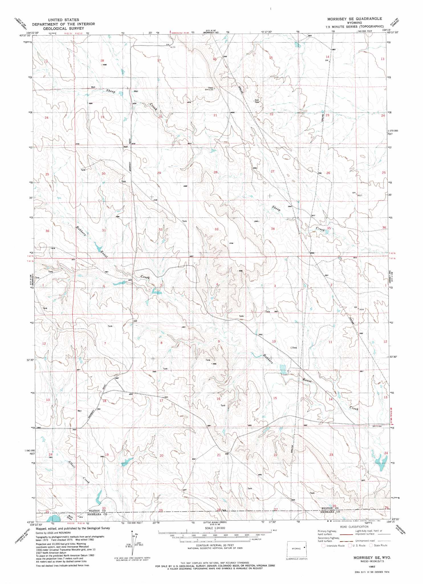
USGS Topo Quad 43104e3 - 1:24,000 scale
| Topo Map Name: | Morrisey Se |
| USGS Topo Quad ID: | 43104e3 |
| Print Size: | ca. 21 1/4" wide x 27" high |
| Southeast Coordinates: | 43.5° N latitude / 104.25° W longitude |
| Map Center Coordinates: | 43.5625° N latitude / 104.3125° W longitude |
| U.S. State: | WY |
| Filename: | o43104e3.jpg |
| Download Map JPG Image: | Morrisey Se topo map 1:24,000 scale |
| Map Type: | Topographic |
| Topo Series: | 7.5´ |
| Map Scale: | 1:24,000 |
| Source of Map Images: | United States Geological Survey (USGS) |
| Alternate Map Versions: |
Morrisey SE WY 1982, updated 1982 Download PDF Buy paper map Morrisey SE WY 2012 Download PDF Buy paper map Morrisey SE WY 2015 Download PDF Buy paper map |
| FStopo: | US Forest Service topo Morrisey SE is available: Download FStopo PDF Download FStopo TIF |
1:24,000 Topo Quads surrounding Morrisey Se
Lassen Creek |
Klodt Reservoir |
Osage Se |
Newcastle |
Fanny Peak |
Dupont Creek |
Timber Creek |
Morrisey Ne |
Owens |
Clifton |
The Nose East |
Morrisey |
Morrisey Se |
Dewey Sw |
Dewey |
Horseshoe Bend |
Threemile Butte |
Little Alkali Creek |
Riverview |
Twentyone Divide |
Boggy Reservoir |
Greasewood Creek |
Bowen Flat |
Mule Creek |
Mule Creek Se |
> Back to 43104e1 at 1:100,000 scale
> Back to 43104a1 at 1:250,000 scale
> Back to U.S. Topo Maps home
Morrisey Se topo map: Gazetteer
Morrisey Se: Dams
House Dam elevation 1165m 3822′Robbers Roost Dam elevation 1147m 3763′
Three Forks Dam elevation 1209m 3966′
Morrisey Se: Reservoirs
House Reservoir elevation 1165m 3822′Robbers Roost Reservoir elevation 1147m 3763′
Three Forks Reservoir elevation 1209m 3966′
Morrisey Se digital topo map on disk
Buy this Morrisey Se topo map showing relief, roads, GPS coordinates and other geographical features, as a high-resolution digital map file on DVD:
Eastern Wyoming & Western South Dakota
Buy digital topo maps: Eastern Wyoming & Western South Dakota